NORMAN, OK — After a very strong year in 2011, I had high hopes coming into the 2012 season. It seemed like forever, but late winter finally turned into early spring. I ended up missing out on the first chase opportunity of the season, which came on March 18 in southwest Oklahoma, because I was in Florida. Despite the delayed start to the season, things sure started with a bang a couple weeks later as more storms erupted in western Oklahoma.
Early April: Supercells, Softball-Sized Hail, and Tornadoes
My chasing season started on April 2nd. I was heading south out of Elk City, Oklahoma waiting for storms to fire on the dryline coming out of the Texas Panhandle. I got on a storm that fired in some moisture advection near Hobart, Oklahoma, and chased it up US-183 towards Clinton as it slowly strengthened. By the time I got to Clinton, the storm was becoming supercellular with the sun setting behind it. I found a paved road off of US-183, pulled over, and was treated to a spectacular show as the sun set behind the supercell.
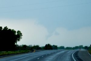
Developing Tornado near Woodward, Oklahoma on April 9, 2012
A week later was one of the most memorable chases of the year in northwest Oklahoma. After abandoning my initial storm that fell apart and went up into Kansas, I set up on a second supercell just to the east of Woodward. Shortly thereafter, a tight rotating wall cloud came right down the road towards me. I chased all of the little spin-ups that I could, but the spin-up tornadoes were too short-lived to get any decent pictures of them.
After producing several little spin-ups, the wall cloud began to go through a cycling phase, where it would stop producing little spin-ups, get itself reorganized, and then finally put down a real tornado. I decided to cut back through Woodward to get set up south of town to get a better visual on any tornado that developed (and get myself out of harm’s way). Unfortunately, I was so excited to get my first tornadoes of the new season that i forgot that the storm was moving southeast instead of northeast. I ended up inadvertently driving right into the hail core, and boy my windshield didn’t stand a chance against softball-sized hail. at least as a consolation prize, I did get to see the main tornado that day, but was unable to get any pictures of it while running from the hail core.
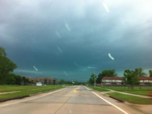
Four days later was Friday, April 13th. I had a brand new windshield and was eager to get back out for another chase. A High Risk was out for the next day across much of the central plains, but I didn’t want to miss out on an opportunity close to home. By mid-afternoon, a single supercell had developed just to the west of Chickasha and was paralleling Interstate 44 as it moved northeast towards Oklahoma City. I set out to chase it, but kept my distance as I did not want to blow out another windshield. I waited by the casino at I-35 and Highway 9 just south of the river and waited for the storm to make its next move. Over the next 15 minutes, you could watch a distinct hook echo develop on radar, and then watch the storm make a right hand turn and head straight for Norman.
I held out as long as I could, but eventually I needed to get out of there and head home. After I got the new windshield under cover and protected from any possible hail, the tornado sirens rang as I was going through my front door. I turned on the TV only to find that a tornado was on the ground in Norman and headed right for me. I got away from windows and kept tabs on it as it skipped across the city. The tornado passed just about 3/4 of a mile north of the house, but we got absolutely blasted by the gust front and RFD. Thankfully, it did no damage to the house and the tornado did minimal damage in town. I ended up busting on the high risk day on April 14th. I tried avoiding the crowds in Kansas and targeted an area close to home in Oklahoma, but it never panned out, which was probably a good thing.
May: More Tornadoes and a Grand Finale
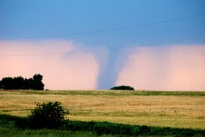
After a long quiet stretch between mid-April and mid-May, things kicked back up on May 19th. A pretty big gamble that really payed off combined with a perfect forecast and perfect timing put me in a front row seat all by myself to one of the best storms of the year. A lone supercell fired on the dryline in southern Kansas and moved into an area with favorable conditions for tornadoes. I was able to pull over on the side of US-160 just east of Harper, KS, sit back, and enjoy the show. The storm produced one landspout and 5 tornadoes, and I was able to get three of them on camera before rain overtook them. I was surprised at how few chasers I saw out that day, but hey, I’m not complaining about no crowds. The best photos of the year were hands down the tornado pictures from May 19th.
The month of May finished with quite a grand finale. 5 straight days of chasing started with my most elegant bust of the year. I drove over 600 miles (pretty deep into southwest Kansas), and only saw a few puffy cumulus clouds going up on a dryline. Thankfully, I had to wait less than 24 hours for redemption. Severe storms came right into Norman at about 5 PM. We got some gust winds and some small hail, and a spectacular double rainbow. A successful gentleman’s chase (when the storm comes to you) was small potatoes compared to what was coming the next two days.
The evening of May 29th brought an all out supercell blitz to Oklahoma City. Three supercells had developed to the north and were steamrolling towards the northwest metro. At the same time, another massive supercell, which had developed down near Lawton, was trucking right up I-44 towards the southwest metro. 5-inch hail (no, that’s not a type-o) was reported throughout Kingfisher County and on the northwest side of OKC…to put it into perspective, 5 inch hail is about 3 inches smaller than a typical bowling ball. The storm coming up from the south had baseball-to-softball sized hail in it, too. I went out and chased the storm to the southwest, and caught some pretty spectacular shots from near Blanchard, Cole, and Washington. A Moderate Risk was already up for the next day, so with time starting to run out on the season, things were shaping up to finish strong.
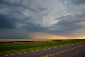
May 30th ended up being the last real chase of the spring season in the southern plains. With a moderate risk up, storms came ripping into southwest Oklahoma from the Texas Panhandle. I tried to tiptoe my way around storms in the Wichita Mountains trying to get a visual on a Tornado-Warned supercell that was near Childress, TX, but it quickly became clear that I wasn’t going to see it, much less catch it. So I turned around and refocused my target to a couple severe thunderstorms that were coming eastbound right down I-40. I tracked right ahead of the storms from Hinton back towards the Yukon and El Reno areas. I finally got my shot near Amber, OK of the severe thunderstorm with the sun setting behind it over a wide open field. Despite nearly getting caught with my pants down as another storm had developed to my southwest and was starting to close off my only escape route, I managed to get out and get home with a rather memorable finale to the main spring chase season.
June: The Chase Scene Shifts West
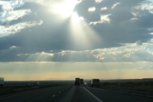
At the end of June, a friend and I went touring around the southwest US. While we were out to do touristy things and sightseeing, we did manage to get a couple “chases” in. It’s quite a bit different chasing up in the Colorado Rockies close to 10,000 feet than it is out on the open plains of Tornado Alley. Our first “chase” was on the high desert in northern Arizona. A gorgeous thunderstorm had formed near Winslow, AZ (it did sadly prevent us from standing on the corner). While the Arizona thunderstorms are just spectacular over the barren desert, it’s the sun shining through the dying thunderstorm that really makes Arizona storms special, and now I know why the Arizona flag looks the way it does.
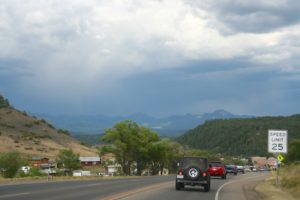
Our second “chase” was across US-160 through southern Colorado. Another beautiful thunderstorm had formed near Durango, CO and we could track right along with it as we crossed the Rocky Mountains. The chase was by far my highest chase, as it brought us to an elevation of 10,857 feet as we crossed the Continental Divide. It was really neat watching the storm interact with the mountains, but the mountains were never able to quite tear it apart. We were finally able to punch out from underneath it as we came down into a valley east of the primary range of the Rockies. We had a spectacular drive across the Front Range with the sun setting behind the storm and the mountains to the west.
July/August: More Chasing in the Mountains
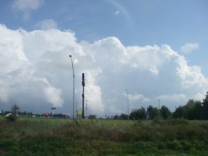
I knocked off chasing in the final US Time Zone as I headed east to visit my family in New England. On the drive back to Oklahoma, I encountered severe thunderstorms crossing the Appalachian Mountains on I-80 in Pennsylvania. These storms were much better organized than the storms in Colorado and the lower elevations of the Appalachians did not effect the storms at all. It was a rather impressive few lines of severe storms, as I picked them up near the Delaware Water Gap in New Jersey and stuck with them for nearly the entire 300-mile trek across Pennsylvania. There were some pretty nice looking photo opps, but the most impressive was of the cumulonimbus towers on the back side of the storms after dropping out of the mountains on the west side.
The fall season this year ended up not really doing much. We had a brief threat of severe weather on October 13th, but the storms had lost much of their punch by the time they approached the I-35 corridor. I got a couple decent shots, but nothing really worth writing home about. It was a little disappointing after the Quakenado/Oklageddon we had on November 7th of last year, but at least now the start of the spring season is only a few short months away.
Have a great holiday season and a great new year!