Large Scale Setup/Discussion
A large ridge of high pressure, or heat dome, has begun to set up over the central US this week, and will be strengthening as we head into this weekend and early next week. As a result, the main branch of the jet stream has been pushed up into Canada, along with any disturbances that are riding along it.
The main effect many people will see from this ridge of high presure is hotter temperatures, especially throughout much of the Great Plains and Mississippi River Valley. Depending on exactly where the heat dome sets up, hotter temps may try to work their way a little bit further east, but that remains to be seen. If we take a look at the upper level wind and surface temperature forecasts from the GFS model, we can see the heat dome setting up pretty clearly this Sunday.
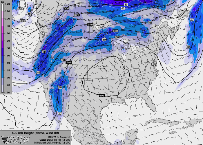
500 mb Wind and Heights
 Surface Temperature, Wind, and Pressure
How Hot Will It Get? Extreme Heat Unlikely!
The good news is that for this heat dome, especially when compared to the past couple summers in the southern plains, will not bring extreme heat to the area. With the exception of a few isolated locations, I do not anticipate temperatures above 100 degrees. Much (if not all) of the area will stay in the low to mid 90’s. The reason is that humidity levels will be high where the heat dome is setting up. In addition to this summer being much wetter than the past two summers, the heat dome is positioned far enough east that the clockwise flow around it is pulling all sorts of tropical moisture from the Gulf of Mexico up into the Great Plains. Dry air heats up much faster than moist air, so the humidity will help keep the temperatures down during the day.
You can clearly see the elevated dewpoints on the left graphic below, but I have also included a plot of relative humidity as well. Keep in mind that relative humidity depends on temperature and will decrease with the heating of the day even if the moisture content doesn’t change. Dewpoint is independent of temperature and is a much better indicator of moisture in the atmosphere.
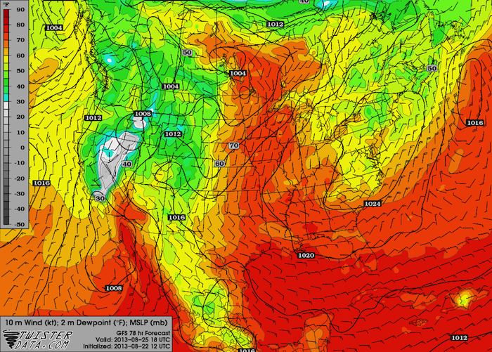
Surface Dewpoint and Winds
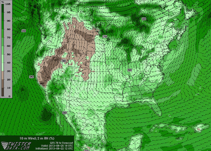
Surface Relative Humidity and Winds
So the bottom line is that while I do not anticipate extreme heat with this heat dome, please do take your heat safety precautions if you’re near the heat dome. Drink plenty of water and try to limit your outdoor work to the early morning or late evening. It will be humid and sticky, especially across the Great Plains, which means that while the actual temperatures will stay down, the heat index or apparent temperature will be high. It would not surprise me to see heat indexes above 100 degrees, especially near the center of the heat dome, which should be centered somewhere over or near Missouri.
A Quick Look at the Tropics: Tropical Depression Nine-E
It has been an unnervingly quiet year in the tropics, and all signs point to that continuing for at least the next few days to a week. A new tropical depression called Nine-E has formed in the Eastern Pacific this morning, but other than possibly bringing some gusty winds and heavy rains to Baja California, it does not appear to be a significant threat to land. I will include some details on the Atlantic side in future posts.
So let’s have a quick look at Nine-E. Forecasts from the National Hurricane Center have it strengthening to a weak tropical storm, and I completely agree with them. Two simple graphics are all I need to show you why. Let’s take a look at the sea surface temperatures, which are shown in the graphic below on the left (along with the storm’s “cone of uncertainty”), and the wind shear, which is shown in the yellow contours on the right hand graphic below.
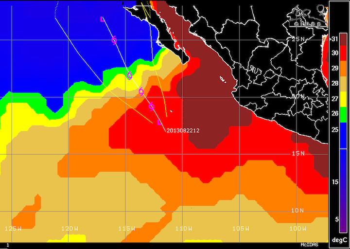
Tropical Depression Nine-E Sea Surface Temperatures
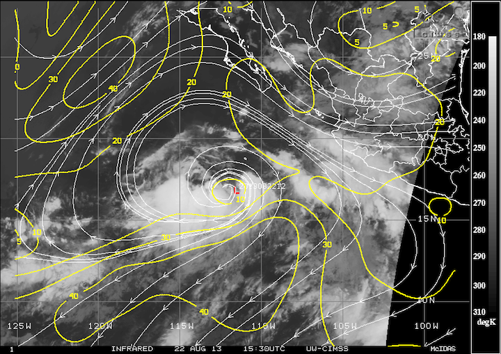
Tropical Depression Nine-E Wind Shear
The Sea Surface Temperatures are pretty self-explanatory. Tropical cyclones require a minimum water temperature around 26°C. Any area shaded in blue indicates sea surface temperatures below 26°C, which by itself is enough to kill a tropical system. Adding wind shear on top of the cold water means a quick and painless death for any tropical cyclone. Tropical storms and hurricanes are healthiest in areas of minimal wind shear. The center of Nine-E, marked by the red “L” on the wind shear plot, fired this morning inside that small contour where there is less than 10 knots of wind shear, which shouldn’t be surprising. As it moves to the north and northwest, it will encounter much stronger wind shear, which will act to rip the storm apart. Finally, you can see on the satellite image beneath the wind shear contours that the center “L” is on the edge of the storm’s main convection or clouds. An asymmetric tropical cyclone (especially one this asymmetric) is a poorly organized tropical cyclone, which are much easier to kill off. The way I see it, that’s three strikes and you’re out for this storm.