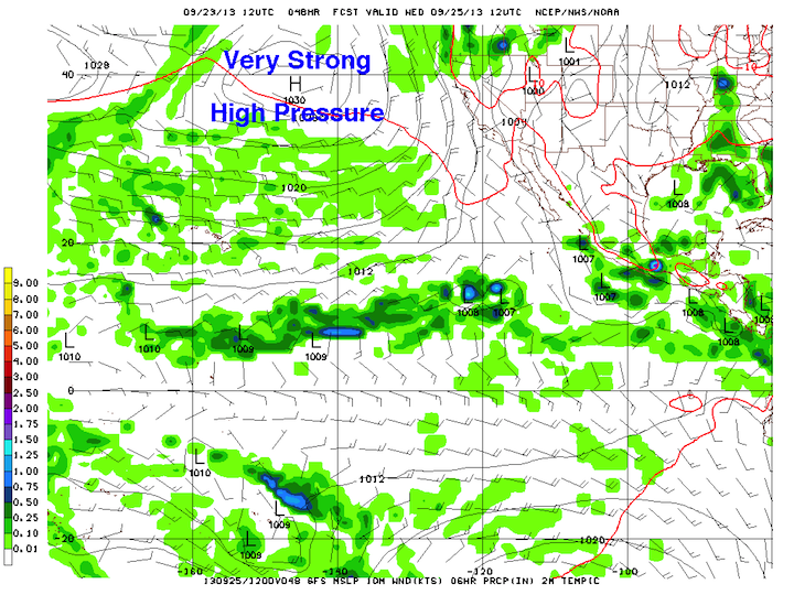
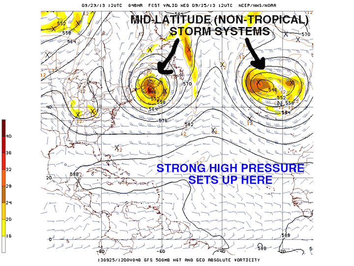
After a brief uptick in tropical cyclone activity in the past two weeks, the outlook for this week looks very quiet for both the Atlantic and Eastern Pacific basins. As we saw earlier this summer, a strong area of high pressure will set up over the south-central Atlantic, and the sinking motion in the mid-to-upper levels of the atmosphere that is associated with these highs will prevent thunderstorm development in tropical waves coming off the west coast of Africa. On the Pacific side, another strong area of high pressure will set up to the northeast of Hawaii, keeping the Eastern Pacific very quiet.

GFS Forecast for the Eastern Pacific

GFS Forecast for the Atlantic
The strong area of high pressure covering much of the tropical Atlantic and Caribbean leaves little opportunity for possible tropical cyclone development. One area to watch this week is the area just off the east coast of Florida. Both the GFS and ECMWF (the European model) are hinting at an area of low pressure developing off the east coast of Florida in the next few days.
The GFS is quite aggressive at strengthening that low, too aggressive in my opinion, but even still, it only strengthens it into a weak tropical storm. While the tropical Gulf Stream waters are plenty warm to support tropical cyclone development, wind shear is quite high because the jet stream is nearby, so if anything does develop, it will strengthen very slowly, if at all. I would be surprised if anything much more than a tropical depression comes out of this. The good news is that the storm’s motion will be to the east/northeast straight out to sea, so it will not be a threat to land. It may try to make a run at Bermuda, but it will not pose a significant risk to life or property.

Possible Weak Tropical Cyclone This Week
Since I have a little time here, I’ll pass along that I will be publishing these weekly tropical weather outlooks every Monday afternoon. They will transition into winter weather outlooks in the winter time, and severe weather outlooks in the spring. They are meant to be a general overview of what to expect for the week, and any details and specific forecasts will be provided in later posts as the week goes on and the event unfolds.