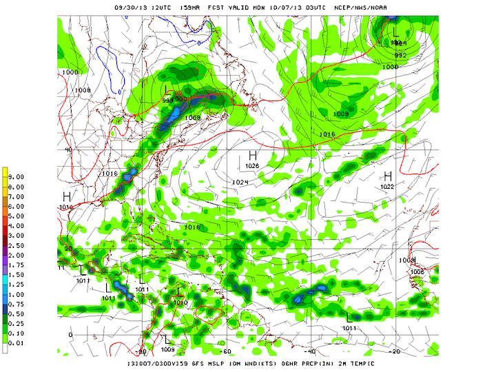
Once again, the tropics have gone quiet, with no indication of any significant activity over the next week. Models are indicating that high pressure will dominate the central and southern North Atlantic, preventing organized convection and thunderstorm activity. Longer-term models are showing that high pressure becoming stronger in the next week or so.
 GFS Forecast for the Atlantic for Monday, October 7th

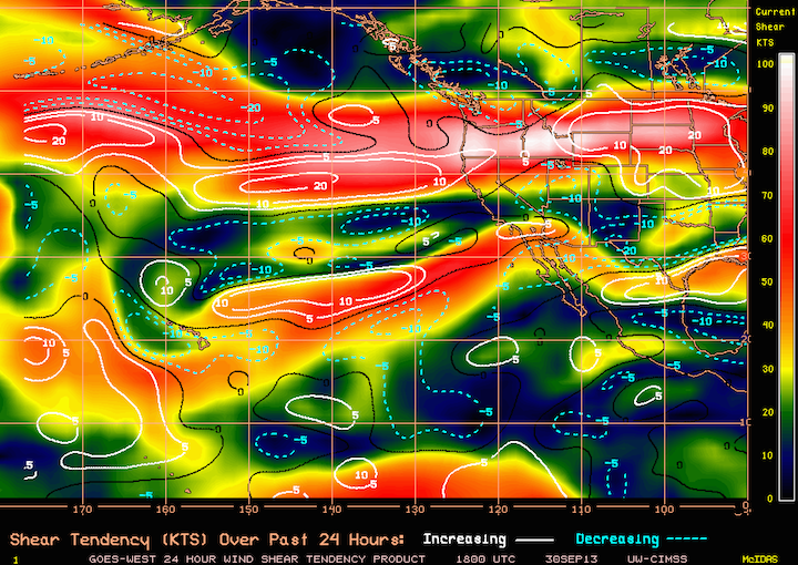
Current Wind Shear (colored) and Shear Tendency (contours) for the Pacific
Looking at current observations, we have Tropical Storm Jerry out over the central Atlantic. Jerry is a minimal tropical storm, and is no threat to any land whatsoever. It is not forecast to move very much over the next few days, and despite being in an area of minimal shear, it is over relatively cool water, which will prevent any significant strengthening and eventually lead to the storm’s dissipation as the high pressure strengthens.
So that’s really about it for this week. Short and sweet. Things on the Pacific side are even quieter. The jet stream has returned to the northern Pacific, so I would expect high amounts of wind shear over much of the Pacific, coupled with high pressure to the south, to keep tropical cyclone activity at bay.