The low that will become the first nor’easter of this winter season is getting set to pop out off the Georgia coast, upon which it will wind up and head right up the east coast. The good news is that the wind and precipitation will be confined primarily to the storm’s warm sector, which will be well above freezing (in the 40s and 50s), making this a rain and wind event and not raging blizzard. The back side of the storm will be cold, but primarily dry.
Part I: Rain and Wind
As a vigorous upper-level trough moves into the northeast, it will help strengthen a potent surface low moving up the coast. Since we are so early in the winter season, the water temperatures off the Georgia and Florida coasts are still warm, so the storm will pull plenty of warm air up with it. A pounding onshore wind will advect these warm temperatures into the coastal areas, resulting in temperatures in the 40s and 50s. Models are showing 925 mb (about 1500 feet) winds between 60 and 90 knots, which will likely translate into sustained surface winds somewhere between 30 and 40 knots with higher gusts (models are in agreement for winds at 925 mb, but vary at the surface). It would not surprise me to see a wind gust or two approaching hurricane strength (64 kts/74 mph) in some of the more exposed areas.
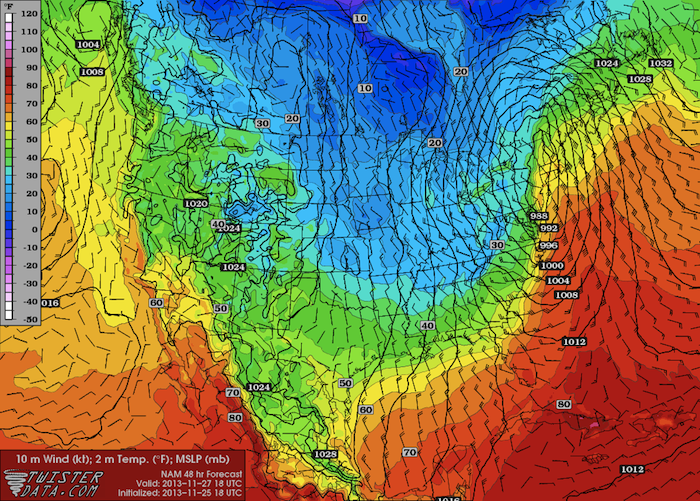
Forecast Surface Temps – Weds at 1 PM EST
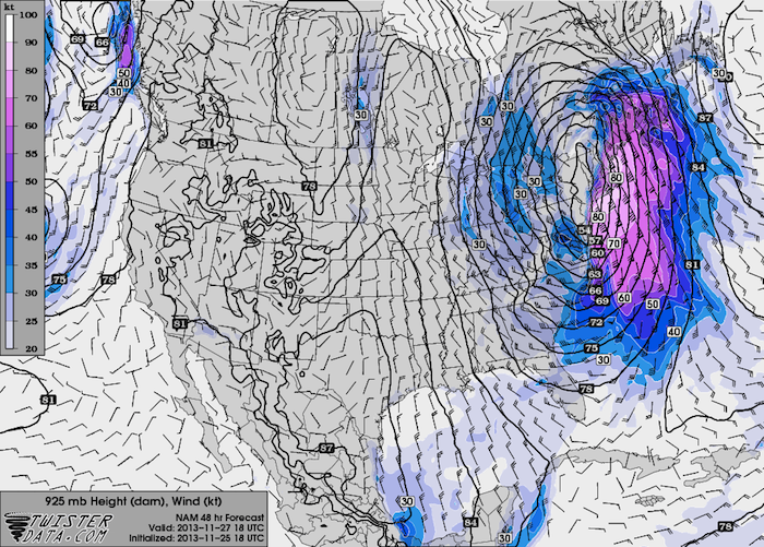
Forecast 925 mb Wind/Heights – Weds at 1 PM EST
In addition to the warm air, the storm will also pull a lot of tropical moisture up with it. Dewpoints will be in the 50s, and may approach 60 in some areas. With so much moisture in place, all areas will see at least an inch of rain. There will be widespread 2-3 inch rain totals across much of the northeast, as well as some isolated higher totals.
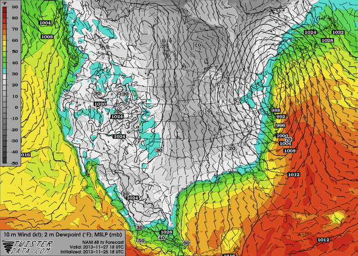
Forecast Dewpoints – Weds at 1 PM EST
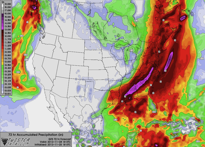
Forecast Rainfall Totals
Part II: The Cold
As with any mid-latitude storm system, there is a cold side of the storm, too. The cold air and moisture will align inland to bring wintry precipitation to the Appalachians, but the storm’s dry slot will be situated over the coastal areas when the cold air moves in. A few snow flurries are certainly possible in these areas, but widespread wintry precipitation at the coast appears unlikely.
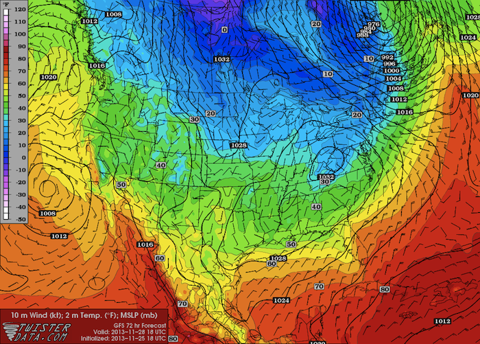
Forecast Temperature – Thurs at 1 PM EST
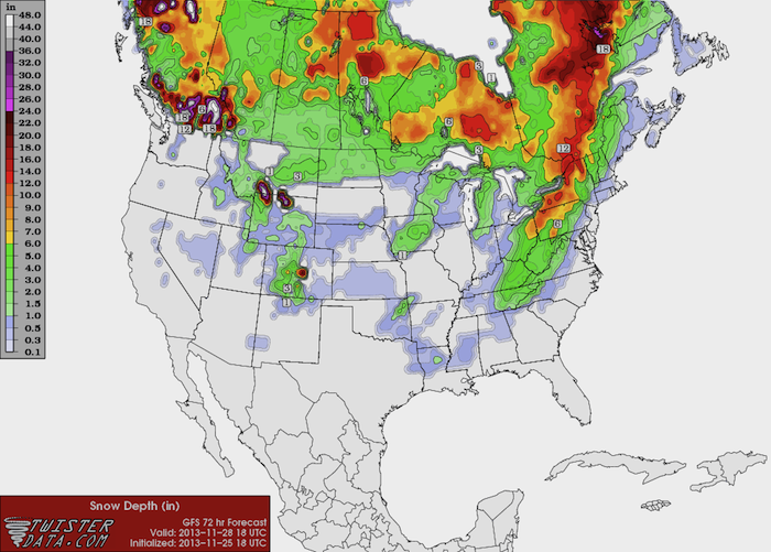
Forecast Snow Depth – Thurs at 1 PM EST
The cold front will cross the coastline sometime Thursday afternoon. Temperatures behind the front will for the most part be in the 20s and 30s, with some inland areas dipping down into the teens. Friday will be cold up and down the east coast, but temperatures will start to moderate over the weekend.
So to summarize, Wednesday will be a wind and rain event at the coast, with snow falling in the Appalachians. Precipitation will end on Wednesday night and be followed by the passage of a cold front on Thursday. Friday will be cold but dry before temperatures begin to rebound over the weekend. Stay tuned for more information over the next few days, as things can change quickly with these storms.