One of the most spectacular displays of thundersnow and thundersleet I’ve ever seen occurred just south of the Oklahoma City metro this past Sunday. A pretty unique weather setup presented itself as a winter storm passed over the area, creating favorable conditions for thunderstorms despite surface temperatures around 12°F. A band of convection set up across southern Cleveland, McClain, and Pottawatomie Counties in the morning, training over the same area before beginning to slide north in the early afternoon. Around 1:30 PM, these thunderstorms began to approach the Norman area. You can check it all out in the video.
A Few Observations from the Thunderstorms
As I’m sure you know, the dynamics inside of thunderstorms are quite complex. These storms provided a very unique observation of mid-level temperature advection that could be seen by simply looking out the window. A light snow had been falling for much of the day prior to the thunderstorms arriving. As the thunderstorms passed overhead, the snow would change over to sleet and drastically increase in intensity. As soon as the thunderstorms passed, the sleet would lighten up and then change back over to snow. The process would repeat as the next cell approached. Exactly why this happens will be covered in later posts.
Even though the outer edges of these thunderstorms just skirted the south side of Norman (the cores of the storms passed between Norman and Purcell), we still got some impressive sleet totals. I measured close to 2 inches of sleet on my back patio from these storms, and I would guess that Noble and Purcell saw even more.
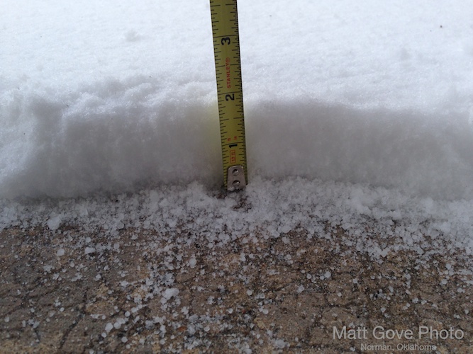
Thundersleet Accumulations on My Patio
Coming Up Next: Analysis of the Setup and the Thunderstorms
In my next post(s), I will dive into some deeper analysis of the meteorological setup that caused the thunderstorms to form, as well what caused the transition to sleet as the thunderstorms passed. Both of these topics are quite fascinating, so stay tuned in the coming days.