Well, the Hurricane Center has been hinting at tropical cyclone development near Puerto Rico for several days now. With it, the probability of tropical cyclone formation has gone up steadily as well (it is 80% chance of development in the next 48 hours as of this morning). Most signs appear to be pointing towards it developing into something. The big question will be what.
The latest model runs are still in pretty complete disagreement on both intensity and track for this storm. The general trend of the models is to take the storm northwest towards the east coast of the US and bend it back out to sea. I have seen models take it right up the US east coast, and I have seen models take it east of Bermuda, so it’s impossible to say right now exactly where it will go.
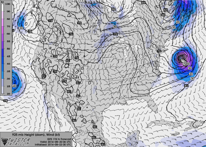
Looking at a couple model runs for the GFS should hammer home exactly how much the storm can vary from run to run. Take a look at the following plots from the GFS run from last night (Friday, August 22 at 8 PM EDT) and early this morning (Saturday, August 23 at 2 AM EDT). You are looking at the 925 mb wind plot (the winds about 1 km up) for next Saturday, August 31st.

GFS Friday Evening Run: Strong Category 1 Hurricane

GFS Saturday Morning Run: Struggling to be a Tropical Depression
With this type of variance in just one model, it’s impossible to say right now what will happen, but I will say this. Looking at the other model runs, the potential is certainly there to get a hurricane off the east coast of the US, but because it’s an El Nino year (which helps hinder Atlantic tropical cyclone activity) and it has been a cool summer across the eastern US, leaning towards a weaker system would probably be the best bet at this time. However, there’s not much we can say for certain right now until both the tropical cyclone forms and the models begin to resemble some form of agreeing with each other.