Tropical Storm Cristobal has finally formed just north of Puerto Rico. As of this morning’s 8 AM EDT advisory, the storm was centered just north of the Turks and Caicos Islands with maximum sustained winds of 45 mph. The Hurricane Center has the storm slowly strengthening while encounters some shear as it drifts to the north/northwest over the next few days before becoming a hurricane off of the Carolinas later this week.
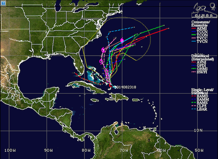
While the model runs this morning somewhat resemble being in agreement, especially when compared to the runs yesterday morning, the run-to-run differences are still very erratic, so we’re not quite at the stage where we can say for certain it’s going to go to this spot at that strength, but we should know a lot more in the coming days. The most recent model runs have been pushing the storm further offshore, but it’s really important, especially at this stage of the game, not to get involved in chasing the models around.
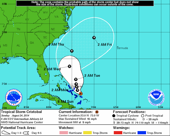
NHC Forecast: 8 AM EDT Sunday, August 24th
As for the specific models, the European and Canadian models have been much more consistent on both intensity and track from run to run than the GFS has. These models both keep the storm slightly closer to shore in their latest runs than the spaghetti plots above show. The GFS is showing the same thing it did yesterday: the evening run has the storm as a Category 2 hurricane, while the morning run has the storm as a pretty weak pile of mush (shown below). Deferring back to the much more consistent European model, my best guess would put the storm somewhere between the two.
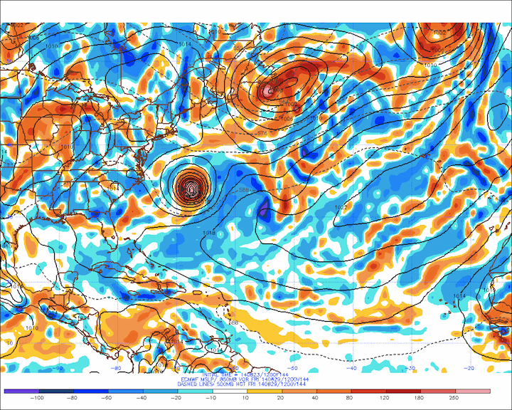 European Model Forecast: 2 AM EDT Friday, August 29
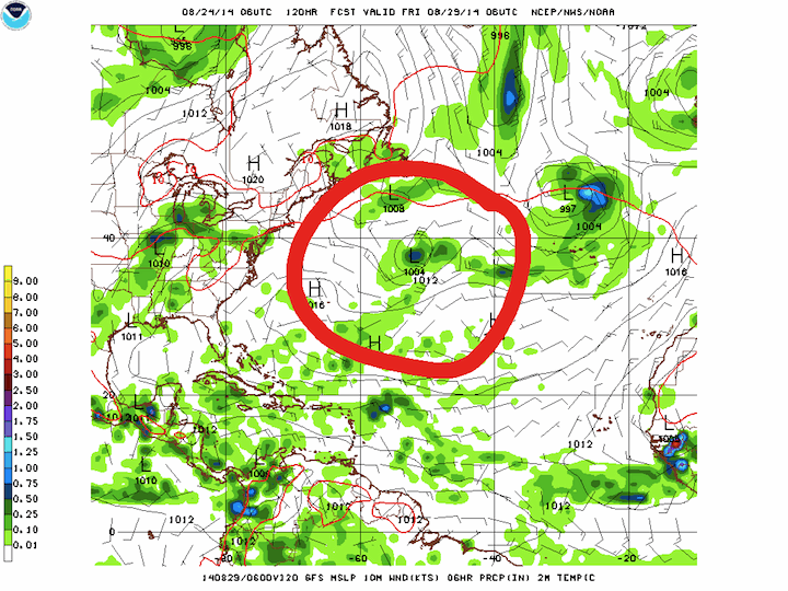
My guess is that the models will begin to converge on a better solution over the next 24-36 hours or so as they gather more data from the now-formed storm. Right now though, the storm does not appear to be a significant threat to the east coast of the US.