Now I don’t know
Jimmy Buffett
I don’t know
I don’t know where I’m a gonna go
When the volcano blow.
Set on top of the Continental Divide outside of Grants, New Mexico at an elevation of 8,000 feet, the Bandera Volcano is a fantastic adventure. Cool off, take in the fresh mountain air, and escape the scorching summer desert heat.
A Violent Geological History
Approximately 10,000 years ago, the Bandera Volcano violently erupted, spewing magma and lava out the southern side of the mountain. As the lava flow cooled and hardened, it created the ice cave at the entrance of a collapsed lava tube. Because the lava rock is such an incredible insulator, the unique shape of the ice cave traps frigid air inside the cave. Temperatures inside the cave never rise above 31°F (-1°C), even in the dead of summer. Coming from the sizzling deserts of Phoenix, nothing felt more refreshing that walking down into the ice cave.
From the visitor’s center, there are two very short hikes to the volcano and the ice cave. Please be aware that both hikes are above 8,000 feet. If you are not accustomed to being at high elevation, you will be huffing and puffing even though both trails are relatively flat. I opted to head up the volcano first. The trail to the volcano is about half a mile one way and rises about 150 feet in elevation.
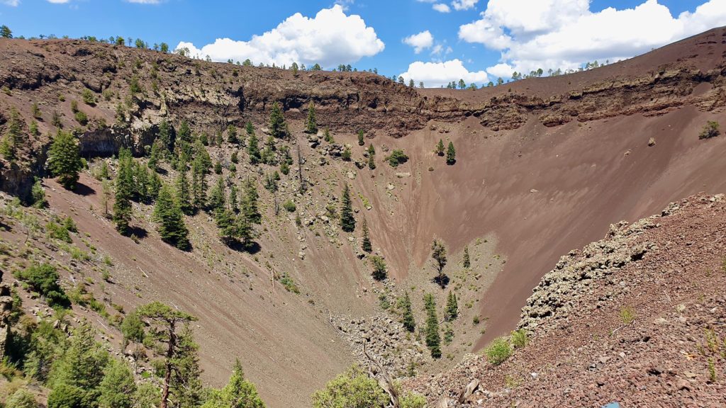
One you reach the edge of the caldera, the first thing that really stands out is just how big the hole in the ground is. The volcano itself is 800 feet deep, which doesn’t sound like much. To put that into perspective, those are full-size pine trees growing inside the crater, as well as on the rim. The amount of force required to make a hole that big in the ground all at once is astonishing. The equivalent amount of dynamite or TNT required to make a hole that big is incomprehensible.
How Does the Bandera Volcano Compare to El Pinacate and Crater Lake?
I found it fascinating to compare the Bandera volcano to other volcanoes I’ve visited in the past. Most recently, in 2017, I visited maar craters (which are formed by volcanic explosions underground) at La Reserva de la Biosfera El Pinacate y Gran Desierto de Altar in Sonora, Mexico and at Crater Lake National Park in Oregon. The maar craters are much more symmetrical in shape. They are also much much bigger than the caldera at the Bandera Volcano. The Bandera Volcano is 800 feet deep and no more than 1,000 feet in diameter. Cráter El Elegante at the El Pinacate Reserve is about one mile in diameter and 850 feet deep. Crater Lake is about 5 miles in diameter and has an average depth of 1,200 feet.
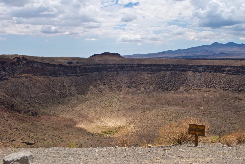
Cráter El Elegante – El Pinacate Biosphere Reserve – Sonora, Mexico 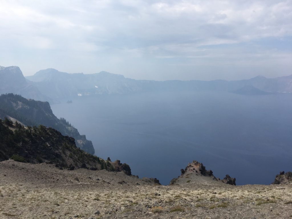
Crater Lake National Park – Oregon, USA
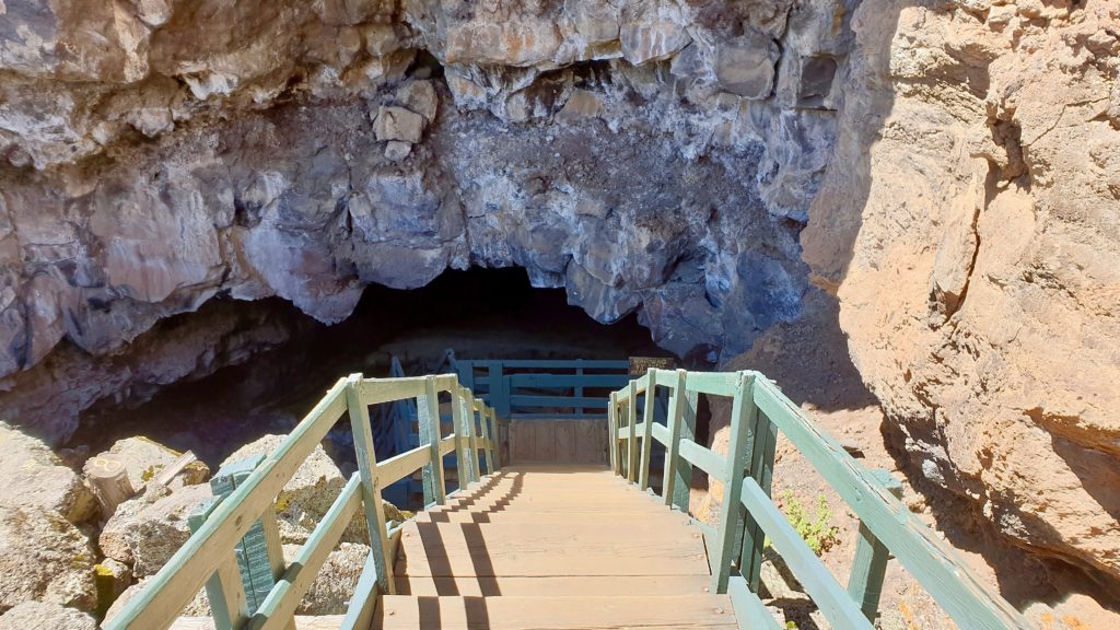
From the volcano, you have to hike back to the visitor’s center to access the trailhead to the ice cave. The trail to the ice cave is an easy hike. It’s about 1/4 mile one way. Other than the 70 or so stairs you need to descend to enter the cave, there is no elevation change.
Like a Walk-In Freezer
As you descend the stairs into the ice cave, logic would dictate that the temperature would gradually drop as you descend into the cave. Amazingly, logic and reasoning will lead you astray here. If you’ve ever gone into a walk-in refrigerator or freezer, that’s essentially what happens when you enter the ice cave. You’ll cross a magic threshold as you descend and the temperature will instantly drop from whatever the ambient air temperature is (about 80°F when I was there this afternoon) down to about 30°F inside the cave.
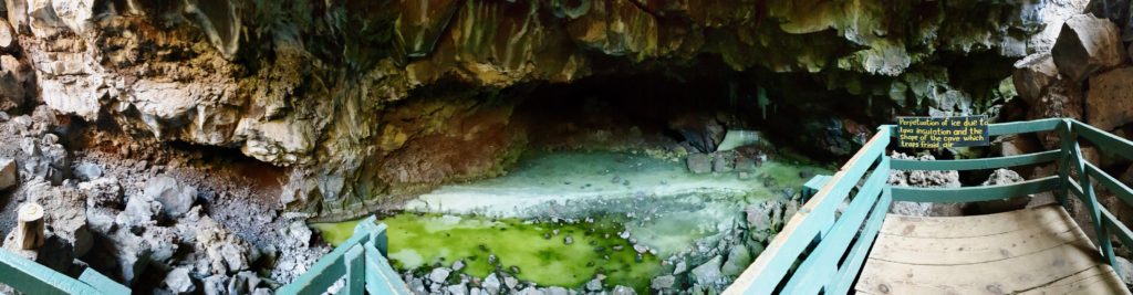
The unique shape of the cave, coupled with the incredible insulating properties of the lava rock, traps cold air inside the cave and creates the walk-in freezer effect. The ice is over 20 feet deep and is roughly estimated to be up to 3,400 years old. The greenish teal tint to the ice comes from Arctic algae and alpine moss. Both are incredibly rare to find this far south.
If you’re ever passing though western New Mexico on Interstate 40, I highly recommend a stop at the Land of Fire and Ice. If you have additional time, driving the full length of NM-53 is a scenic and breathtaking alternate to Interstate 40. It passes through the Zuni Reservation and becomes AZ-61 once you cross into Arizona.