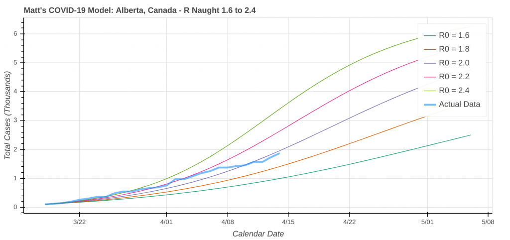
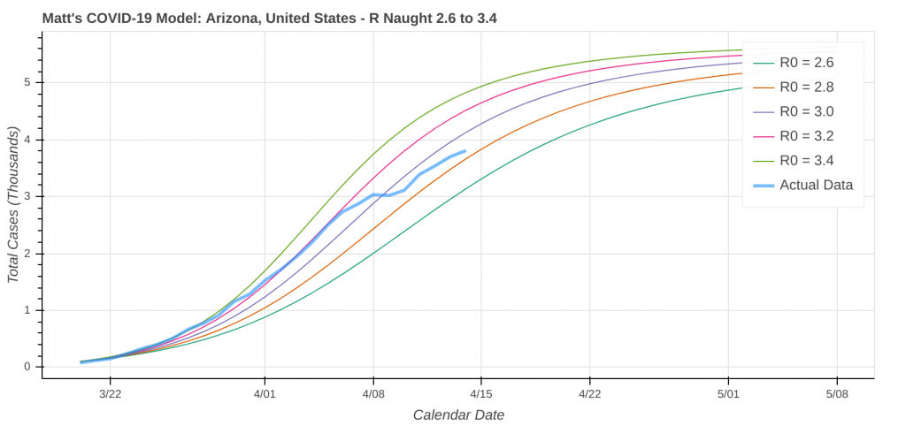
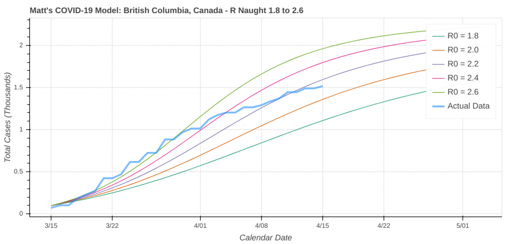
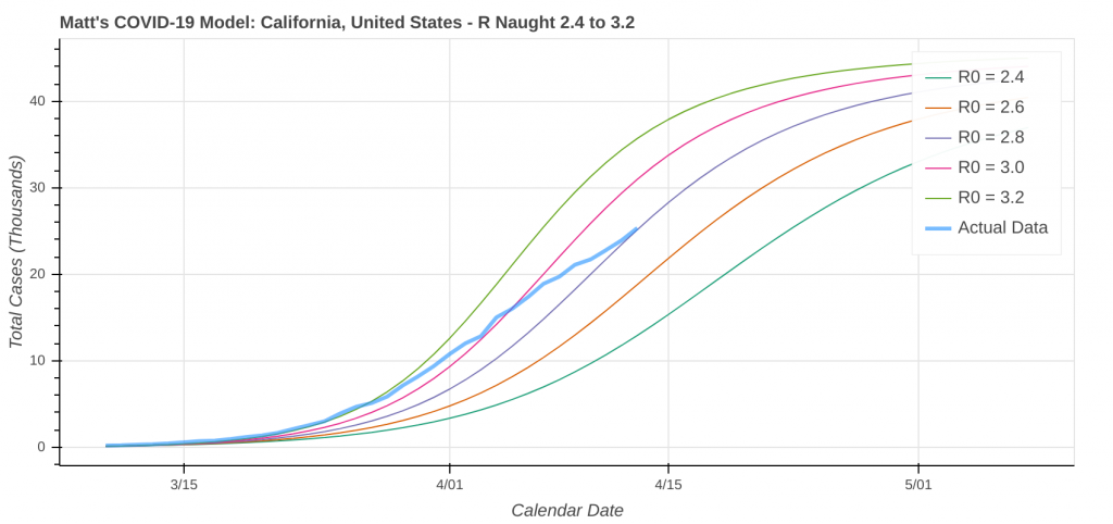
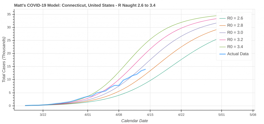
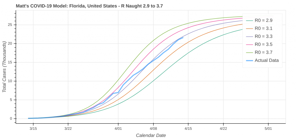
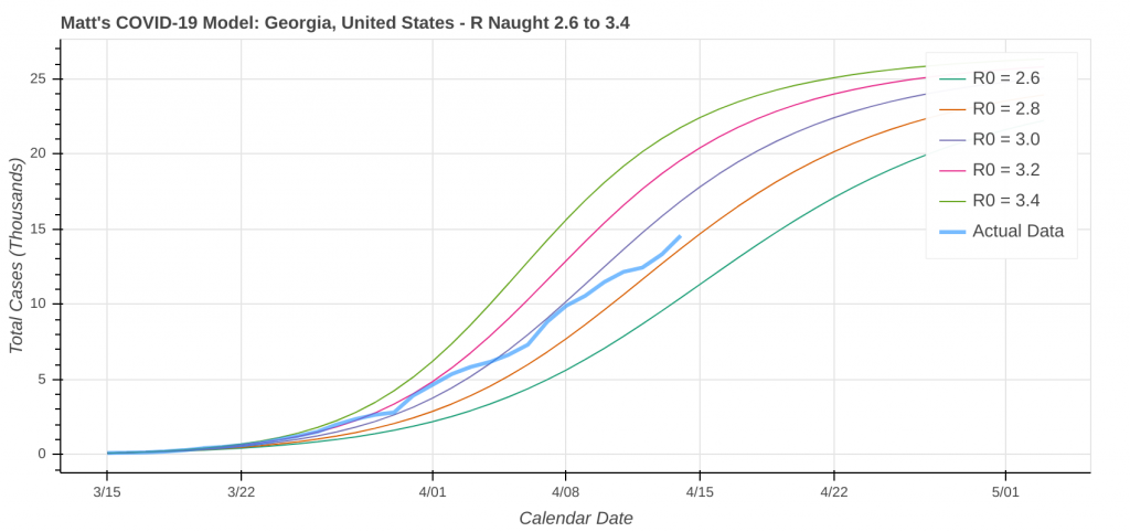
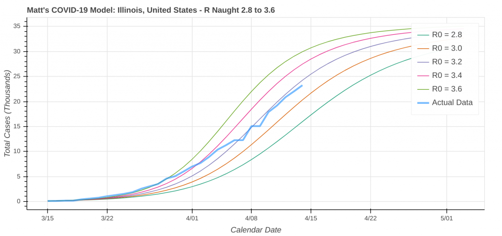
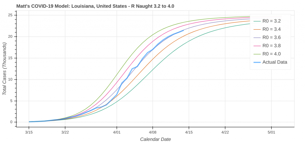
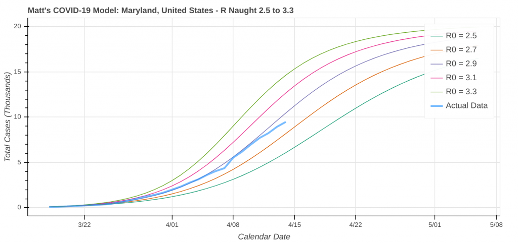
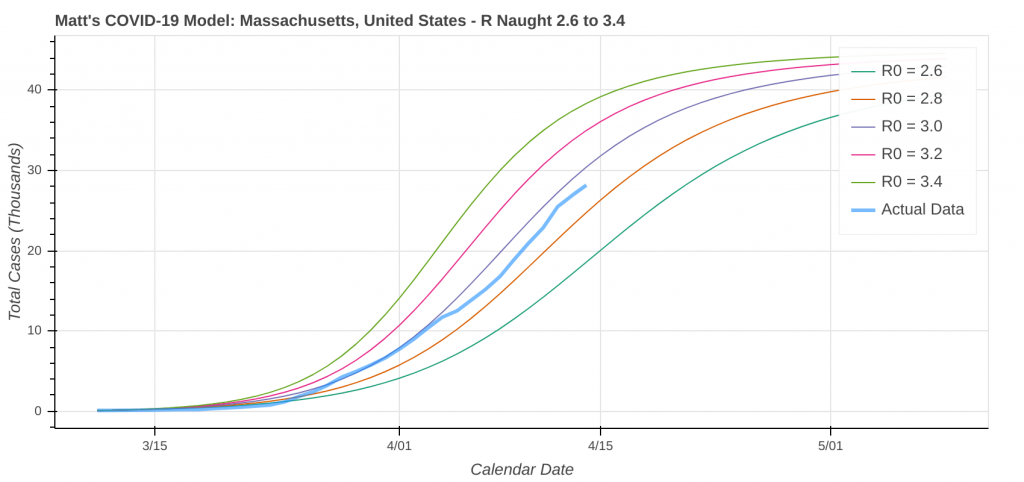
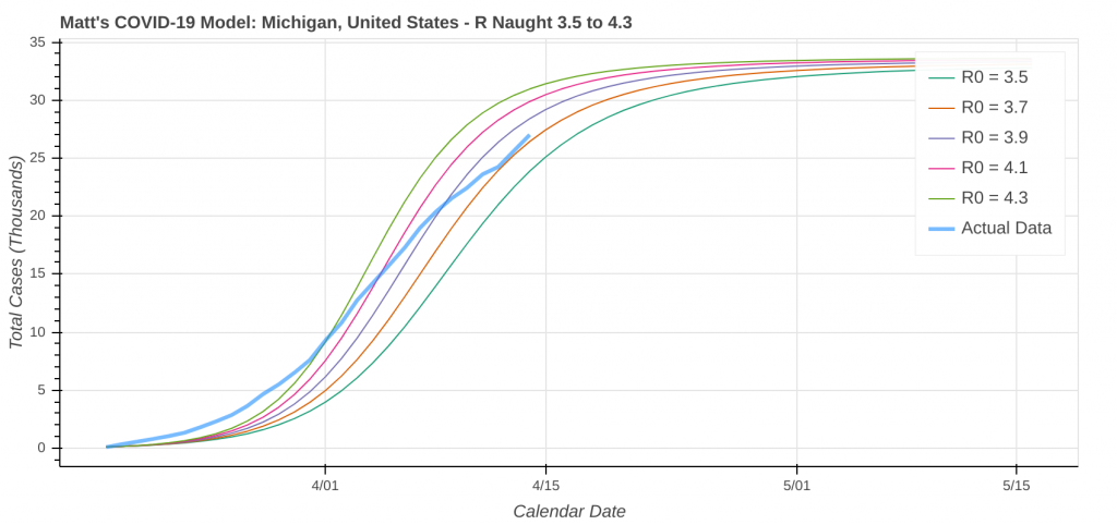
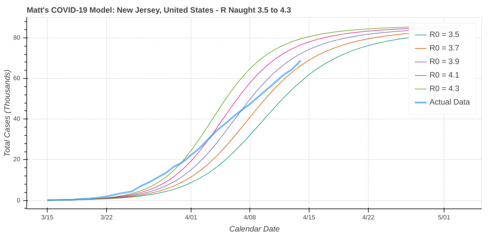
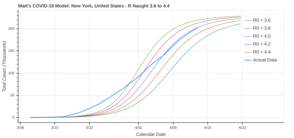
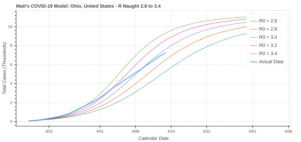
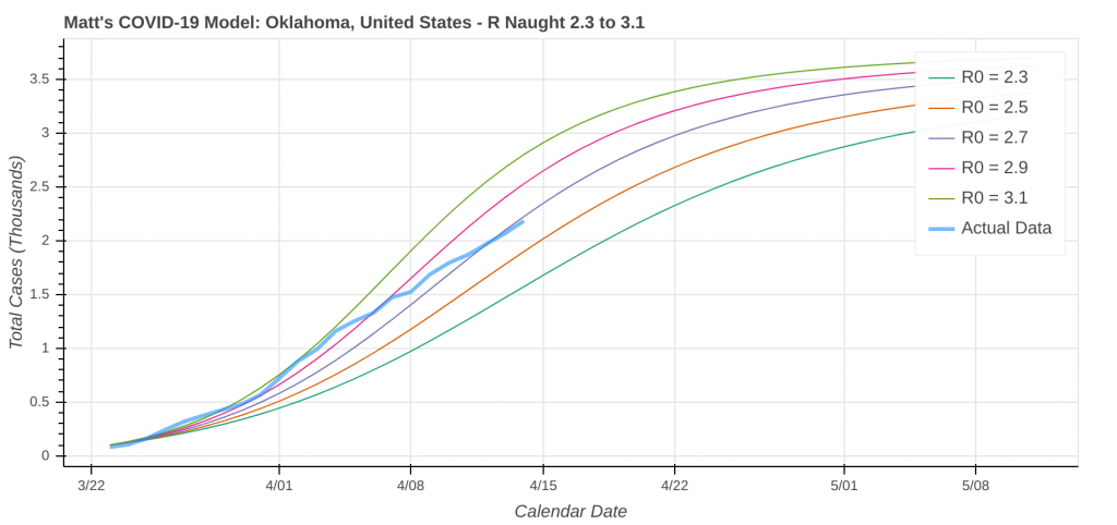
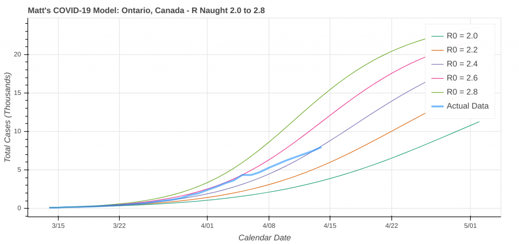
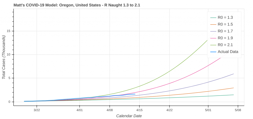
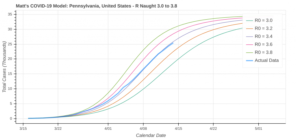
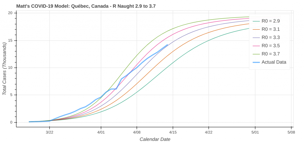
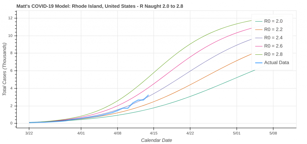
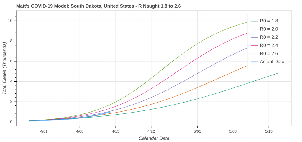
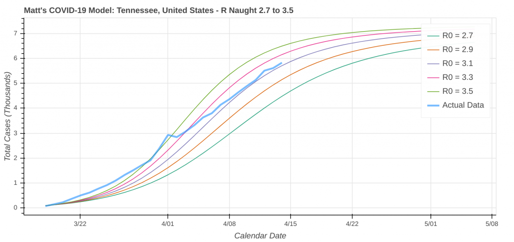
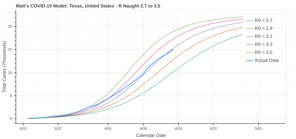
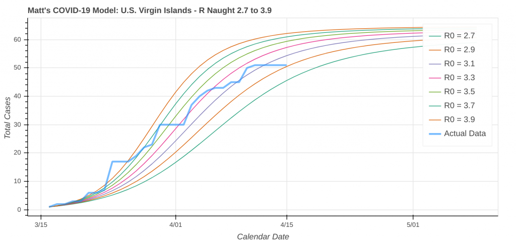
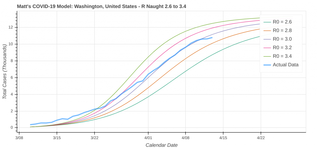
Below you will find the latest state and provincial projections from the 15 April model run of my COVID-19 model for the US and Canada. I have included states and provinces that are in “hot” areas in both countries, as well as places where I have friends, family, and other loved ones. I alphabetized the plots by state or province name. The thick blue line represents the actual or observed data, and the other lines indicate the model predictions.
I only ran the models out until early May because we need to focus on what’s going to happen in the next two to three weeks, not what’s going to be happening several months in the future. Additionally, model forecasts get less accurate the further into the future you go. This run assumes current social distancing restrictions remain in place through mid-May and does not account for any additional surges or waves of the virus that may occur later this spring, this summer, or this fall.
Don’t forget, you can always get more information about the model and view detailed case data on my COVID-19 Dashboard. Additionally, I will write up a separate post about the mathematics, equations, and methodologies used in my coronavirus model, which I’m hoping to get posted in the next day or two. Stay tuned for additional discussions about each hot zone as more data comes in.
Alberta
Arizona
British Columbia
California
Connecticut
Florida
Georgia
Illinois
Louisiana
Maryland
Massachusetts
Michigan
New Jersey
New York
Ohio
Oklahoma
Ontario
Oregon
Pennsylvania
Québec
Rhode Island
South Dakota
Tennessee
Texas
U.S. Virgin Islands
Washington (State)
After several requests, I updated this post on 16 April, 2020 to include additional states and provinces, bringing the total to 26 plots instead of 24.
Top Photo: Palo Duro Canyon State Park – Amarillo, Texas – August, 2019