After setting foot inside the Utah National Parks for the first time in 2012, getting to all of Utah’s “Big 5” National Parks instantly went on my bucket list. After allocating far too little time during that first visit to Zion in 2012, I knew I would get back to Utah, eventually. At the time, I had no idea if eventually meant 5 years, 10 years, or even 20 years. I just knew I needed to get back.
Five years later, I did finally get back. On a family trip in 2017, we checked off Zion (again), Bryce Canyon, and Capitol Reef National Parks in southern Utah. Despite being so close to each other, all three National Parks are so different, so unique, and so breathtaking. But the two northern Utah National Parks, Arches and Canyonlands, remained elusive. And living in Arizona, it was another frustrating case of so close, but yet so far. Year after year. But that only made me more driven than ever to get there.
What Are the “Big 5” National Parks in Utah?
If you’re unfamiliar with Utah’s geography, the state has an incredible diversity of National Parks, National Monuments, National Forests, National Recreation Areas, and Bureau of Land Management (BLM) land. Utah is quite literally a recreation paradise that offers just about every outdoor activity you can think of. The five national parks in Utah are, in alphabetical order:
- Arches National Park
- Bryce Canyon National Park
- Canyonlands National Park
- Capitol Reef National Park
- Zion National Park
Zion, Bryce Canyon, and Capitol Reef National Parks are clustered together in the southern part of Utah. At the same time, Arches and Canyonlands National Parks sit about 30 minutes apart in northeastern Utah.
The COVID-19 Pandemic Provides Motivation for Going to Check Off Bucket List Items
I, like many people, took a lot of things for granted prior to the COVID-19 pandemic, including travel and photography. When the world shut down in March, 2020, it took the travel and photography away from me. For over a year and a half, it felt like part of me was missing. And in a way, it was. But instead of seeing the pandemic as a setback, it became a once-in-a-lifetime opportunity for me.
The pandemic has made me more driven than ever to pursue my passions, goals, and mission. I decided to further integrate travel, photography, and videography into the core of my business. It led me to realize exactly what I want life to look like. And now, it’s time to chase those new dreams.
Utah National Parks: Trip Background and Motivation
The primary purpose of this trip was to take care of the business of selling my house in Arizona. However, I wanted to make sure I mixed in a bunch of fun, too. And that has nothing to do with the fact that moving sucks, and I’ve done it far too many times. It’s because I haven’t had a fun trip since my 2019 Road Trip across Mexico, the United States, and Canada. Two and a half years is a very long time to go without something that you’re not only passionate about, but also something you use as an escape from tough times.
The logistics for the trip came into place absolutely perfectly. Because COVID-19 was still raging in the south, I opted for the northern route (I-80) across most of the country. Furthermore, one of my friends had just moved to Boulder, Colorado, which was also conveniently right along the way. But best of all, it meant that I’d be driving right by the two remaining Utah National Parks – Arches and Canyonlands – that I had yet to visit, on my way back to Arizona. Unfortunately, I only had about a day and a half to explore both parks, so I wanted to make sure I made the most of every minute I had.
Day 1: Catching Sunset at Arches National Park
After a spectacular drive across the Colorado Rockies on Interstate 70 from Boulder, I rolled into Moab around 3:30 PM local time. After checking into the hotel, I didn’t even bother heading up to the room. I headed straight to Arches National Park. This was in early December, so I only had about an hour and a half to familiarize myself with the park and scope out a good place for a sunset photo shoot.
I Nearly Missed the Sunset Because I Wasn’t Paying Attention
If you’ve ever been to Arches before, you’ll know that it takes about 45 minutes to drive from one end of the park to the other. Unfortunately, I didn’t realize this because it was my first time at Arches. If there’s one thing you need to know about me, it’s that I tend to pull off and shoot a lot of photos and videos my first time I visit somewhere new. This is especially true for a place as beautiful as Arches.

After what felt like just a short few moments, I looked down at the clock. It was almost 4:40 PM. I only had about 15 minutes to find a spot to watch the 5:00 PM sunset. And wasn’t even half way through the park, yet. That’s about when that little bit of panic sets in. Am I going to miss sunset because I was being an idiot and not paying attention to the clock? Not if I can help it. To make matters worse, there’s no cell service inside the park, either.
Thankfully, with the help of my GPS and the brochures the National Park Service gives you when you enter each park, I identified a good spot several miles back that would be a good spot to watch sunset. But could I make it in time? The truck may have felt like an Indy Car at times racing back to that spot, but rest assured I obeyed the speed limit at all times. And the timing ended up being perfect, as I got there about 7 minutes before sunset.
Post-Sunset Twilight at Arches National Park is Absolutely Magical
If you think the golden hour is a magical time for landscape photography, you’ve never seen Arches National Park during that 40-or-so-minute window of dusk and twilight following sunset. The entire landscape is cast in a spectacular color. It starts as a vibrant violet or purple right after sunset and slowly shifts to a navy blue hue as dusk progresses. When contrast against Arches’ brilliant red rocks and a fresh blanket of snow on the top of the nearby LaSal Mountains, it’s no wonder why these are such sought-after shots. The same goes for all of the other Utah National Parks, too.
While watching the last dregs of light disappear from the western horizon, I was completely awe-struck by what I had witnessed. It was really that beautiful. I could have easily sat there all night watching the stars, but that’s a project for another day. Time to head back to the hotel to get dinner and a good night’s sleep.
Utah National Parks Day 2: Diving Deeper into Arches and an Afternoon at Canyonlands
After waking up, I rolled over and looked at the clock. 6:20 AM. Then I opened the weather app on my phone to check the sunrise. 7:23 AM. There was more than enough time to get to Arches to see the sunrise. I hadn’t originally planned to get up in time for sunrise because thick cloud cover was expected to roll in early that morning. But skies were still relatively clear, so I quickly got dressed and headed back up to Arches. I wouldn’t be able to live with myself if I missed a beautiful sunrise.
The Arches Sunset was Breathtaking. Then Sunrise Said “Hold My Beer.”
If there’s one thing I learned in all the years I spent storm chasing, it’s that plans rarely go off without a hitch. Mother Nature always seems to throw you a curveball at some point. Sometimes it’s for the better. Other (read: more often) times it’s not. Up at Arches that morning, the weather gods were looking out for us. The arrival of the thick cloud cover was delayed a few hours. It left absolutely perfect conditions for a beautiful sunrise in its place.
To Fully Experience Arches National Park, You Need to Get Out and Hike
Despite the gloomy skies and cold temperatures, I was actually most looking forward to doing some hiking at Arches National Park. After catching the sunrise, I headed up to Devil’s Garden, at the far northern end of the park. My friend in Boulder had recommended this hike because it gave you the most bang for your buck for seeing as many arches as possible if you didn’t have much time. And boy, was he ever right.
After setting off from the trailhead, you only need to hike about 600 feet, or 200 meters, to reach the first arch. From there, you’ll see 4 additional arches in the first mile of the trail, which will bring you to Landscape Arch. In September, 1991, visitors at Landscape Arch witnessed one of the largest rock falls in Arches National Park history. After hearing some cracking sounds, nearly 180 tons of rock fell from the bottom of Landscape Arch to the ground below. Those rocks still litter the landscape today.
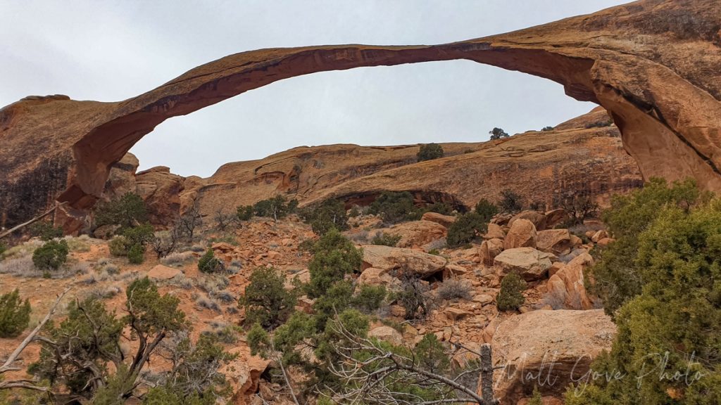
Following the rock fall, park rangers closed the trail that led underneath Landscape Arch. That trail remains closed to this day. However, you can still get plenty close enough to get good photos and videos of it.
While you can make a loop through even more arches past Landscape Arch, I opted to return to the parking lot. The end of the main trail is at Landscape Arch, and I didn’t want to risk getting lost on the primitive trail. Plus, there were other parts of the park I still wanted to see, and I didn’t have a whole lot of time left, so I hiked the 1 mile (1.6 km) back to the parking lot.
Don’t Miss Delicate Arch, which is Utah’s Most Famous Arch
Even if you’ve never heard of Delicate Arch, I’ll be willing to bet that you’ve seen it before. It’s one of the most famous geologic features in the world. You can find pictures of it on tourism brochures, guides, and promotions not just in Utah, but throughout the western United States. It’s one of the most photographed spots in the entire National Park system, and even appears on the Utah license plate. And you can find it at Arches National Park.
Unfortunately, I did not have time to hike the three mile (4.8 km) round trip to Delicate Arch. And I’ll be the first to admit, I was a bit lazy too. The previous hike in the cold certainly didn’t help. But that didn’t stop me from getting pictures of it. You just have to work smarter, not harder.
There is a lookout where you can view Delicate Arch from two viewpoints off of a parking lot about half a mile (just under 1 km) from Delicate Arch. I had hoped to hike to the closer viewpoint, but I found barricades across the trail. It was closed for maintenance. So I got my big telephoto lens and walked out to the second, further away viewpoint. All I can say is, well, telephoto lens for the win!
Take Another Short Hike at The Windows on the Way Out of Arches National Park
If you’re short on time, I can’t recommend a hike at The Windows enough. At 0.7 miles (1.1 km) round trip, it’s an easy, relatively flat hike that will net you three additional arches. You’ll first visit the beautiful pair of arches that make up The Windows. You can actually hike right up underneath them and take in the view on the other side. Then, turn around and you’ll find a bonus: Turret Arch. While it doesn’t dominate the landscape the way The Windows do, Turret Arch is a great place to get your picture taken standing underneath the arch.
Well, Arches, it’s been real, but it’s nearly mid-day, so it’s time to head over to Canyonlands.
Canyonlands National Park: An Island in the Sky
The main entrance to Canyonlands National Park is about a half hour north of Arches National Park. Driving into Canyonlands for the first time felt an awful lot like the first time I visited the Grand Canyon. After a beautiful drive across the plateau, you arrive at the entrance station. A short distance from the entrance station, you get your first view of the canyon. And you realize right away why they call it Island in the Sky.
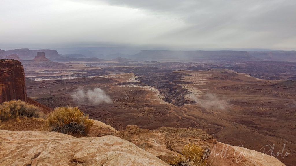
Like Grand Canyon, the Colorado River is responsible for carving Canyonlands National Park out of the surrounding plateau. Canyonlands also is broken into two areas. However, you’ll notice a few distinct differences. First, Canyonlands is much shallower and much wider than Grand Canyon. Second, it’s much less crowded, and you can actually drive down to the river. It’s a primitive dirt road through gnarly backcountry, but that’s a story for another day.
Canyonlands’ Grand Overview
The road into Canyonlands National Park ends at Grand View Point, about 12 miles (19 km) from the Visitor’s Center. I recommend you start there for two reasons. First, it’s the best view in the whole park. Grand View Point features 270-degree views of the surrounding canyons. Second, by starting at Grand View Point and working your way back to the Visitor’s Center, you’ll be able to see the whole park if you run out of time.
A Different Perspective Around Every Corner
One of my favorite aspects of my trips to Grand Canyon National Park is that for all of the pulloffs and lookouts it has, each one has a different perspective of the canyon. Canyonlands is the exact same. I stopped at every overlook I could find, and they photos simply speak for themselves.
Take an Excursion Down Upheaval Dome Road
About half way between the Visitor’s Center and Grand View Point, you’ll find the turnoff for Upheaval Dome Road. Along the road, you’ll find numerous hiking opportunities, as well as plenty of pullouts, overlooks, and beautiful scenery. I hiked short distances down both the Upheaval Dome and Whale Rock trails, but the windy, cold, and raw weather made longer hikes rather unpleasant. I guess that’s just another excuse to return to Canyonlands in the future.
The sun going in and out of the clouds did, however, make for some spectacular lighting in both photos and videos. The sun shines through the clouds like a spotlight on the landscape, bathing the jagged landscape in a beautiful, warm light. Again, here, I’ll just let the photos tell the story.
A Deserted Mesa Arch will Make Even The Most Seasoned Instagrammers Jealous
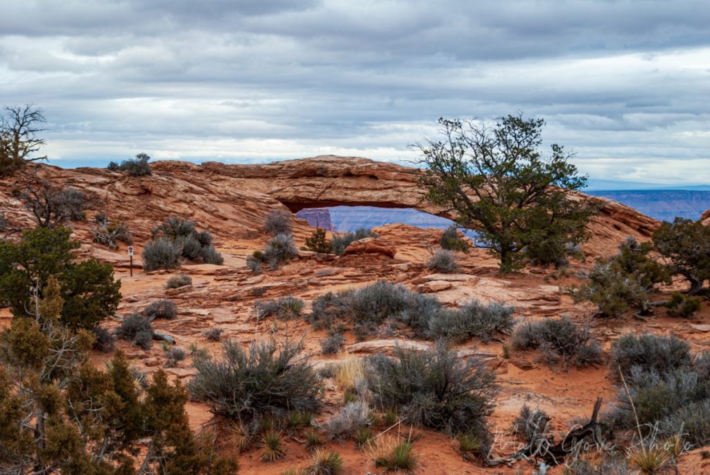
Mesa Arch is the most popular photo spot in Canyonlands National Park. Sought after by everyone from professional landscape photographers to social media influencers, Mesa Arch is best known for its sunrise photo ops. In fact, it’s so popular that there is actually a sign there telling people not to take too much time taking photos at the arch itself so that other people have a chance to take pictures as well.
One of the biggest perks of being at both Arches and Canyonlands National Parks in early December is that you’re there at the peak of the offseason. As a result, I had both parks to pretty much myself. Even at the most popular hiking trails, there may be two or three other cars in the parking lot, but other than that, it was completely empty. And best of all, this is what Mesa Arch looked like. Just admit it. I know you’re jealous.
Sunset at Canyonlands
As I made my way down the hill back to the Mesa Arch trailhead, the western sky was starting to clear. Conditions weren’t quite as perfect as they had been at Arches that morning, but if they held, sunset would be spectacular. Not wanting to repeat the same mistake two days in a row, I knew exactly where I wanted to go photograph the Canyonlands sunset: the Green River Overlook. And best of all, it’s only about a three-minute drive from the Mesa Arch trailhead.
I got to the Green River Overlook at about 4:15 PM for a 5 PM sunset. Conditions still looked really good for sunset. However, I knew from my training in meteorology that it was pretty much a flip of a coin whether it would hold on long enough to give us a beautiful sunset. And while everything aligned perfectly that morning for the sunrise at Arches, this one unfortunately went the other way.
By about 4:35 PM, thick clouds had rolled in, covering the western sky. You just knew those clouds were there to stay. There would be no spectacular Canyonlands sunset that day, as thick clouds just kept rolling in. But they couldn’t take away the spectacular view at the overlook.
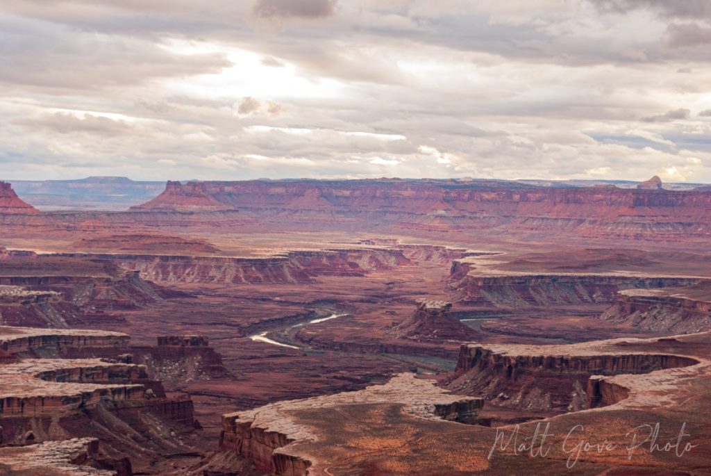
Even though the sunset didn’t work out, it was impossible to drive back to Moab fully dejected. It had been an incredible day-and-a-half exploring Arches and Canyonlands National Parks. Plus, I still the southern (Needles) part of Canyonlands to look forward to the next day. I ended the day with some really good Thai food in Moab. Basil chicken with some of the best hot chili sauce I’ve ever had.
Day 3: The Rest of Canyonlands Leads to a Couple Unexpected Surprises
On my final morning in Utah, I woke up to a very unexpected surprise. Winter Storm Warnings were up for most of east-central and southeastern Utah. Parts of San Juan County, which sits just south of Moab, could see heavy blowing snow and up to 8 inches of accumulation. It had my attention.
While conditions were fine in Moab itself, I knew that things could be much different once you get south of town, where you climb from from about 4,000 feet up to 7,000 feet in elevation. Further complicating the matter, the only route available to get back to Arizona took me right through the heart of the Winter Storm Warning. Conditions would only deteriorate as the morning went along, so I didn’t waste any time getting on the road heading south.
The Needles District of Canyonlands National Park
While Island in the Sky and Needles – the two districts of Canyonlands National Park – sit just across the canyon from each other, the two entrances are about 70 miles (113 km) apart. Because of its proximity to Moab and better views of the canyon, Island in the Sky sees far more visitors than the Needles district. Needles is generally considered to be much more rustic and remote than Island in the Sky. It’s the same phenomenon you see in the South vs North Rims of the Grand Canyon.
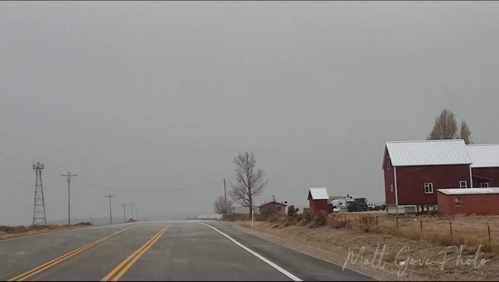
As luck would have it, the majority of the Needles district was north of the Winter Storm Warning. However, as I approached the turnoff, it became very clear that the turnoff that went to the entrance of the Needles District was far enough south that it fell within the Winter Storm Warning. By the time I got to the turnoff, light snow had begun falling, and gusty winds were starting to pick up. There was also a sign stating that the road into the Needles District of Canyonlands National Park was closed due to the incoming snowstorm. So I begrudgingly continued south.
A Second Unexpected Surprise Checks off Another Bucket List Item
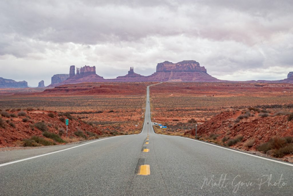
By the time I rolled into the town of Blanding in southeastern Utah, I was through the Winter Storm Warning, but I still didn’t know what I wanted to do as. an alternative to Canyonlands. I knew that the very least, I wanted to go take photos of the rock that gave the town of Mexican Hat its name. In addition, I also planned to stop at the famous movie spot north of Monument Valley where they filmed the scene in which Forrest Gump stopped running.
Valley of the Gods: Checking Off Another Bucket List Item
As I made my way towards Mexican Hat, a small sign on the side of the road caught my eye. That sign was for Valley of the Gods Road, with an arrow pointing off into the desert. Holy crap! That’s the perfect alternative for Canyonlands. Driving through the Valley of the Gods had been on my bucket list ever since I moved to Arizona. I had hoped to drive it on my trip through southern Utah in 2017, but I had my parents with me then. We simply didn’t have enough time to drive it. Furthermore, my mom and dad didn’t want to go bouncing down a dirt road for two hours.
As you turn down Valley of the Gods Road, there are huge signs warning you that the road becomes impassable when wet, even with four wheel drive. And with that winter storm just to the north, rain was a very real possibility. With the last fleeting bar of cell service, I tried to pull up the nearest radar, which was in Grand Junction, Colorado. No signal. I tried and tried again. Still no signal. Finally, the radar image appeared. Rain was just on the other side of the mesa that formed the western boundary of the Valley of the Gods. It couldn’t have been more than 15 or 20 miles (25 to 32 km) away, and it was heading straight at me.
Will the Rain Hold Off or Render the Road Impassable?
My background in meteorology gave me a gut feeling that the mesa would likely be tall enough to wring all of the rain out of the clouds, preventing it from reaching the Valley of the Gods. A closer look at the radar showed that the line of rain was struggling to push east as it approached the mesa.
I was this close to checking off another bucket list item, plus had just gotten stuffed up at Canyonlands. I didn’t come all this way just to go home empty-handed. So I took the gamble that the mesa would keep the rain at bay. And boy, was it ever worth it. I did not see a drop of rain in the nearly three hours I was in Valley of the Gods.
Conclusion
By far, the best part about visiting national parks like Arches and Canyonlands in the offseason is that you basically have the entire park to yourself. If you can tolerate the cold, damp, raw, and even snow, you’re bound to have a fantastic time. And that goes for not just Arches and Canyonlands, but for National Parks across Utah and the rest of the west. Having now visited all of the “Big 5” National Parks in Utah, it only intensifies the drive to return to the parks, dive much deeper into them, and be able to fully experience and explore everything the Utah National Parks have to offer. This time, I just hope it will take shorter than 5 years to make it back there.
Top Photo: The sun begins to rise at Arches National Park
Moab, Utah – December, 2021


