With the beginning of the fall or “second” severe weather season here on the Great Plains, coupled with the tropics remaining quiet, I am going to shift this week’s discussion from the tropics back closer to home and talk about severe weather. The fall severe weather season started quite emphatically this past weekend, with an EF-4 tornado in Nebraska and close to 4 feet of snow in parts of South Dakota.
Another powerful upper-level storm system is set to move across the United States later this week, and a cold front will sweep across parts of the central and northern plains between Thursday and Saturday. While it is still too early to say exactly what will happen, I would expect to see at least a few severe storms somewhere in that time frame.
Before we jump into the details, remember that to generate severe weather, you need four main ingredients: instability, moisture, lift, and shear. Let’s start by looking at the big picture forecast from the GFS for Thursday evening at 7 PM CDT. Below you will find the upper-level jet stream map, as well as a surface temperature/wind map, with the approximate location of the cold front labeled.
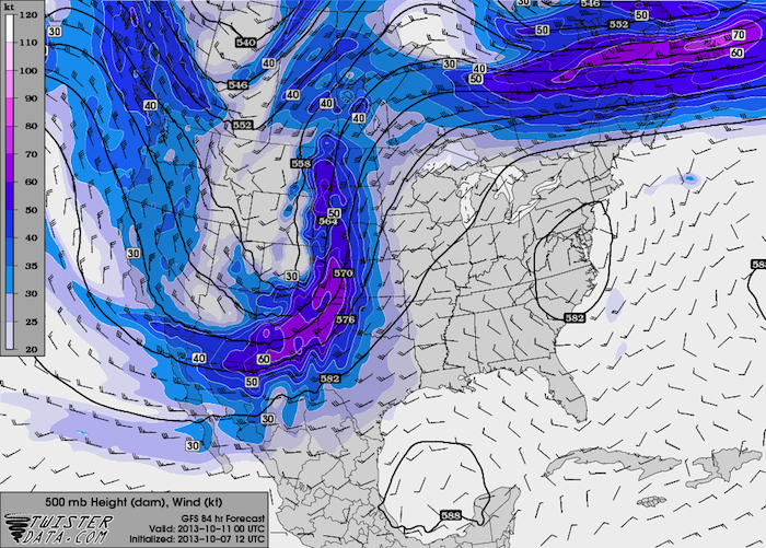
500 mb Wind and Height (GFS Forecast)
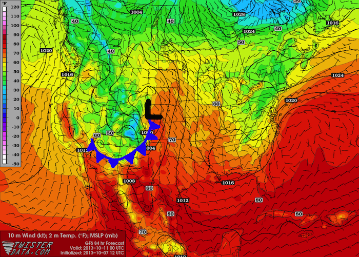
Surface Temperature and Wind (GFS Forecast)
While I normally use CAPE (Convective Available Potential Energy) to assess instability, predicted CAPE values are expected to be between 1000 and 1500 J/kg. These are relatively low CAPE values for the plains, but is enough to generate thunderstorms, especially if the front is powerful and can provide large amounts of upward forcing (the lifting mechanism). I have also included a plot of Theta-E to show the axis of higher instability across western Kansas and Nebraksa, extending south into the Texas and Oklahoma Panhandles. The easiest way to describe Theta-E is that it combines temperature and moisture into one index, which is essentially what instability is. Higher Theta-E values indicate where the warmer and more humid air is located.
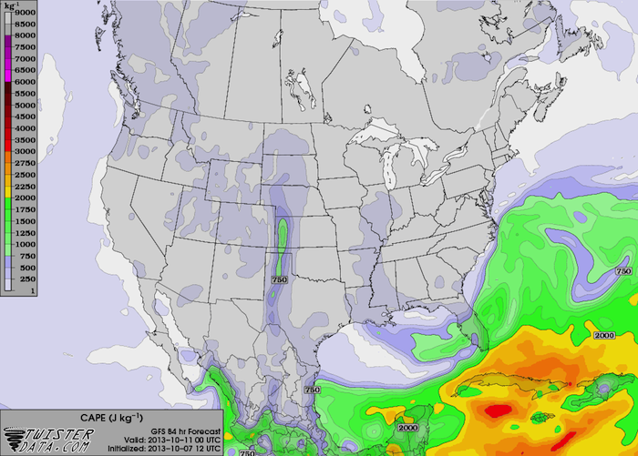
GFS Predicted CAPE for Thursday, Oct. 10th at 7 PM CDT
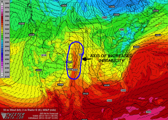
GFS Predicted Theta-E for Thursday, Oct. 10th at 7 PM CDT
One ingredient that is noticeably lacking in the latest model runs is moisture. Dewpoints ahead of the cold front will struggle to get to 60°F, if they can even get that high, which explains the low instability values. The cold front that swept through over the weekend left an extremely dry air mass over much of the plains, and this week’s storm system is coming in so close behind it that there is simply not enough time to get significant moisture return into Kansas and Nebraska from the Gulf of Mexico. A lack of moisture often results in LP (low-precipitation) or high-based storms, but it can prevent storms from forming altogether (which is unlikely to occur with this week’s system).
The final ingredient for severe weather is the wind shear. The axis of maximum shear contains shear values above 50 knots, which is plenty of shear to produce severe thunderstorms. The axis of maximum shear also aligns almost perfectly with the axis of maximum instability, which should set the stage for thunderstorms as the cold front sweeps through the area and provides lift.
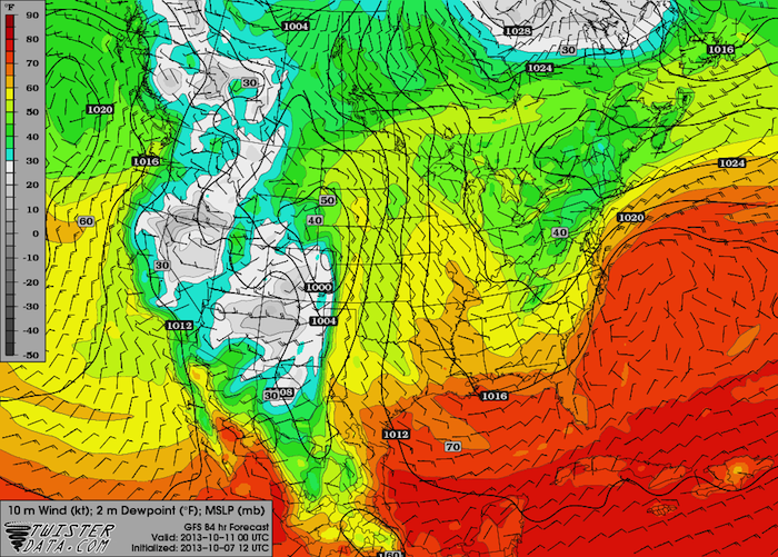
GFS Predicted Dewpoint for Thursday, Oct. 10th at 7 PM CDT
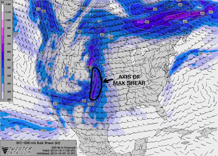
GFS Predicted Shear for Thursday, Oct. 10th at 7 PM CDT
So the bottom line at this point is that the most likely thing to happen would be for a squall line to form on the leading edge of the cold front, extending from western Nebraska back through western Kansas and into the Texas Panhandle. The most likely area to see severe weather is over western Kansas, where the four severe weather ingredients best come together. I am not anticipating a big outbreak with this system. Wind and hail will be the primary threats, but a few isolated tornadoes will certainly be possible. Vertical wind profiles will be very favorable for supercells, so if discrete cells can fire ahead of the main squall line, they could become supercellular despite the low instability. We are still a long ways out, and things will likely change, so stay tuned for more updates as we get closer.