ST. PETERSBURG, FL — The system that brought the deadly tornado outbreak to Mississippi and Alabama on Saturday came ripping through Florida on Sunday and into Monday. The front brought tornado warnings into northern Florida on Sunday morning and progressed south with the front. The first line of storms arrived […]
Read MoreMatt Gove Photo
Use photography to go on an adventure around the world. Get inspired to get out in nature, expand your own horizons, and become a better global citizen.
Strong Cold Front Rips Through Central Florida
THE INTERSTATE 4 CORRIDOR — A strong cold front ripped through Central Florida this afternoon, bringing strong winds, blinding rain, lightning, microbursts, and tornado warnings from Tampa to Daytona Beach. In Pinellas County, we saw mainly a rain/wind event, with a few rumbles of thunder (the majority of the lightning […]
Read MoreGorgeous Electrical Storm Over Pass-a-Grille
ST. PETE BEACH, FL — The winter storm chasing season got off with an early bang at Pass-a-Grille Beach. The season started early this year, thanks to El Nino being firmly in place and blowing severe weather into west-central Florida. A massive low pressure system formed off the Texas coast […]
Read MoreTornadoes Break Out Across Tampa Bay
PINELLAS PARK, FL — Everything was in place for an epic severe weather outbreak along the I-75 corridor east of Tampa Bay. After a frustrating afternoon waiting for storms to fire and coming up empty, I sat down to dinner in front of a Two and a Half Men episode. […]
Read MoreViolent Cold Front Brings Hurricane Conditions and Tornadoes
ST. PETERSBURG, FL — The morning of April 14 started just like any other dreary, rainy day in Florida. I sat down in front of the TV for breakfast and turned on Bay News 9. Their meteorologists were tracking several severe thunderstorms across Pinellas, Hillsborough, and Pasco counties. Around 9:30 […]
Read MoreIntercept of Hurricane Ike on the Skyway Bridge
ST. PETERSBURG, FL — Having closely monitored Hurricane Ike as it churned west through the Caribbean, I have watched the awesome power of Ike churn its way into the Gulf of Mexico. With the eye of this powerful Category 4 Hurricane sitting less than 200 miles off the coast of […]
Read MoreSuccessful Woods Hole Intercept
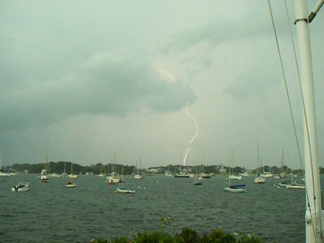
WOODS HOLE, MA — When I fired up Weather Underground this past Saturday, I looked at Sunday’s forecast and saw that there was an 80% chance of thunderstorms, as well as a huge batch of storms (some severe) stretching from upstate New York back into central New Jersey and Pennsylvania. […]
Read MoreA Near Miss in Marion
MARION, MA — It was another typical day for me at BYC. It was an early Monday afternoon. The hot, humid, stagnant air made for a slow morning of launch driving. With about an hour and a half left in my 7:30-3 shift, I noticed an impressive cloud buildup to […]
Read More


