Maps

Travel the world virtually on stunning two and three dimensional maps. Learn how to communicate complex ideas, increase your efficiency, and save money. Interact with real-time data and see your results on a powerful analytics dashboard.

Quick Update: Thanksgiving East Coast Storm

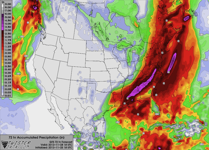
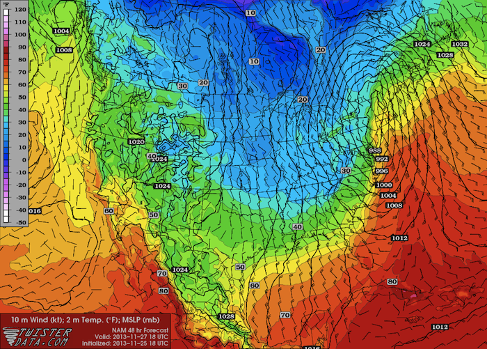
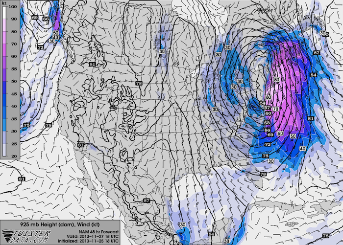
Surface observations this morning show the surface low centered over New England, with a cold front extending from near the MA/RI/CT Triple Point southwestward, closely following the coastline to near Jacksonville, FL (the front is just offshore). Rhode Island and southeast Massachusetts are still on the warm side of the […]

Read More

Morning Update: Thanksgiving East Coast Storm

Hi all. Just checking in with a quick morning update. Everything from last night’s forecast is still right on track. This morning’s model runs are showing the strongest winds across coastal areas southern and eastern New England, including Massachusetts, Rhode Island, and much of Connecticut. This swath of strong winds will shift […]

Read More

Coastal Storm Getting Set to Impact the East Coast

The low that will become the first nor’easter of this winter season is getting set to pop out off the Georgia coast, upon which it will wind up and head right up the east coast. The good news is that the wind and precipitation will be confined primarily to the […]

Read More

Winter Weather Set to Invade the Southern Plains

A big blast of arctic air is set to invade the Great Plains the next few days, bringing the chance for winter precipitation to parts of the region. I am not expecting this to be a significant storm, but it will bring very cold temperatures and the chance of all […]

Read More

Extreme Weather Slams Parts of the Far East

I have been away from the blog for a few weeks due to being sucked into the baseball playoffs (Go Sox!) and being off on some photography adventures, as the fall colors have been peaking here in Oklahoma over the past couple weeks. I am back now and will be […]

Read More

Weekly Severe Weather Outlook: October 7, 2013

With the beginning of the fall or “second” severe weather season here on the Great Plains, coupled with the tropics remaining quiet, I am going to shift this week’s discussion from the tropics back closer to home and talk about severe weather. The fall severe weather season started quite emphatically […]

Read More

Weekly Tropical Weather Outlook: September 30, 2013

Once again, the tropics have gone quiet, with no indication of any significant activity over the next week. Models are indicating that high pressure will dominate the central and southern North Atlantic, preventing organized convection and thunderstorm activity. Longer-term models are showing that high pressure becoming stronger in the next […]

Read More

Weekly Tropical Weather Outlook: September 23, 2013

After a brief uptick in tropical cyclone activity in the past two weeks, the outlook for this week looks very quiet for both the Atlantic and Eastern Pacific basins. As we saw earlier this summer, a strong area of high pressure will set up over the south-central Atlantic, and the […]

Read More

We Have Our First Atlantic Hurricane of 2013

We officially have our first hurricane of the 2013 Atlantic season. Earlier this morning, Humberto was upgraded to a hurricane, coming within a few hours of the Atlantic record for latest first hurricane. Humberto currently sits over the far eastern Atlantic, right off the west coast of Africa, and is […]

Read More

EXAMPLE FORECAST: New England Winter Storm: February 8-10, 2013

Large Scale Setup/Discussion A weak wave of energy is currently crossing Colorado’s Rocky Mountains and is forecast to undergo “lee cyclogenesis” (it’s actually more of a lee intensification) as it ejects off the Front Range and into the Great Plains on Thursday, ahead of a much more powerful upper level […]

Read More