The post USGS Data Series 741 appeared first on Matthew Gove Blog.
]]>What They Needed
- A simple way to analyze and display the complex three-dimensional data both on the website and on a poster
- A version of the report that could be distributed both on the web and on CD
The Solution
We had several large datasets containing up to 354,000 three-dimensional ocean chemistry measurements. We needed to be able to display this data on a map. Unfortunately, Excel cannot plot data on geographic maps, nor could ArcGIS plot three-dimensional maps at the time.
To solve the problem, I wrote a Mathematica script that consolidated over 50 two-dimensional figures into 4 three-dimensional figures. We plotted those figures on a three-dimensional bathymetric grid of the ocean floor, allowing the entire dataset to be displayed on a single poster. Coupled with the animation of the 3D dataset that I created with Mathematica, our poster was one of the most talked about at the 2010 American Geophysical Union Fall Meeting.
The Publication
Using a template that the USGS provided, I also built them a simple HTML website that hosted everything from the project.
- Raw Cruise Data
- XML Metadata
- GIS Shapefiles
- Graphs, Figues, and Plots
- Our published paper
We published the final report in 2013.
The post USGS Data Series 741 appeared first on Matthew Gove Blog.
]]>The post Meteotsunami Research appeared first on Matthew Gove Blog.
]]>What is a Meteotsunami?
A meteotsunami is an atmospherically-induced tsunami caused by rapid changes in barometric pressure. Because meteotsunamis are independent of tectonic plate activity, they can strike anywhere. However, they’re much smaller earthquake or landslide-induced tsunamis. They’ll never cause the destruction you saw with the 2004 Indian Ocean Tsunami that devastated Indonesia and Thailand. Nor will they come anywhere close to reaching the intensity of the tsunami that caused the 2011 Fukushima nuclear meltdown in Japan.
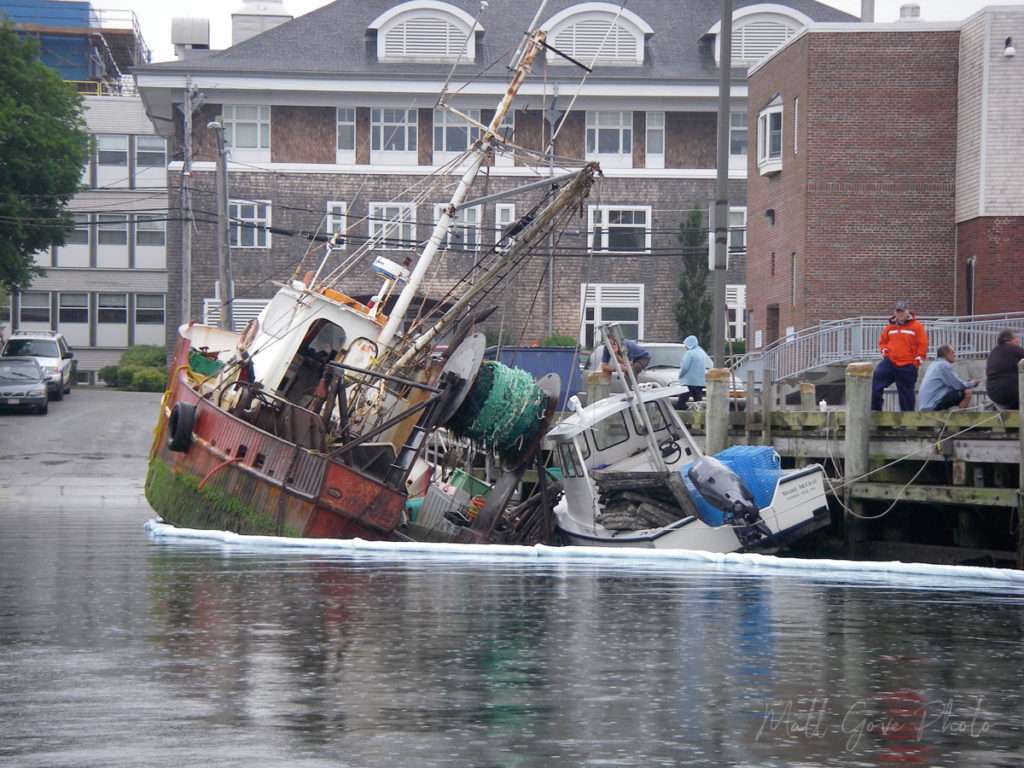
However, meteotsunamis can cause extensive damage when they come into harbors where people moor their boats. This is exactly what happened when a meteotsunami struck Falmouth, Massachusetts on 13 June, 2013. While it did not affect anything on land, it did a surprising amount of damage to boats in Falmouth Harbor.

About Our Research
In September, 2013, the U.S. Geological Survey in Woods Hole, Massachusetts reached out to us to help with their research on meteotsunamis. Our extensive knowledge in meteorology plus 20 years of boating experience in Woods Hole proved to be the perfect skillset.
Our tasks for this project were simple.
- Compile a database of all known cases of meteotsunamis that stuck the east coast of the United States between 2000 and 2013.
- Compile a database of any weather phenomena that may have cause those meteotsunamis. Such phenomena include fronts, squall lines, thunderstorms, hurricanes, tornadoes, and more.
- In the database of weather phenomena, record the following.
- Speed and compass direction each weather phenomenon moved (estimated from radar data)
- Observed wind speed and barometric pressure changes at the nearest NOAA weather observation station.
The End Result
We compiled a database of 223 meteotsunamis that struck the US east coast between 2000 and 2013. The link between meteotsunamis and weather phenomena that caused sudden pressure changes was undeniable. For more information, please read our publication. Despite the lengthy US Federal Government shutdown in October, 2013, we published our research paper three months ahead of schedule in June, 2014.
The post Meteotsunami Research appeared first on Matthew Gove Blog.
]]>The post California Mercury Modeling appeared first on Matthew Gove Blog.
]]>What They Needed
To ensure a sustainable, clean water supply, California’s government routinely conducts studies of water quality throughout the state. The state government hired us to help model the presence and transportation of mercury through the Yolo Bypass and the San Francisco Bay Delta. This area is so critical because the watershed supplies the heart of the state’s agriculture belt in the Central Valley. It also provides clean water to both the Sacramento and San Francisco Bay Areas.

The Solution
The project consisted of several components
- 3 Mathematical Models
- Mercury quantity and transport through the Yolo Bypass
- Mercury quantity and transport through the San Francisco Bay Delta
- Water flow rates through the Yolo Bypass.
- 11 Microsoft Access databases containing up to 24 million data points each
- A GIS Application
- A Model-Independent Parameter Estimation and Uncertainty Analysis Application
The End Result
We improved the connection between the four components listed above. That improvement boosted the efficiency and accuracy of both the model and scenario development, as well as the model runs. Because we used the output from one model as input for the other, ensuring its accuracy was very important. Indeed, incorrect output from one model wreaked havoc on the results of the other. As a result, we used Python to debug and develop a breakthrough solution to the issue.
By the time the project wrapped up, we had written 7 custom Python packages and over 30 scripts. The Python code improved process efficiencies by as much as 8,000%. As a result, the project finished by its scheduled completion date in August, 2020.
The post California Mercury Modeling appeared first on Matthew Gove Blog.
]]>


