As a travel, nature, and landscape photographer, I love taking scenic drives through beautiful countrysides. One of my primary long-term goals is to be able to drive these scenic backcountry roads, not just in North America, but around the world. Additionally, I want to be able to inspire you to get out and enjoy these beautiful drives as well.
As I graduated from hobbyist to semi-pro, and now to professional photographer, the need for a single, centralized location to log scenic drives is more critical than ever. The Scenic Drives map includes scenic drives I’ve taken, am hoping to take, are on the bucket list, and more.
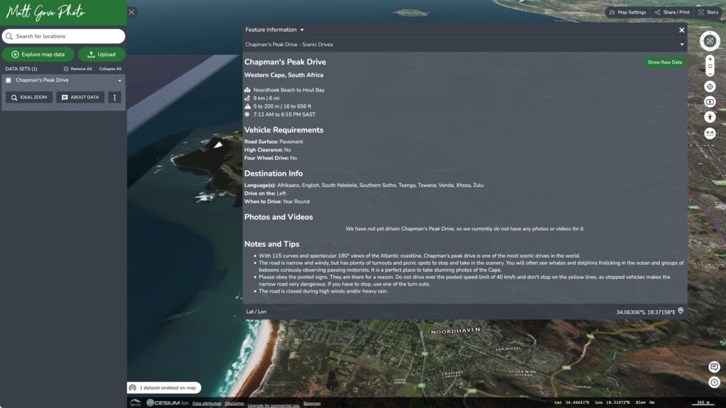
The Scenic Drives Application and Map
Using the TerriaJS mapping software, a database, and a simple PHP back end, we built an application that holds all of the scenic drives you see on the map. When you click on a scenic drive on the map, you’ll see all of the details for that route. You’ll get the mileage, road surface, high clearance and 4×4 requirements, sunrise, sunset, and much more. At its launch in 2016, the database contained over 1,200 drives in 110 countries. We’ve only added more as time has gone on.


The Benefits
The scenic drives map application has provided countless benefits. It has proven to be an invaluable planning tool. You have the ability to query the database on location, elevation, road surface, vehicle requirements, and much more. Additionally, it has proven invaluable to share these scenic drives with friends, family, and anyone else who is interested in them.
More Maps
If the scenic drives map has left you craving more, we have plenty of additional interactive maps to explore. From our media map highlighting our photos and videos to our bucket list to travel guides and more, we’ve got maps for everyone. We are data science and GIS professionals after all.