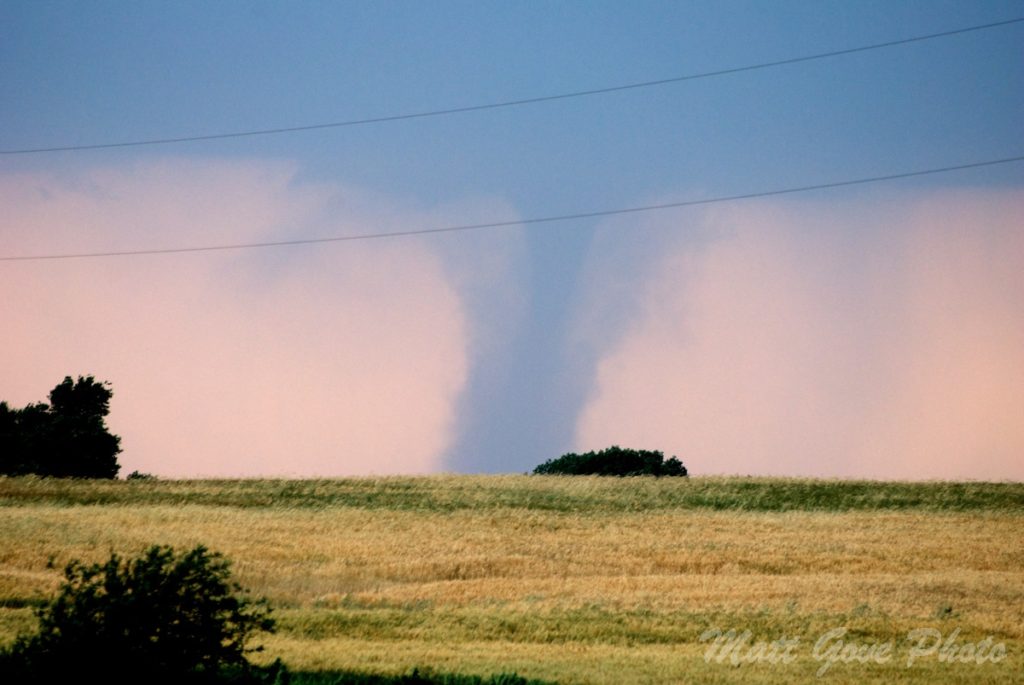
The Southern Great Plains are well-known for their wild, unstable, and sometimes violent weather. Aptly known as Tornado Alley, the region sees more tornadoes and severe weather than anywhere else in the world. Its proximity to both the frigid air of the Rocky Mountains and the warm, tropical waters of the Gulf of Mexico make it a breeding ground for weather extremes. Throw the Polar Vortex and the COVID-19 pandemic in the mix and you’re bound for a wild ride.

As I began planning my COVID-19 cross-country road trip last fall, my goal was to avoid the worst of winter across the midwest and northeast. Little did I know that the North Pole would come down and so kindly greet me as I crossed Tornado Alley. The Polar Vortex shattered all kinds of records and left several states – most notably Texas – under a significant emergency.
What is the Polar Vortex?
The Polar Vortex is a large area of very cold air that circulates around both the North and South Poles in the wintertime. Under normal conditions, the stability of the atmosphere keeps the Polar Vortex locked around the poles.
However, certain triggers high above the Earth can cause the Polar Vortex to rapidly destabilize and plunge southward (northward in the Southern Hemisphere) into the mid-latitudes. One particularly powerful trigger occurred in late January, 2021.
What Triggers the Polar Vortex to Destabilize?
To understand how the Polar Vortex behaves, we must travel about 20 to 50 km above the earth’s surface, well above where any weather happens or any airplanes fly. This part of the atmosphere is known as the stratosphere, and contains the far outer ranges of where weather balloons can travel.
Temperatures in the stratosphere are frigid. In the past 40 years, meteorologists have measured temperatures as low as -96°C (-141°F) in the stratosphere. Those cold temperatures are what holds the Polar Vortex in place above the poles.
Armed with that knowledge, you can probably deduce what causes the Polar Vortex to destabilize: a sudden and significant warming of the stratosphere. That’s exactly what happened in January, 2021. In less than 24 hours, the stratosphere warmed by 45°C, or 81°F. It was one of the most extreme stratospheric temperature swings ever recorded.
The January, 2021 destabilization was so powerful that it caused the Polar Vortex to completely fracture in half. One half plunged into the central and eastern parts of the United States and Canada. The other half dove south into Siberia. Temperatures in Yakutsk, Russia dropped to a bone-chattering -58°C (-73°F).
Have We Seen a Polar Vortex Like This Before?
You don’t have to go back very far to find a similar meteorological setup. In January, 2015, meteorologists observed a similar warming of the stratosphere above the North Pole. Shortly thereafter, the Polar Vortex split, sending parts of the US, Canada, and Russia into one of their coldest and snowiest winters ever.

One particularly interesting phenomenon is how the strong Polar Vortex makes the east coast of both the US and Canada so vulnerable to major snowstorms. Indeed, two blizzards crippled New England on 27 January and 15 February, 2015. That was only the beginning of a true snowmageddon winter.
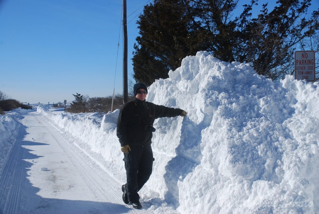
Between the two storms, many locations in southeast New England received between 6 and 8 feet of snow. Boston was one of many cities that ran out of places to dump their plowed snow. Even once summer arrived, you’d still see some snow piles driving around. There was so much snow piled so high it took that long to melt. Not surprisingly, we all got a pretty bad case of cabin fever that winter.
Thankfully, 2021 did not suffer the same fate.
A Beautiful Day Across Central New Mexico
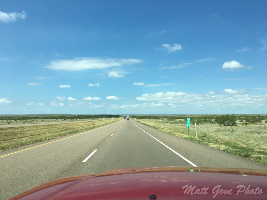
If you hadn’t looked at the weather before hand, you would have had no idea what lay ahead with the Polar Vortex. Temperatures were unseasonably warm as I made my way across the high deserts of eastern Arizona and western New Mexico.
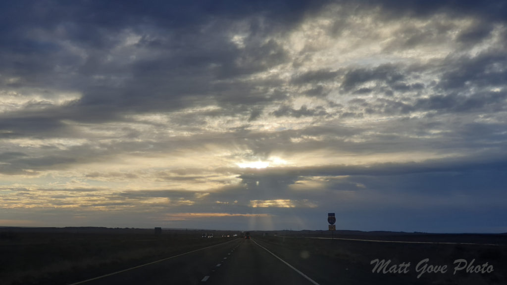
As I descended into Albuquerque, the mercury topped 70°F (21°C). Even with strong winds, it made for very pleasant driving. However, once I climbed back out of the valley, things really began to change. Thick mid-level clouds replaced the warm sun and blue skies. You definitely had that feeling of “something crazy is about to happen” in the air.
Santa Rosa, New Mexico: Running Head-On into a Freight Train of Cold Air
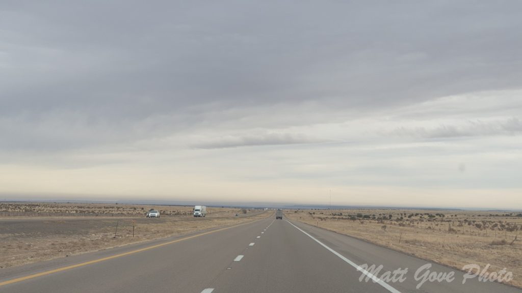
If you’ve ever driven Interstate 40 across New Mexico, you know that it’s largely a vast emptiness of open desert. Aside from the occasional blink-and-you-miss-it town, you’re at the mercy of Mother Nature.
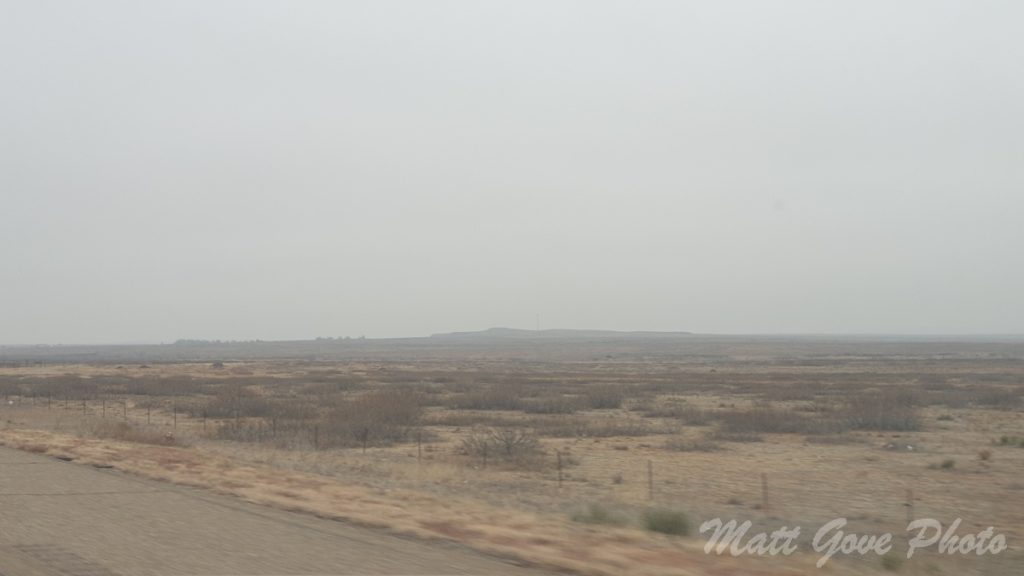
As I got further east of Albuquerque, that layer of mid-level clouds got progressively thicker, darker, and lower. Despite the ominous outlook, temperatures remained quite pleasant, hovering around 65°F (18°C). As I approached the town of Santa Rosa, New Mexico, things took a dramatic turn.
When I lived in Oklahoma as a meteorology student, I saw my fair share of wild weather. Whether it was EF-5 tornadoes, ferocious wildfires, thundersleet, a quakenado, or massive hail, it was nothing like what I saw punching through the Polar Vortex. Just when I thought I had seen it all, Mother Nature threw me something new. Wrap your head around this temperature drop.
| Time (MT) | Temp (F) | Temp (C) |
|---|---|---|
| 12:00 PM | 72 | 22 |
| 12:30 PM | 64 | 18 |
| 1:00 PM | 61 | 16 |
| 1:10 PM | 55 | 13 |
| 1:11 PM | 52 | 11 |
| 1:12 PM | 48 | 9 |
| 1:13 PM | 46 | 8 |
| 1:14 PM | 45 | 7 |
| 1:15 PM | 43 | 6 |
| 1:17 PM | 41 | 5 |
| 1:19 PM | 39 | 4 |
| 1:22 PM | 37 | 3 |
| 1:30 PM | 36 | 2 |
| 1:54 PM | 34 | 1 |
| 1:56 PM | 32 | 0 |
| 2:04 PM | 27 | -3 |
| 2:25 PM | 24 | -4 |
For a different perspective, here is that same data on a time-series graph. Click on the graph to enlarge it.
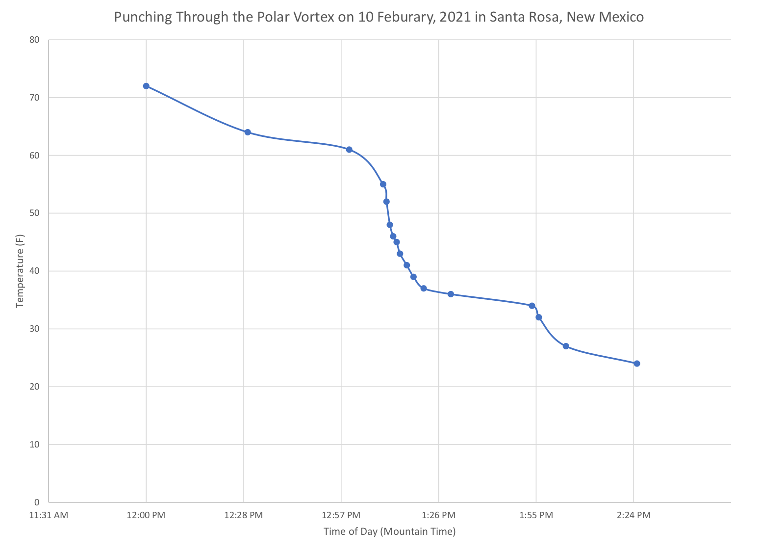
And to think, this was just the tip of the iceberg.
Entering the Freezing Fog Twilight Zone in Texas
Between storm chasing, road trips, and photography adventures, I’ve driven across the Texas panhandle more times than I can remember. My favorite part of the drive is looking out at the open prairie. You can see forever, and really gives you a sense of freedom being on the open road.
What a contrast this trip turned out to be! As a result of the Polar Vortex invasion, we were treated to one of the rarest, and surprisingly, most dangerous weather phenomena in Texas: freezing fog.
What is Freezing Fog?
Freezing fog is no different than regular fog, with one distinct difference. Water droplets in freezing fog are supercooled, meaning that they are below freezing, but remain in liquid form.
Why do they remain as a liquid if they’re below freezing? Water molecules freeze much more efficiently when they are in contact with other particles versus being pure water. These particles can include sand, dust, minerals in tap water, and objects such as trees and vehicles.
Fog forms when water vapor condenses out of the air. Those fog droplets are pure water, and therefore freeze less efficiently.
Why is Freezing Fog so Dangerous?
Whenever water remains in a supercooled state, it poses an enormous risk to both vehicles and airplanes. Remember that we just reviewed how water freezes much more efficiently when in contact with other particles than when it is pure water?
When a supercooled water droplet comes into contact with something other than pure water, it instantly freezes. While freezing fog coming into contact with trees and grasses is largely harmless, it’s a much different story when it freezes on roads, overpasses, and your vehicle. Black ice is dangerous enough to begin with. It’s even more so in places like Texas that are not used to seeing it.

How Does Freezing Fog Form in a Hot, Arid Climate Like West Texas?
Warm air can hold much more moisture than cold air. Most of that moisture is in the air as water vapor. We measure it with either the dewpoint or the relative humidity.
When air cannot hold any more moisture, it reaches saturation. Any more moisture that gets added after that condenses out either as clouds or precipitation. There are two ways to reach saturation.
- Add moisture to the environment. You see this when the bathroom fogs up as you take a shower.
- Lower the temperature of the environment. There is no better example of this than when you see your breath on a cold day. Your warm breath has more moisture than the ambient cold air can hold, so it condenses out as a fog.
The powerful cold front I had punched through in eastern New Mexico had swept across the Texas Panhandle only a few hours earlier. Even in an arid environment like West Texas, the temperature dropped so extremely and rapidly that the air could not hold what little moisture it had. As a result, the excess moisture condensed into a freezing fog.
It was almost as if you could see Mother Nature’s breath.
Enter the Polar Vortex Twilight Zone
Being used to crossing the Texas panhandle in the summertime made this experience even more unique. The freezing fog shrouded everything in an eerie haze reminiscent of some kind of twilight zone. In addition, the Polar Vortex had been in place just long enough to start coating the landscape with a visible layer of ice. The setting late afternoon sun made that haze even eerier.

The deeper I got into Texas, the longer the bitter cold Polar Vortex air had been entrenched in place. Temperatures continued to plummet. Not surprisingly, the fog got thicker the further east I got. The setting sun slowly swallowed you into that twilight zone of darkness.
Things got even weirder as I crossed into Oklahoma.
Oklahoma? More Like Snow-klahoma!
How many times have you seen something bad happen and thought, “that won’t happen here”? I’ve done it more times than I care to admit, including this trip. Once I crossed the state line into Oklahoma, it didn’t take long for me to realize the full seriousness and severity of the Polar Vortex. At a gas station in Elk City, I noticed that both the windshield cleaner and the hand sanitizer had frozen solid as I fought 50 mph (80 km/h) winds and -11°F (-24°C) wind chills to fill my gas tank.
The Polar Vortex Flexes Its Muscles
Less than 48 hours after arriving in Norman, the first of back-to-back snowstorms hit the Southern Plains. After just a few days of wild weather we had shattered all kinds of winter weather records.
Most notably, the National Weather Service measured the coldest temperatures ever recorded in the State of Oklahoma. The only Oklahoma saw colder temperatures occurred in the late 1800s, when it was still the Indian Territory.
| Parameter | Date | Metric | Imperial |
|---|---|---|---|
| Total Snowfall | 10-15 Feb | 33 cm | 13 in |
| Coldest High Temp | 15 Feb | -16°C | 3°F |
| Warmest High Temp | 23 Feb | 23°C | 74°F |
| Coldest Low Temp | 16 Feb | -24°C | -12°F |
| Coldest Wind Chill * | 15 Feb | -34°C | -30°F |
| Temperature Swing | 16-23 Feb | 47°C | 86°F |
| Max Wind Gust * | 14 Feb | 52 km/h | 32 mph |
* More extreme data is likely missing due to icing on wind sensors
Thankfully, the snow didn’t stick around for very long. Temperatures rapidly warmed as the Polar Vortex pulled out of the area. In true Oklahoma fashion, we were walking around in shorts and t-shirts less than a week later as temperatures soared to 74°F (23°C).
Having Fun with Physics During a Power Outage in Sub-Zero Polar Vortex Temperatures
It often feels daunting when you lose power during a storm. Initial panic sets in that much more when the power goes out when it’s -5°F (-21°C) out and blowing over 30 mph (50 km/h). That’s the exact situation we found ourselves in the middle of the heaviest snow during my stay in Oklahoma.
I awoke in the middle of the night. As I reached for my phone to check the time, I noticed that it felt chilly in the house. I figured the thermostat had been turned down at night, and I didn’t think much of it. It was about 5:15 AM, so I decided to check the weather on my phone to see how cold it had gotten.
Much to my surprise, my phone could not connect to the internet. Not only was the WiFi out, I had no cell service, either. Being in the middle of a city of 125,000 people, something was very wrong.
I sat up and noticed that all of the night lights in the hallway were flickering and and off. I kept thinking, was I back in the twilight zone I was in driving here? At that point, I knew it was only a matter of time before the power company pulled the plug.
Less than 5 minutes later, the power went out for good. All you could hear was the wind, the snow, and the transformers blowing up nearby. At that point, there wasn’t much I could do, so I rolled over and went back to sleep.
Physics and Thermodynamics: An Alternate Source of Entertainment
If you’ve ever studied physics, chemistry, or thermodynamics, you’ve probably heard of the ideal gas law. While it has its limitations, the law is a good approximation of many gases, including air, under many conditions. Mathematically, it is defined as:
pV = nRT
where
- p is the pressure
- V is the volume
- n is the amount of gas
- R is the ideal gas constant
- T is the temperature
Now, here’s where the fun starts. I slept on an air mattress while I was in Norman. Because the power was out, the heat in the house did not work, so the house cooled off. In terms of the ideal gas law, we know that R is already constant. Inside the sealed air mattress, both the amount of air (n) and the volume (V) are also constant. We can reduce the ideal gas law to a simple relationship.
p ~ T
In layman’s terms, that equation just means that as temperature changes, the pressure will change in the same manner, and vice versa. We were now about 3 hours into the power outage, and the house was really starting to feel cold. As the temperature continued to drop, I could feel the air mattress getting softer and softer until I could feel my butt hit the floor underneath the mattress.
Here’s the best part. Shortly after 8 AM, the power came back on. It was cold in the house, so I decided to stay in my nice warm sleeping bag until the heat could work its magic. As the house warmed back up, the air mattress reinflated as the pressure inside increased. Before I knew it, the ideal gas law had lifted my backside up off the floor, and the house had returned to its normal temperature.
Up Next
As memorable as my stopover in Oklahoma has been, this is not the end of my dance with the Polar Vortex and Old Man Winter. Next week, we’ll continue east and see if it really was that wise of a decision to go camping in the mountains in Kentucky in February…in the middle of an ice storm. All that and more right here next Friday at 9 AM Pacific Time. See you then.
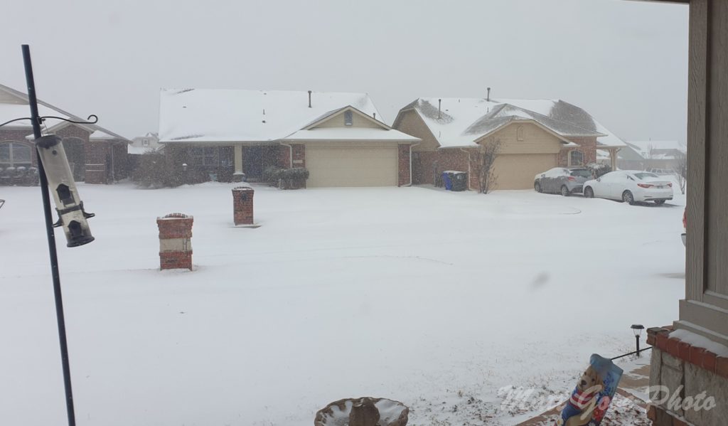
Top Photo: Heavy Snow Falls During the Polar Vortex
Norman, Oklahoma – February, 2021
Pingback:Pioneering Peril, Part 2: Pandemic Polar Vortex Camping in Kentucky