One of my favorite aspects of traveling, adventuring, and exploring is finding new things in unexpected places, especially in other countries. In fact, I find that you most often encounter this phenomenon when you least expect it. My recent cross-country road trip at the height of the COVID-19 pandemic is no exception.
Countries are constantly reshaping international borders around the world using everything from treaties to natural forces. Over the years, odd quirks, mystical clauses, and even human error have resulted in some, well, let’s just say, creative international borders.
The border between Baarle-Nassau, Netherlands and Baarle-Hertog, Belgium just boggles the mind. And what about Dahala Khagrabari? Until the signing of a 2015 treaty, it was a piece of India inside of a piece of Bangladesh inside a piece of India inside a piece of Bangladesh. If that gives you an ice cream headache, let me put it another way. Dahala Khagrabari is the only third-level enclave in world history.
Today, we’re going to take it a step further. Instead of looking at strange borders, let’s instead look at some countries that pop up in some rather unusual and unexpected places. You’ll learn about their history and explore some new places. Who knows, maybe you’ll even get some inspiration for your next adventure.
1. Ceuta and Melilla: Visit Spain and Africa at the Same Time
Spain is best-known for its rich culture, beautiful beaches, and temperate climate. In the 1500’s and 1600’s, it spread its influence around the world. Spanish conquistadors colonized everywhere from what is modern-day Latin America to the Philippines. In fact, did you know that in the 1800’s, Spain designated Mexico City as the administrative capital of the Philippines?
While Spain no longer holds any overseas colonies or territories, it still holds 2 exclaves outside of Europe. You’ll find both Spanish cities on the northern coast of Africa, embedded in Morocco. Ceuta has been part of Spain since 1668. A treaty with Morocco fixed the current city limits of Melilla in 1859.
Despite being part of Spain, you won’t find the traditional Spanish culture like you’d experience in the main body of Spain. Both cities are also rich in Arab culture with Jewish and Portuguese influences. Many of these influences stem from when Portugal occupied parts of Morocco from the middle ages to the 19th century.
Fun Fact
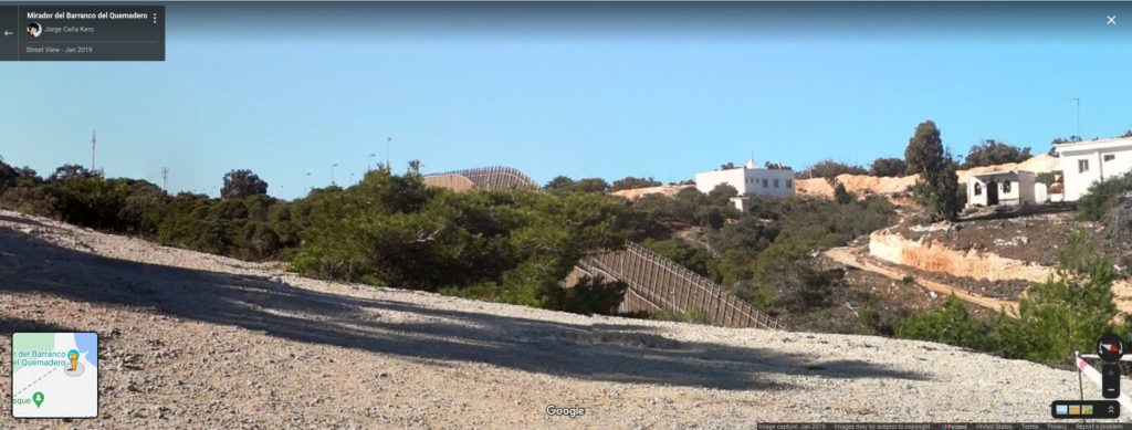
During his 2016 presidential campaign, Donald Trump frequently cited fencing around both Ceuta and Melilla as arguments for building a wall along the US-Mexico Border.
Interestingly, this is not the only time you’ll find Spain in an unexpected place. However, you will have to get very close to Spain to do so.
2. Llívia: Visit Spain Without Actually Going to Spain
Thanks to a bizarre history and the European Union’s laws that allow you to freely move between countries, you can visit Spain without actually going to Spain.
The town of Llívia sits about 2 km north of the border crossing between Bourg-Madame, France and Puigcerdà, Spain. Over the years, both countries have laid claim to it, while at other times, neither country has claimed it.
Llívia’s long and strange history began in 1659, when the Treaty of the Pyrenees ceded the enclave to France. However, due to a quirk in the wording of the treaty that stipulated that all villages would become part of France, Llívia was considered a town instead of a village, despite France’s claim to it. Over the years, both countries have laid claim to Llívia numerous times before finally ending their squabbling upon the formation of the European Union.
Today, Llívia remains steeped in history and rich in Spanish architecture, culture, and cuisine. Because both France and Spain are in the European Union’s Schengen Area, you can easily pass through town and not realize you are in another country. Despite France’s numerous claims to the territory, Llívia retains Spanish dialing codes, postal codes, and emergency services. Ironically, French is not spoken at all in Llívia. Its two primary languages are Spanish and Catalan.
Which is a perfect segue into our next oddity.
3. Campione d’Italia: The Italian Village That’s Part of Switzerland
Up until 1 January, 2020, the village of Campione d’Italia was one-of-a-kind. You needed to clear Swiss customs to access the village. Taxes that funded public services were paid to Switzerland. Campione had Swiss police, fire, and ambulance services. The town had Swiss postal and dialing codes. Its residents registered and insured their vehicles in Switzerland. Salaries were paid in Swiss Francs. So what’s the problem with this quaint Swiss village? It’s actually part of Italy, not Switzerland.
Campione d’Italia is another town with a long twisted history that starts with a geographical anomaly. As the crow flies, Campione is only 600 meters, or about half a mile, from the border between Switzerland and Italy. However, because of the steep and rugged mountainous terrain in the Alps, one must drive more than 20 km from town to reach the main body of Italy. This is just part of the reason that the town relied on Swiss infrastructure.
The Ancient Romans founded the village during the first century BC, which officially became part of Italy in the year 777. Between 1512 and 1900, Campione had numerous opportunities to become part of Switzerland, but it rejected them each time. Ironically, in 1848, the town petitioned Switzerland for annexation. The Swiss government denied the request over their desire to remain neutral.
Integration into Switzerland
Shortly after Benito Mussolini rose to power in Italy in the 1930s, his regime lost control of the Campione enclave. During that time, residents of Campione rejected Mussolini’s fascism and integrated with Switzerland. Campione remained essentially part of Switzerland until 1 January, 2020, when it formally became part of the EU Customs Territory.
Since its integration into the European Union, its Swiss postal codes have been invalidated and residents are now required to register their vehicles in the Italian Province of Como. Interestingly, calls to everywhere in town except for city hall still use the international dialing code for Switzerland.
4. A 2-for-1 Special: Two American Towns Stranded in Canada
In 1846, the US and Great Britain signed the Oregon Treaty. The treaty established the 49th parallel as the northern border of the United States through the Rocky Mountains. Today, the 49th parallel forms the international border between the US and Canada.
Before signing the treaty, ambassadors from both Britain and the US agreed to survey the coastal area south of Vancouver, British Columbia. Both countries wanted to make sure the 49th parallel did not split any islands off the coast between the two countries.
After the survey, the US agreed to cede the southern end of Vancouver Island to the British. Both countries established the border through the Salish sea between Port Angeles, Washington, and Victoria, British Columbia.
Unfortunately, the surveyors were so focused on the islands that they missed part of the Tsawassan Peninsula that extended south of the 49th parallel near Vancouver.
Point Roberts, Washington
By the time the surveyors realized their mistake, it was too late. The treaty had already been signed. The border had cut off the southern tip of the Tsawassan Peninsula from the rest of the United States. The British government requested that the entire Tsawassan Peninsula should be part of Britain, but the US ultimately rejected the offer. The southern tip of the peninsula remained part of the US.
During the 1858 gold rush, Canadian prospectors established Robert’s Town on the US part of the Tsawassan Peninsula in an effort to avoid paying taxes. The town lasted less than a year, but was ultimately settled by Americans and named Point Roberts. It remained part of the Oregon Territory until the US Government granted Washington State statehood in 1889.
Much like Campione d’Italia, Point Roberts relies on Canadian services and infrastructure. The town’s water comes from Vancouver, and the municipality of Delta, British Columbia provides assistance to the Point Roberts police and fire services when requested. Up until 1988, Point Roberts used British Columbia’s 604 area code, meaning you had to make an international call to reach the rest of the United States.
Elm Point and Northwest Angle, Minnesota
It turns out that Point Roberts wasn’t the only “whoopsie” the treaty negotiators made in 1846. Much like Point Roberts, Elm Point is a tiny strip of land in Manitoba that dips south of the 49th parallel, making it technically part of Minnesota. Thankfully, Elm Point is uninhabited and thus does not have the logistical headaches of Point Roberts.
The US-Canada Border’s Biggest Anomaly
Not far from Elm Point is the largest anomaly on the entire US-Canada border. Minnesota’s Northwest Angle sits north of the 49th parallel and logically should be part of Canada. Due to an inaccurate map of the area, the Americans and the British had agreed to a geographical impossibility when they signed the Oregon Treaty in 1846.
The original treaty established the US-Canada border as running from Lake Superior west through the Rainy River to the northwest corner of Lake of The Woods. From there, it would run due west until it intersected the Mississippi River. It didn’t take long for surveyors to find a couple major problems.
- The northwest corner of Lake of the Woods is north of the 49th parallel
- If you go due west from there, you do not intersect the Mississippi River
Due to poor 19th century technology, it took decades to reach an agreement on where the border should be established. Once both Canada and the US were able to make accurate maps of Lake of the Woods, they agreed to run the border from the lake’s originally agreed upon northwest corner due south to the 49th parallel.
In doing so, they sliced off the Northwest Angle from Manitoba and made it part of Minnesota. Both Canada and Great Britain tried several times to buy the land back from the US in the late 1800’s. The US Government rejected every offer, and the Northwest Angle has stood as-is to this day.
5. Visit France on a Short Day Trip from Canada
When you ask about experiencing European or French culture in North America, most people would tell you to head to either Montréal or Québec City. While I have zero qualms against either Montréal or Québec City, why not take it a step further and just take a short day trip to France instead?
Wait, what? A short day trip to France from Canada? Yes, you heard that right. You can get on a ferry in Canada and be in France less than 2 hours later. Only 25 km from Point May, Newfoundland, Canada, you will find the French territory of St. Pierre et Miquelon.
Consider the following excerpt from our exploration of France in the Weird Geography series last summer.
St. Pierre and Miquelon may be small islands, but they carry a stark cultural distinction not just from Newfoundland and Labrador, but to Canada as a whole. When you visit the islands, you’ll experience French food, wine, and music. You’ll pay with Euros, charge your devices with 220 volt plugs, and of course will be speaking French, not English. Finally, St. Pierre and Miquelon are part of France, so don’t forget your passport.
Matt Gove, in Weird Geography: 10 Bizarre and Unusual Facts About France
5 July, 2020
6. Fancy Warmer Weather? Head to South America to Visit France
Nope, we’re not yanking your chain here, either. If the cold, damp, and grey in the Canadian Maritimes don’t suit your fancy, head south. In addition to the Caribbean islands of Martinique and Guadeloupe, French Guiana is rich in both French and Creole culture. It’s wedged between Brazil and Suriname, and it’s part of France, to boot.
French Guiana’s tropical climate is much more attractive, too. Average high temperatures are between 28 and 30°C (82 and 86°F) for 10 months of the year. The territory has never recorded a temperature below 18°C (64°F) either. Most of its population lives on the coast. Interior French Guiana is largely dense, uninhabitable jungle.
Read more about French Guiana in our Weird Geography visit to France.
7. Brits, Want a Holiday on the Mediterranean without Leaving the UK? You Can Do That, Too.
The United Kingdom has a reputation for being grey, chilly, and rainy. However, you can enjoy the spectacular climate and beaches of the Mediterranean Sea without having to leave the UK.
Gibraltar
Gibraltar sits on the southern tip of the Iberian Peninsula, just south of La Línea de la Concepción, Spain. Its name is actually derived from the Arabic term Jabal Tāriq, which means “Mountain of Tariq”. While it doesn’t feel like the rest of United Kingdom, Gibraltar is a melting pot of cultures. You’ll find cultural influences from Spain, the Arab part of northern Africa, Judaism, and even Hinduism. English and Spanish are Gibraltar’s primary spoken languages, but you’ll hear languages from all over the world.
The British captured Gibraltar in 1704. Spain officially ceded the territory in 1713. Unlike places like Llívia or Campione d’Italia, there have been very few squabbles over Gibraltar. It’s been a bit awkward since the UK left the European Union. Thankfully, the EU and the UK are currently negotiating an agreement that would allow Gibraltar to participate in the Schengen Area and prevent a hard border with Spain.
Cyprus
The United Kingdom also has two Sovereign Base Areas on the Island of Cyprus. Both Sovereign Base Areas are heavily restricted and cannot be used for anything other than military purposes. The laws of both Sovereign Base Areas are similar, and in some cases identical to the corresponding Cypriot laws. However, British agencies handle law enforcement and the legal system.
Cyprus has an interesting history since its independence from Britain in 1960. Greece and Turkey immediately began posturing for control of the island. In 1974, the Greek Military executed a coup d’état to unite the island with Greece. Five days later, Turkey invaded Cyprus, setting off months of conflict on the island. By the time order was restored, the island had split in two. Turkey occupied the northeastern half of Cyprus, while Greece occupied the southwestern half.
In response, the United Nations declared a buffer zone between the two sides. After being completely sealed off from each other for 30 years, both sides began to ease border restrictions in 2003. Today, you can cross between the two sides, but you do need a passport. Greece and Turkey have discussed reunification, but those negotiations have all collapsed. You can still see the UN Buffer Zone denoted on Google Maps today.
8. Less than 500 km (300 mi) From Berlin, Germany, You’ll Find…Russia
A seemingly harmless cession of a portion of Germany at the end of World War II landed Russia a port that remains critical to its military and economic success to this day. The city of Kaliningrad is the only Russian port on the Baltic Sea that is ice-free year-round. Without Kaliningrad, the only available Russian ports in the winter would be on the Black Sea, which is less than ideal both militarily and economically.
Here’s the excerpt about Kaliningrad from our Weird Geography exploration of Russia last August.
Formerly part of East Prussia and Germany, the Kaliningrad Oblast (Калининградская область) is an isolated exclave of the Russian Federation sitting between Poland and Lithuania. In January 1945, the Soviet Union invaded and annexed all of East Prussia except for the city of Königsberg. After the Nazis were defeated in 1945, the Germans agreed to cede the city to the Soviets.
In 1946, the Soviets changed the name of Königsberg to Kaliningrad. By 1950, the remaining German population had been forcibly expelled, and Russian replaced German as the oblast’s official language. When the Soviet Union collapsed in 1991, the Kaliningrad oblast was designated part of Russia. Kaliningrad has become even more isolated since Poland and Lithuania joined the European Union and significantly tightened their border security.
Matt Gove, in Weird Geography: 10 Bizarre and Unusual Facts About Russia
30 August, 2020
9. Go Island Hopping in Indonesia and Run into…Australia
Australia is not a country you would typically associate with overseas territories. However, it does have two. You’ll find both Christmas Island and the Cocos Islands just off the coast of Indonesia.
Christmas Island has a particularly fascinating history. Europeans first reached the island in 1643, but the British did not formally annex the island until 1888. During World War II, the Japanese became particularly interested in the island’s rich phosphate deposits. Japan took the island by force in 1942. When the Axis powers surrendered at the end of the war, Christmas Island became part of Singapore.
So how did Australia wind up with it? From the end of World War II until 1961, both Singapore and what is currently Malaysia were part of the United Kingdom. The Australian Government requested that the UK transfer sovereignty of Christmas Island from Singapore to Australia. On 1 October, 1958, Christmas Island officially became part of Australia, where it remains to this day.
10. Go Way Off the Grid in Bir Tawil. You Won’t Be in Any Country.
Bir Tawil sits along the border between Egypt and Sudan. It’s the result of a spectacular bungling of language in a treaty the United Kingdom drew up with Egypt and native tribes that inhabit the area in 1902.
At the time of the treaty, the British controlled what is now Sudan. In the intial treaty, Egypt and the UK agreed that the 22nd parallel would form the border between Egypt and Sudan. However, native tribe activity in two triangular areas along the border disrupted those plans.
The primary area in dispute, known as the Hala’ib Traingle is north of the 22nd parallel on the Red Sea. A much smaller area, Bir Tawil, sits south of the 22nd parallel and southwest of the Hala’ib Triangle. You can see both areas marked by the dashed lines in the map below.
An Attempt to Account for Native Tribes Backfires
In an attempt to better reflect the native tribes’ land use, the British redrew the border in November, 1902. They argued that Bir Tawil was grazing land used by a native tribe in Egypt and should become part of Egypt. Additionally, the native inhabitants of the Hala’ib Triangle were much culturally closer to Sudan, so the Hala’ib Triangle should be part of Sudan.
Egypt immediately fired back that the original border that they agreed to (the 22nd parallel) was the actual border. Using the 22nd parallel as the border would place the Hala’ib Triangle in Egypt and Bir Tawil in Sudan.
So what’s the result? You can probably guess.
- Both Egypt and Sudan claim the Hala’ib Triangle
- Neither country claims Bir Tawil
To this day, Bir Tawil remains the only terra nullius, or habitable place on earth not claimed by any recognized government.
So why hasn’t anyone claimed it for 120 years? Mainly because of Bir Tawil’s remoteness and extreme desert climate. Average high temperatures exceed 40°C (104°F) for seven months out of the year. Bir Tawil has measured temperatures above 100°F in every month of the year except December and January.
Conclusion
Whether it’s due to a poor choice of words, outdated technology, or just a bit of luck, countries often pop up where you least expect to see them. Making these discoveries Since many countries still restrict travel due to the COVID-19 pandemic, I hope this at least somewhat satisfies your drive to get out and explore. We’ll be back out adventuring in person soon.
Until then, in the list above, I’m most interested in a day trip to France from Canada and exploring the two Spanish cities on the coast of North Africa. Which countries intrigue you the most?
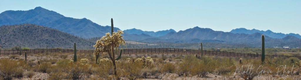
Top Photo: Welcome Sign at a Mexican Port of Entry
Los Algodones, Baja California, Mexico – December, 2017