Starting in the 1830’s, Nebraska became the first major challenge to wagon trains heading west along the Oregon Trail. Featuring steep ascents and descents, river crossings, and extreme weather, it tested emigrants with a little bit of everything. Today, many of the Oregon Trail’s original landmarks remain not just in Nebraska, but across its entire route to Oregon.
While Interstate 80 follows the Oregon Trail’s approximate route across the majority of Nebraska, you’ll need to get off the Interstate to fully immerse yourself in an incredible piece of American history. You’ll literally be walking over the exact same spots the wagon trains followed over 180 years ago. And if that’s not enough, you can still see and wagon ruts at many landmarks across Nebraska, Wyoming, and Idaho. And on this trip, you’ll actually be able to walk right along side them.
Overview
You’ll want to start your day either in Lincoln or Omaha and head west along Interstate 80. Along the way, you’ll stop at forts, hills, springs, and rivers. Your journey will cover nearly 500 miles (800 km) of the Oregon Trail from one end of Nebraska to the other.
As you set off for your journey west, take that first hour once you get west of Lincoln to truly appreciate just how endless, open, and expansive the Nebraska prairie is. Put yourself in the shoes of the settlers and emigrants traveling the Oregon Trail. Imagine what they were thinking seeing that prairie for the first time. What did you think when you saw the endless prairie for the first time?
A Word About Nebraska’s Weather
When you plan your Oregon Trail trip across Nebraska, be aware that Nebraska’s weather can be extreme and volatile at times. Summer temperatures routinely exceed 90 to 95°F (32 to 35°C). In the winter, sub-zero temperatures are common. Average low temperatures across the state drop to 10 to 15°F (-12 to -9°C) at their coldest point. Furthermore, snow and wind can cause blizzards that can paralyze the state.
Finally, don’t forget about the state’s location in Tornado Alley. Tornado season in Nebraska peaks in the late spring, from May to early June. When you come to Nebraska, make sure you plan and dress accordingly for the weather conditions you’ll likely experience.
Buy a Nebraska State Parks Entry Permit
Several of your stops on this Oregon Trail road trip are at Nebraska State Parks. To enter the state parks, you’ll need to buy an entry permit from the state, either online or at the park. You can buy daily or annual passes. Passes will get you into all of the Nebraska State Parks for either the day or the year, so you don’t need to buy a pass at every park you visit. In addition, as of the time this article was published, all National Park facilities along your route route do not charge entry fees.
Prepare for Your Journey at Fort Kearny
Fort Kearny was the first fort settlers on both the Oregon and California Trails reached on their journey west. The U.S. Army established the fort in 1848 to protect emigrants from the threat of Native American attacks. Today, Fort Kearny is one of Nebraska’s State and Historical Parks. You will need to buy an entry permit either online or at the park before going off to explore the fort.
Fort Kearny itself is located just across the river from the town of Kearney on State Route 50A. It’s easily accessible from Exits 279 or 272 on I-80. At the fort, you can partake in several outdoor activities.
- Watch an interpretive video about the history of the fort and its relationship with nature
- Tour reconstructed buildings and see live re-enactments of what life was like at the fort during the heyday of the Oregon Trail
- Hike or bike the nature trail. Fort Kearny is along a major sandhill crane migration route and is a haven for birdwatchers during the migration.
- Visit the nearby Fort Kearny Recreation Area for even more outdoor activities.
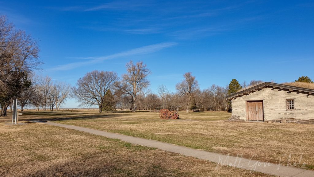
For the most immersive experience, you’ll want to visit during the warmer months when everything is open. On the other hand, if you visit in the winter, having the entire park to yourself can be magical.
Hike California Hill, the First Major Ascent on the Oregon Trail
Ascending 240 feet in about a mile and a half, California Hill presented the first topographical challenge for westbound wagon trains. Near the town of North Platte, Nebraska, the Platte river forks into the North Platte and South Platte rivers. After the fork, the Oregon Trail follows the North Platte River across western Nebraska and into Wyoming.
Because the Oregon Trail started in Missouri, wagon trains went along the south shores of the Platte River east of the fork. But here’s the dilemma. The easiest crossing of the South Platte River meant that you had to go over California Hill. The alternate route passed over relatively flat terrain, but the river crossing was far more perilous. As a result, many wagon trains opted for California Hill as the safer option.
How to Access the Trailhead at the Base of California Hill
Today, California Hill has some of the best-preserved wagon ruts on the entire Oregon Trail. Unfortunately, online directions to the hill itself are inaccurate at best and misleading at worst. From the town of Brule, Nebraska, head west on US-30. About 4.5 miles (7.2 km) west of town, you’ll see a pull off on the side of the road with the historical marker for California Hill. However, if you want to hike up California Hill or simply get the best view of it, you’re still in the wrong place.
At the historical marker, you’ll see a dirt road that heads north from US-30. Follow that dirt road north for about a quarter mile or so, and park in the small cutout on the left side of the road. There are no signs or anything for parking, but it’s the only cutout along the whole stretch of road. There are small placards for both the Oregon and California Trails nailed to the fence. It’s not well noted, but the National Park Service owns the land here, which is open to the public.
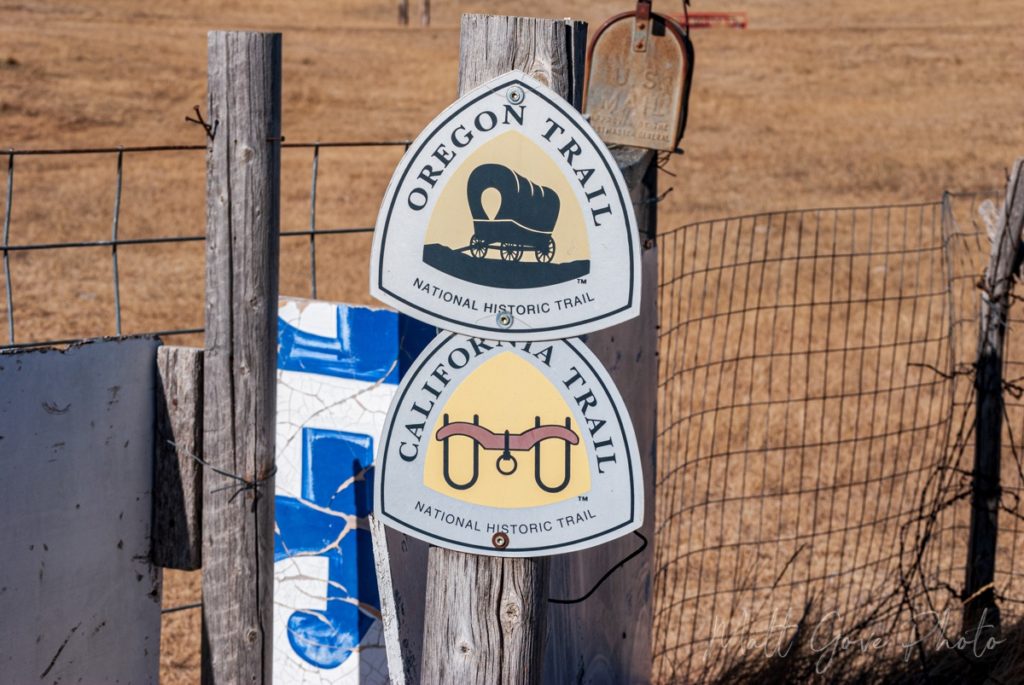
Experience Some of the Most Well-Preserved Wagon Ruts on the Entire Oregon Trail
Walk through the cut in the fence and follow the tire tracks up the hill. The initial tire tracks you see are modern, but you’ll quickly pass by some old cow troughs and under some power lines. As soon as you’re under the power lines, everything you see from that point onward are the wagon ruts from the Oregon Trail. Most of these ruts are between 150 and 180 years old. While you’re welcome to walk to the top of California hill, the best wagon ruts are only about 1,000 feet (300 m) from the parking area.
See More Wagon Ruts Where Emigrants Locked Their Wheels to Descend Windlass Hill
Just 20 miles from California Hill is the first major descent on the Oregon Trail, and the steepest descent in Nebraska. Windlass Hill marked the transition from the high table lands of western Nebraska down into the North Platte River Valley.
Despite Nebraska’s reputation as being largely flat, Windlass Hill is mind-numbingly steep – about 50% steeper than the steepest hills in San Francisco. Wagons had to descend a 25° angle, or 47% grade, for about 300 feet (100 m). For comparison, the steepest grades on major U.S. highways are usually between 6 and 8%. Because Windlass Hill is so steep, most wagon trains simply locked their wheels and dragged the wagons down the hill.
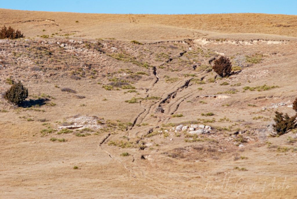
While it was an effective method to control the wagons on the descent, locking the wheels left deep scars in the landscape, which are still clearly visible today. And unlike California Hill, the wagon ruts on Windlass Hill are clearly visible from the parking lot.
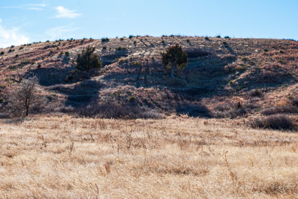
However, to completely immerse yourself in the history, hike the 0.6 mile (1 km) round trip paved trail to the top of the hill. You’ll quickly discover that the wagon ruts on the top of Windlass Hill are not the deepest scar in the landscape. Not even close. It’s the deep gorge at the bottom of the hill as you transition into the valley. You’ll cross a bridge over the gorge about 150 feet or so after you leave the parking lot.
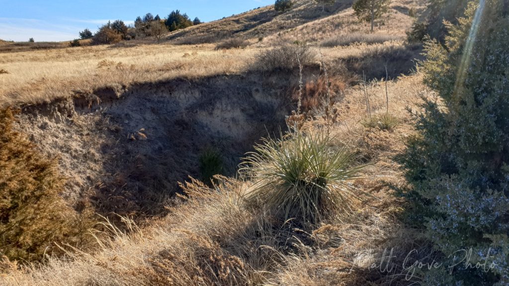
Interestingly, at first glance, the gorge looks like a natural feature, but the exact opposite is true. The gorge is 100% man-made and would not exist had the Oregon Trail not run through there. It is the result of wagon trains with locked wheels passing over the same area for 50 years.
When you return to the parking lot after the hike, have a look across the valley. You’ll see several sets of wagon ruts going up and over the next hill and down into Ash Hollow.
Ash Hollow Spring: An Oasis on a Arid Prairie
Water was a precious resource along the Oregon Trail. While the Platte River is a logical source of water for the Oregon Trail route across Nebraska, heavy traffic often contaminated the water in the river. That’s why Ash Hollow Spring was such an oasis for westbound wagon trains. In fact, Ash Hollow was so precious that Native Americans fought bitterly over the spring for centuries before the white man first arrived in the early 1800’s.
Ash Hollow gave emigrants a source of pure, clean spring water. As a result, Ash Hollow was a popular “rest area” on the Oregon Trail. Settlers often camped at the spring for a few days to rest up and recharge before continuing on their journey west.
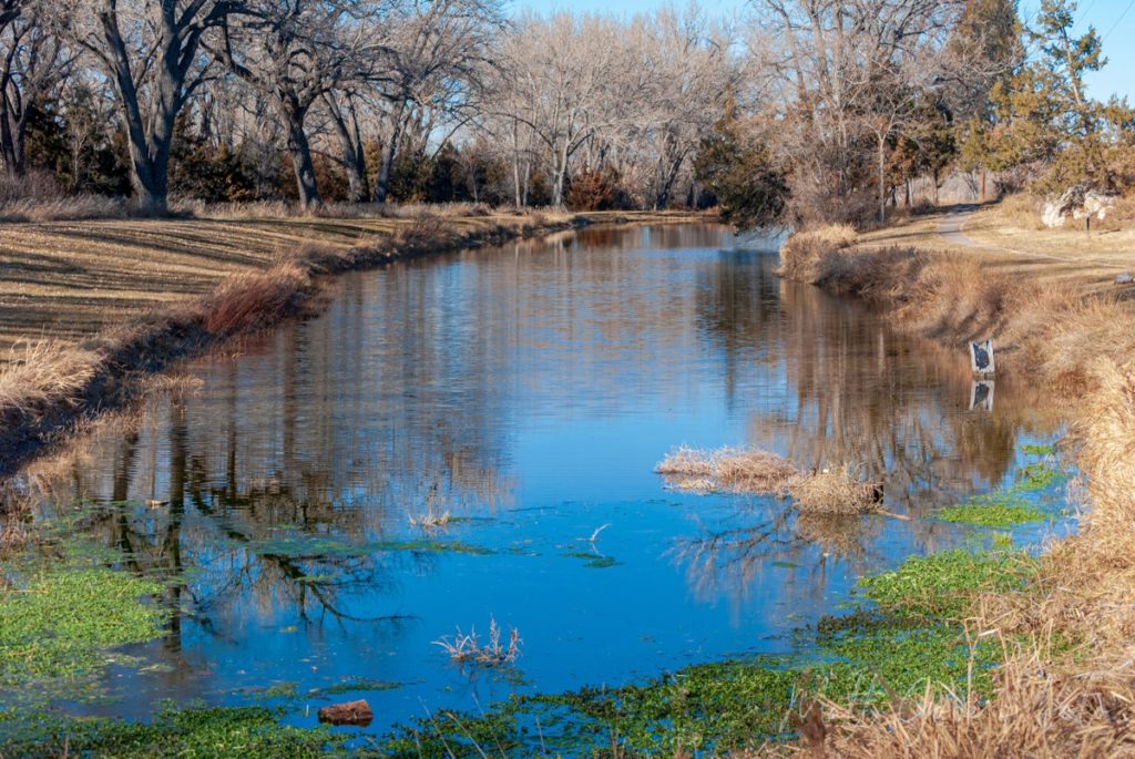
Ash Hollow is located right off of US-26, about 2.5 miles (4 km) northwest of Windlass Hill. Once you’re in the park, take the first left onto an unmarked dirt road. That dirt road will end after short distance at a picnic area. Park at the end of the road and walk across the picnic area to Ash Hollow Spring. Sit on one of the benches and enjoy the peaceful tranquility, or walk along the edge of the spring. And keep your eyes peeled. There’s plenty of wildlife to see in the area.
Finally, don’t forget to enjoy the rest of Ash Hollow State Historical Park. At the very least, drive up to the top of the bluff and take in the breathtaking view of the surrounding prairies and hills. There is a visitor’s center and museum up there, too. However, they were both closed when I was there due to the COVID-19 pandemic.
Take in the Breathtaking Vistas from Courthouse and Jail Rocks
Originally called McFarlane’s Castle, Courthouse and Jail Rocks were the first major rock landmarks for westbound settlers. Marking the point where the major trunks of the Oregon and California Trails merged, the massive presence of Courthouse Rock caused many people who passed it to liken it to a castle or court. Records of using Courthouse and Jail Rocks as a landmark date back as early as the fur traders that charted the original Oregon Trail around 1810.
From a geologic standpoint, Courthouse and Jail Rocks give you a glimpse into the ancient plateau that once towered over what is now western Nebraska. Over thousands of years, wind and water have slowly eroded the plateau. It left behind several stunning monoliths across western Nebraska that became famous landmarks along the Oregon Trail. Can you think of any others? Chimney Rock is one that immediately comes to mind.
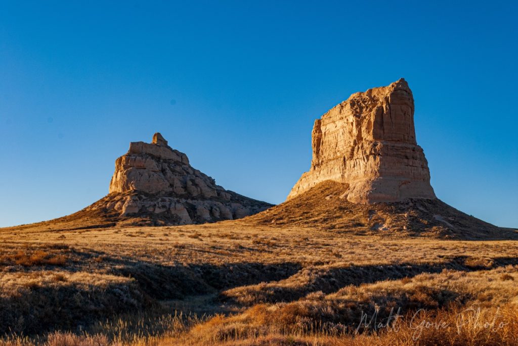
Courthouse and Jail Rocks are located along State Route 88 about 4 miles (7 km) south of Bridgeport, Nebraska. The rocks tower over the surrounding landscape, so they are quite hard to miss. When you get close to the rocks, turn right onto a dirt road called Road 81. It’s not terribly well marked other than a small Oregon Trail placard at the entrance to the road. In good weather, the road is easily passable in a standard passenger car. Park at the end of the road, hike the short loop around Courthouse and Jail Rock, and take in the breathtaking vistas of the surrounding prairies.
Chimney Rock: The Most Famous Oregon Trail Landmark
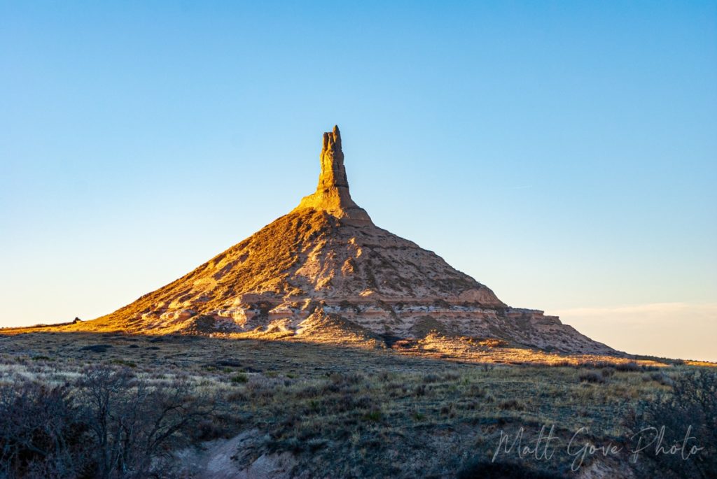
I don’t know about you, but the one landmark I really remember from playing the Oregon Trail game as a kid is Chimney Rock. Like Courthouse and Jail Rocks, Chimney Rock is one of the most famous rock landmarks on the entire Oregon Trail. And it didn’t just provide a very recognizable landmark for the Oregon Trail. Westbound settlers on the California Trail and the Mormon Trail also used Chimney Rock as a critical landmark.
Shortly after leaving Bridgeport on US-26 going west, Chimney Rock should come into view way off in the distance. From this vantage point, you can see why it was such a world famous landmark. Even in a car at 65 mph, you can see it for at least 15 minutes before you get to the turnoff. On a wagon train, it would be visible for at least a day or two. You have to try really hard to miss it.
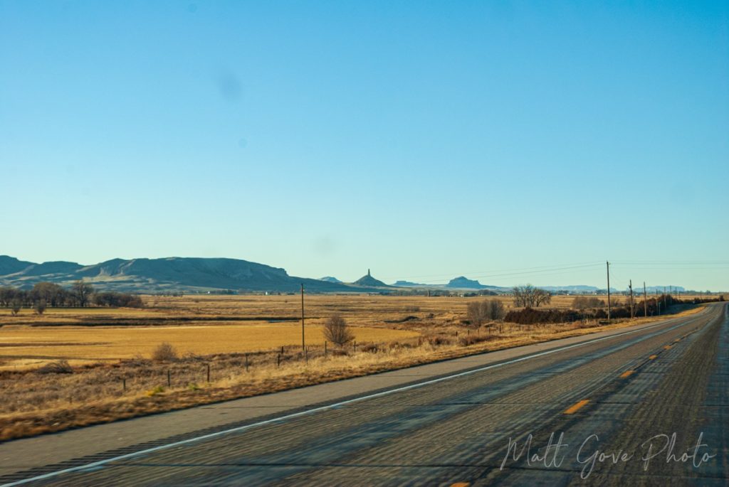
Thankfully, access is both easy and well-signed. Chimney Rock is located just south of the junction of US-26 and SR-92 near Bayard, Nebraska. Regardless of where you’re coming from, just follow the signs for Chimney Rock. It’s really that easy. In addition to the beautiful landscapes, there is a Visitor’s Center, museum, cemetery, and hiking trails at Chimney Rock.
There are a few things to keep in mind for your Chimney Rock photography and videos. The only roads and viewpoints to it look west, so mornings offer the best light for photographing Chimney Rock. The viewpoint at the end of the road and the hiking trails offer the best photo opps.
However, if you’re there in mid-December like I was, you can also take advantage of the low sun angles in the afternoon. From the lookout area, once the sun disappears behind the nearby bluff, it still bathes Chimney Rock in a beautiful low, warm light. You actually get a bit of an extended Golden Hour before sunset that is simply divine.
End Your Oregon Trail Journey Across Nebraska Taking in Sunset at Scottsbluff National Monument
Towering 800 feet over the North Platte River, Scott’s Bluff is a fitting place to end your Oregon Trail road trip across Nebraska. The bluff was another key landmark for settlers along the Oregon, California, and Mormon Trails, as well as the Native Americans. The wagon ruts have unfortunately eroded over time, but you can still walk about half a mile of the actual Oregon Trail within the National Monument.
If you want to drive up the bluff, make sure to arrive at least 30 to 45 minutes prior to sunset, as the road closes shortly before sunset. However, I find that your best photo and video opportunities actually come from down near the Visitor’s Center. Take advantage of the Golden Hour as the setting sun lights up the bluff in brilliant shades of yellows, oranges, and reds.
From Scottsbluff National Monument, it’s a quick drive back into town for accommodations for the night. In Scottsbluff, you’re only about 20 miles (30 km) from the Wyoming border. As a result, you’ll be in perfect position to continue your Oregon Trail journey west into Wyoming the next day.
Conclusion
Taking a road trip along the Oregon Trail route across Nebraska is one of the most interactive ways to immerse yourself in American history. You’ll literally be passing over the same terrain and seeing the same sights that the westbound settlers experienced nearly 200 years ago. While modern amenities have made the journey today far safer and more comfortable, I hope you’ll get an appreciation for the sacrifices and hardships so many emigrants encountered as they chased a better life in the west. Have you driven any of the Oregon Trail across Nebraska? Please feel free to share your experiences in the comments below.
If you want more of these travel guides, please consider signing up for our email newsletter. We’ll send these travel guides, plus exclusive deals, tutorials, and much more, straight to your inbox, twice per month, all for free.
Top Photo: Wagon Ruts are Carved into the Side of California Hill
Brule, Nebraska – December, 2021


