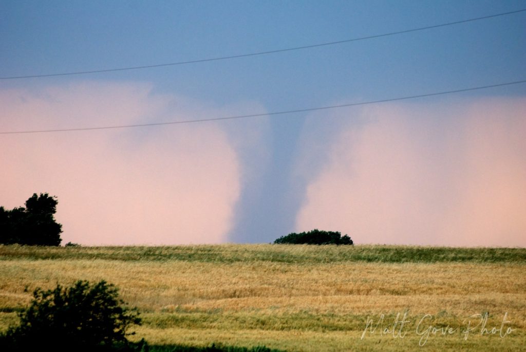
Weather apps are one of the most powerful tools to use in your landscape photography and travel videos. To demonstrate, let’s go back to my storm chasing days in Oklahoma. You get up in the morning and the day looks ripe for tornadoes. It’s a rare high risk day – a warning that’s only issued a few times per year for severe weather, even in the heart of Tornado Alley. After pouring over models, you pick out your target area, grab your cameras and storm chasing gear, and head out on the prairie.
Right on cue, a line of massive rotating supercell thunderstorms explodes on the dryline in the late afternoon. You don’t have to wait long before Tornado Warnings start blaring on the weather radio. Now, you have some decisions to make.
- What storm in the line do you target? The strategy for choosing a target storm for photography or video can be very different from deploying sensors in its path.
- How close to the storm can you get and still stay safe? Consider both storm intensity and speed at the very minimum.
- Are there any storms nearby that could cut off possible escape routes? On a high risk day, there likely will be.
Those are just a few of the decisions you’ll need to constantly be making while you’re actively chasing a storm. Because things happen so fast, you have to constantly evaluate and adjust as needed. But where do you get this info?
Enter Weather Apps
If you’re like me, you lack the budget for the state-of-the-art technology the professional photographers and videographers use for not just storm chasing, but any outdoor adventure. Unfortunately, most weather apps (especially the free ones) don’t give you the information you need to properly plan an outdoor photo or video shoot. But that doesn’t mean you’re out of luck.
While there is no one “silver bullet” app that will give you all the information you need, I will be giving you the storm chaser’s toolbox of weather apps to plan your next outdoor photo shoot. You’ll be amazed at how well these weather apps work for landscape photography and travel videos. And best of all, they’re affordable. There’s no need to shell out hundreds or thousands of dollars on high end software anymore.
I also want to point out that I am not affiliated with or paid by these applications in any way. This is just a collection of my favorite weather apps that I use on most of my landscape and outdoor photography and video shoots.
Weather Apps for Landscape Photography and Travel Videos
Weather is a key component of not just landscape photography, but also travel, adventure, and outdoor videography. It can make or break your shot. In fact, weather is often the difference between that awe-inspiring shot that will sell your photo or video and a visual media file that gets deleted before you even get a chance to post-process it.
No matter what type of weather you need for your shot, these apps will give you the information you need to ensure that you get the shot you want. They cover blue skies to blizzards, tornadoes to sunsets, and everything in between. Once you assemble this toolbox of weather apps for your landscape photography or travel video shoot, you will no longer need to waste time just “taking a chance” on a good sunset or an approaching storm. Instead, you’ll already be in position ready to start filming before your target weather phenomenon even arrives.
RadarScope: The Cadillac of Weather Apps
Platform: iOS, Android, macOS, Windows
$9.99 (mobile), $29.99 (desktop)
Originally developed in the weather mecca of Norman, Oklahoma, RadarScope was built with one goal in mind: to keep you safe during severe weather. It was my number one go-to app during the height of my storm chasing days nearly 10 years ago, and it remains the go-to app for storm chasers and weather enthusiasts today. Its user base now reaches much further than just the storm chasing community. And it includes both landscape photographers and travel and outdoor videographers.
RadarScope displays highly detailed doppler radar data on an easy-to-read map. Even better, they have managed to ver successfully pull off what I consider to be the Holy Grail of GIS. When you look at the screen, the map seemingly fades into the background, drawing your eye to the radar data. Yet at the same time, you can instantly tell where the severe weather is with just a quick glance. In the world of GIS, that’s an incredibly difficult thing to do, and they have pulled it off absolutely flawlessly.


In addition to viewable radar data, RadarScope comes with a plethora of features and functionalities.
Key Features of RadarScope
- GPS Support. Plot your location on the map with radar data
- Severe weather warnings displayed on the map. Tap on the warning to read the text of the warning.
- In addition to reflectivity data, it supports all types of doppler radar data, such as wind speeds, echo tops, estimated precipitation totals, and dual-pol technologies.
- Includes a distance measuring tool so you can easily see how far you are from severe weather threats or measure how high the radar beam is at any given location
- Drawing tool lets you mark up and share the radar image
- Quickly export maps and data as either animated GIFs or as still images
- Supports both metric and imperial units
- Currently supports radar in all US States and Territories, as well as Canada, Australia, several European Union nations, Japan, and South Korea.
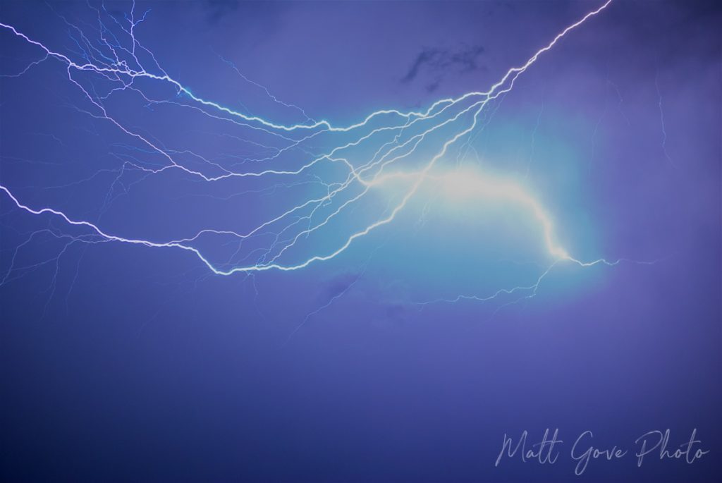
- Pro version has even more features, such as lightning strikes, split screen comparisons, watches and mesoscale discussions, storm reports, and much more.
Nothing has proven more valuable for my storm chasing, photography, and adventures than RadarScope’s GPS feature. Being able to plot your location on the map is critical to ensure that you are in the best position to capture the shots you need for your project. Even for benign weather features such as sunsets, things happen incredibly fast once you get out in the field. You don’t want to miss your shot trying to figure out where on the map you are. RadarScope’s GPS ensures that you can reposition and make adjustments as quickly as possible.
Windy
Platform: iOS, Android, Web Browser
Free, Pro Features Available
Windy is my favorite app for viewing model data on my phone or tablet. Best suited for detailed short-term forecasting at all geographic scales, Windy has a stunning display showing atmospheric flow around the world. View real-time observed data or model predictions in four dimensions. Windy provides two-dimensional maps at numerous heights throughout the atmosphere, as well as vertical soundings and time-series point forecasts for your specific location.


Windy currently provides model predictions for four models. You can find support for the GFS (American), ECMWF (European), and NAM (North American Mesoscale) models, as well as a German model called ICON, which stands for Icosahedral Nonhydrostatic.
Key Features of Windy
- Stunningly beautiful display for analyzing data
- Huge choice of weather parameters to plot
- Data available in four dimensions and all geographic scales, including point forecasts
- View both observed data and model predictions on the same map
- Includes forecasts for airports, sports/recreation, wildfires, tides, and much more
- Bookmark your favorite locations for easy reference
- While it doesn’t support plotting your location on a map like RadarScope does, Windy does have GPS functionality that allows you to quickly and easily get data for your current location.
- Supports both metric and imperial units
Pivotal Weather
Platform: Web Browser
Free, Pro Features Available
If you’re looking for comprehensive model data, Pivotal Weather is where you need to be. Best used for both short and long-term modeling, you’ll find detailed model forecasts for over 20 global, regional, and mesoscale models. Like Windy, Pivotal Weather allows you to display data in four dimensions at all geographic scales. It works on a global scale, so you’re not restricted to specific countries or other geographic boundaries. We used Pivotal Weather extensively during our analysis of Hurricane Henri and Hurricane Ida last summer.


My favorite feature of Pivotal Weather is its high quality maps. So many weather modeling websites have such poor quality maps that it can be difficult in some situations to pin down exactly where a weather event will take place. While it’s not a big deal on a large scale, it can become a major issue once you drill down to the local level. Pivotal Weather lets you plot model data at those local levels, plus displays the predicted value as you mouse over the map.
Key Features of Pivotal Weather
- More than 20 global, regional, and mesoscale models
- Provides data worldwide
- Displays model predictions in four dimensions at all geographic scales
- Numerous choice of map scale levels
- Much higher quality maps than most weather modeling websites.
- You’ll get the best experience viewing on a computer, not a phone
- Additional features available with Pivotal Weather Plus
Federal Weather Bureaus
Platform: Web Browser
Free
How many times have you opened a free app or website and just got bombarded with ads, pop-ups, and other promotions? That’s why I often go straight to the source for weather data and information: the federal government. Because federal weather bureaus in every country are government agencies, you won’t get bombarded with all the ads, video clips, and other useless promotions you find on so many other apps and websites.
Federal weather bureaus are one-stop shopping for observations, forecasts, analysis, and past data. In addition to their own analysis, most federal weather bureaus provide the data so you can also do your own analysis. You’ll have all tools to look at all geographic scales, regardless of whether you’re looking at the entire world or your neighborhood. Use the models and forecasts to identify the best spot for your shoot. Once you get out in the field, use observations to fine-tune and adjust your strategy and location as needed.


Here are a few links to federal weather bureaus around the world. If your country is not listed below, a quick Google search will find it pretty quickly.
| Country | Federal Weather Bureau |
|---|---|
| United States | National Weather Service |
| Canada | Environment Canada |
| Mexico | Servicio Meteorológico Nacional |
| Australia | Bureau of Meteorology |
| South Africa | South African Weather Service |
| United Kingdom | Met Office |
| France | Météo France |
| Spain | Agencia Estatal de Meteorologíca |
| Italy | Servizio Meteorologia |
| Germany | Deutscher Wetterdienst |
| Russia | Hydrometeorological Centre of Russia |
| Japan | Japan Meteorological Agency |
| Malaysia | Jabatan Meteorologi Malaysia |
| Thailand | Thai Meteorological Department |
| Jordan | Jordan Meteorological Department |
National Centers for Environmental Protection
Platform: Web Browser
Free
If you’re in the United States, the National Centers for Environmental Protection, or NCEP, contains all of the weather information you need to plan and execute a successful outdoor photo or video shoot. Run by NOAA and the National Weather Service, NCEP is comprised of 8 centers. While they are primarily aimed at the United States, many of them make predictions that go beyond America’s borders.
| Center | Location | Products |
|---|---|---|
| Aviation Weather Center | Kansas City, Missouri | Forecasts for Aircraft |
| Climate Prediction Center | College Park, Maryland | Long-Term Climate Patterns, Temperature, and Precipitation Outlooks |
| Environmental Modeling Center | College Park, Maryland | Latest News on Weather Model Development |
| National Hurricane Center | Miami, Florida | Tropical Weather Predictions for Atlantic and Pacific |
| Ocean Prediction Center | College Park, Maryland | Weather, ice, and ocean current predictions for the Atlantic, Pacific, and Arctic Oceans |
| Storm Prediction Center | Norman, Oklahoma | Severe Thunderstorm and Fire Weather Outlooks and Forecasts |
| Space Weather Prediction Center | Boulder, Colorado | Forecasts for Space Weather Effects on Earth |
| Weather Prediction Center | College Park, Maryland | Hydrological and Flooding Forecasts |
The Possibilities for Using NCEP Weather Apps for Landscape Photography and Travel Videos are Endless
The possibilities for using these weather apps for landscape photography and travel videos are endless. Use the Climate Prediction Center to look at historical weather patterns to ensure that the weather will cooperate for your shoot. For instance, you don’t want to head down to the Caribbean to film a hurricane only to find out that a strong El Niño has neutralized the Atlantic Hurricane Season.
Additionally, visit the Aviation Weather Center for all your drone photography and video needs. Perhaps you want to try your hand at storm chasing? In that case, the Storm Prediction Center has all of the information you need. Likewise, use the Space Weather Prediction Center to plan your Aurora Borealis or astrophotography shoot. The list goes on and on.
I could write an entire blog post on NCEP alone, but you get the idea.
NOAA High Resolution Rapid Refresh (HRRR) Model
If RadarScope is my favorite weather app to use in the field for landscape photography and travel videos, then NOAA’s HRRR model is its best compliment. Excelling in day-of-event modeling and forecasting, use the HRRR to anticipate any adjustments you’ll need to make in your shoot. Its 3 km resolution is fine enough to resolve most individual thunderstorms, making it an incredibly powerful tool for outdoor photography and videos. As a result, it has never let me down in every storm chase I’ve taken part in since 2011.


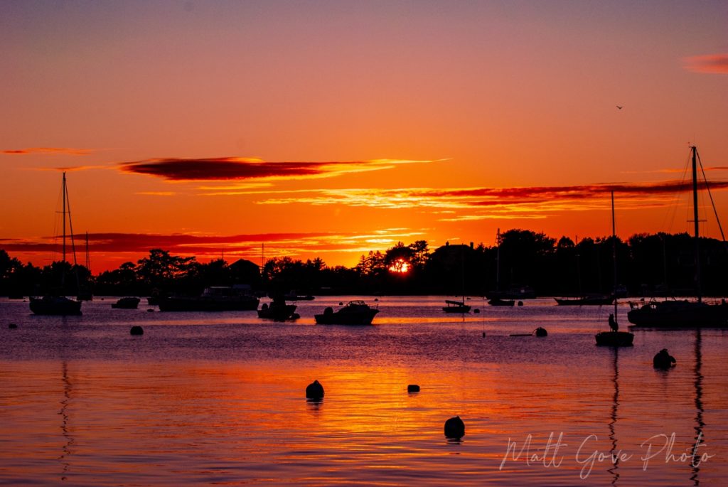
For example, consider a simple sunset shoot. Sounds easy enough, right? Conditions in the morning look perfect for a spectacular sunset. Unfortunately, you are completely unaware a storm system is moving in from the southwest. Thick clouds will cover the western sky, completely obscuring the sunset.
Thankfully, you have been monitoring the HRRR throughout the day. As a result, you see that your original plan for a spectacular sunset will go down in flames. Additionally, you see that the spectacular sunset will occur about 70 miles up the coast. You adjust your plan accordingly, leaving an hour earlier so you can get up the coast in time for sunset.
Most importantly, though, you capture one of the best sunsets you’ve ever seen. As soon as the prints hit your online store, they start selling like hot cakes. Imagine how different things would have turned out if you hadn’t been able to anticipate that storm system coming in.
Use the HRRR for All Types of Outdoor Photography and Videos
The HRRR includes highly detailed information for every type of outdoor photography or videography. That’s what makes it so powerful. You’ll be able to use it for everything from sunsets to winter weather, fire weather to space weather, and lightning to beach photography.
Next week, we’ll cover the HRRR model in detail. You’ll learn how to use the HRRR to apply storm chasing strategy to your outdoor photography and videography. After that, you’ll be armed with the tools you need to take your landscape photography and travel videos to the next level.
How Will You Use Weather Apps for Your Landscape Photography and Outdoor Shoots?
Weather is an often mundane part of our everyday lives. However, once you get out in the field to film it, weather seems to happen extremely fast. They key to success with any type of outdoor photography or videography is to stay ahead of the weather. These weather apps provide you with the toolset you need to take your landscape photography, travel videos, and other outdoor media to the next level. Use them responsibly, and always keep safety in mind first.
Do you want more photography and video tips and tutorials? Please sign up for our email list. We’ll send them to your inbox, twice per month, all for free.