The post Weird Geography: 10 Bizarre and Unusual Facts About the United States appeared first on Matthew Gove Blog.
]]>1. Contrary to Popular Belief, Maine is not the Easternmost State in the United States
If you want to see the first sunlight in the United States, you have to head to Maine, right? Well, not quite. While Maine is certainly easy and convenient to get to, it’s doesn’t see the day’s first sunrise in the United States. For that, you paradoxically have to go west. So far west, in fact, that you actually go east.
So where is the United States’ first sunrise? Believe it or not, it’s actually in Alaska. And it’s not in the main part of Alaska, either. You have to venture to the westernmost parts of the Aleutian Islands. Because those islands stretch so far west, they actually stretch into the Eastern Hemisphere. Excluding territories, the Aleutian Islands are the only part of the United States located in the Eastern Hemisphere. That means you’ll see not just the first sunrise in the United States, but one of the first sunrises in the entire world.
And Alaska’s claims don’t stop there.
2. Alaska is the Easternmost, Westernmost, and Northernmost State in the United States
At the eastern end of Semisopochnoi Island in the Aleutians, you’ll find the easternmost point in the United States (179.777°E). Interestingly, Semisopochnoi Island is actually closer to Russia than the main part of Alaska. But it’s far from the closest point to Russia. That belongs to Little Diomede Island in the Bering Strait. Little Diomede sits just 2.5 miles (4 km) from Big Diomede, it’s Russian counterpart, despite a 21-hour time difference between the two islands.
Only 65 miles (105 km) to the southeast of Semisopochnoi Island, you’ll find the westernmost point in the United States in the Alaska Maritime National Wildlife Refuge (179.143°W). Consisting of several uninhabited islands, the refuge is one of the most remote outposts on America’s northern frontier. But you can go further. The furthest, westernmost, and remotest post in the Aleutian Islands is Attu Station. At 172°E, Attu Station sits just 475 miles (770 km) from Ust’-Kamchatsk (Усть-Камчатск) on the Russian mainland. That’s a stark difference from the 1,500 miles (2,400 km) you’d have to travel to return to Anchorage.
Thankfully, things are much less complicated if you look north and south. It’s pretty clear that Alaska is the northernmost state in the United States. The town of Utqiagvik, which was formerly called Barrow, is the northernmost town in the United States. At 71.18 °N, it’s also one of the northernmost towns in the world. Only Canada, Russia, Norway, and Greenland have population centers further north.
And for the southernmost state…
3. Key West is not the Southernmost Point in the United States
While it’s true that Key West is the southernmost point in the Lower 48, it’s not even close to being the southernmost point in the United States. For that, you’ll need to look six degrees of latitude further south and a long way west. At the southern tip of Hawaii Volcanoes National Park, you’ll find Ka Lae, the actual southernmost point in the United States.
Additionally, if you include territories, you can go a lot further south. The southernmost point in a US territory is located at the Rose Atoll in American Samoa. The tiny island covers just 0.21 square kilometers and reaches latitudes of 14.6°S.
| Southernmost Point | Latitude |
|---|---|
| Key West, Florida | 24.55°N |
| Ka Lae, Hawaii | 18.55°N |
| Rose Atoll, American Samoa | 14.6°S |
4. Los Angeles County Has a Larger Population than 41 States
It’s hard to believe, but Los Angeles County does actually have a larger population than 41 states. With a population of 10.04 million as of 2019, LA County is by far the most populous county in the United States.
And what are those 9 states that have a larger population? Here they are, ranked by population.
| State | 2020 Population |
|---|---|
| California | 39.613 million |
| Texas | 29.730 million |
| Florida | 21.944 million |
| New York | 19.299 million |
| Pennsylvania | 12.804 million |
| Illinois | 12.569 million |
| Ohio | 11.714 million |
| Georgia | 10.830 million |
| North Carolina | 10.701 million |
| Los Angeles County | 10.014 million |
5. You Can Get on a Plane in Anchorage, Alaska and Be Anywhere in the Northern Hemisphere in Less Than 10 Hours
Amazingly, Anchorage is the only city in the world that can lay claim to this fact, even if you include the equivalent in the Southern Hemisphere. So what makes Anchorage so special? First, it has a major international airport that processes most cargo and many passengers bound for the United States from east Asia.
Not only does Anchorage have a major international airport, but it’s also the closest major international airport to either pole. Anchorage’s proximity to the North Pole makes it very quick and easy to fly over the pole to reach the other side of the world.
Consider an “over-the-pole” flight from New York City to Tokyo or Beijing. At the very minimum, you’re looking at 13 to 14 hours of total flight time. That’s because half of that time is spent getting from New York up to the pole.
When you start in Anchorage, you’re already most of the way to the pole. As a result, a direct flight from Anchorage to Frankfurt, Germany covers basically the same distance as a flight from Boston to Los Angeles.
| Flight Leg | Distance (mi) | Distance (km) |
|---|---|---|
| Anchorage to Frankfurt | 2,895 | 4,659 |
| Boston to Los Angeles | 2,611 | 4,202 |
6. Maine is a Particular Geographic Oddity
The state of Maine is best-known for its rugged outdoors, diverse wildlife, and world-famous seafood. However, being wedged between New Hampshire, Québec, and New Brunswick means that it’s got its fair share of geographic oddities.
- Maine is the closest US State to Africa. Quoddy Head, Maine sits just 3,154 miles from El Beddouzza, Morocco. For comparison, Florida is more than 4,000 miles from its nearest point on the African continent.
- If you take a road trip through the Lower 48, passing through each state only once, you always end in Maine. That’s because Maine is the only state in the continental United States that borders only one other state.
- More French is spoken in Maine than any state in the United States. When French explorers landed in eastern Canada back in the 1600’s, many of them settled in what is present-day Maine. Their descendants are still there today. It doesn’t hurt bordering two French-speaking Canadian provinces, either.
- Maine is the single largest producer of blueberries in the United States.
- Nobody knows how Maine got its name. All they know is that the name first appeared in writing in 1622.
- Despite the mystery behind its name, Maine was part of Massachusetts until 1819.
- Maine is larger than the other 5 New England States combined.
- If you visited one island per day, it would take you more than 9 years to visit every island in Maine
- At 3,478 miles, Maine’s coastline is longer than California’s (3,427 miles)
- Maine is home to the only desert in New England (40 acres outside Freeport). It formed 11,000 years ago, when a glacier deposited large amounts of sand on the site.
- Portland, Oregon is named after Portland, Maine. The Oregon city’s name was decided on a coin toss between Portland and Boston.
7. The United States is Home to the Shortest River in the World
The Roe River in Montana is only 200 feet long. That’s a stark contrast to the Missouri (2,341 miles) and Mississippi (2,202 miles), the United States’ two longest rivers.
8. Nebraska is the Only Triply Landlocked State in the United States
A triply landlocked state means that you have to pass through at least three other states (and/or Canadian Provinces) to reach the ocean. Nebraska is the only state in the United States that can make the claim of being triply landlocked. Don’t believe me? Have a look at some of its neighbors. Do note that in the table below, there may be more than one way to reach the ocean. The table lists the fewest states you need to pass through to reach the ocean.
| State | States to Pass Through to Reach the Ocean |
|---|---|
| Nebraska | Kansas, Oklahoma, Texas |
| South Dakota | North Dakota, Manitoba |
| Wyoming | Idaho, Oregon |
| Colorado | Oklahoma, Texas |
| Kansas | Oklahoma, Texas |
| Iowa | Minnesota, Ontario |
| Missouri | Arkansas, Louisiana |
9. Hawaii’s Mauna Kea is Taller Than Mt. Everest
The summit of Mauna Kea is only 13,796 feet above sea level, less than half the elevation of Everest’s summit (29,032 feet). However, Mauna Kea extends deep into the depths of the Pacific Ocean, while Everest is completely landlocked. The Pacific Ocean has a mean depth of over 14,000 feet, and the Hawaiian Trough reaches an average depth of over 18,000 feet.
As a result, when you account for the underwater part of Mauna Kea, it’s much taller than what you see on the Big Island in Hawaii. Mauna Kea is actually 32,808 feet tall, surpassing the height of Mt. Everest, despite the stark difference in elevation at each respective summits.
10. The Statue of Liberty Should Be in New Jersey, not New York
When you think of New York City, the Statue of Liberty is probably one of the first things that comes to mind. Lady Liberty is so quintessentially New York. But did you know that she should actually be in New Jersey, not New York?
When France gifted the Statue of Liberty to the United States in 1885, the US Geological Survey placed Liberty Island in New York’s 8th Congressional District. However, when you look at a map, you’ll see the Statue of Liberty is actually in New Jersey Waters. Regardless of what the state line says, the statue remains part of both the State and the City of New York.
Bonus: America’s Four Most Sprawling Cities Are All in Alaska
Alaska’s large size and small population means that its cities and towns have plenty of room to spread out. Indeed, Alaska has one of the lowest population densities in the United States. What surprises most people is that Alaska is home to the country’s four most sprawling cities.
From a strictly surface area to population ratio, the Alaskan Cities sprawl far more than Los Angeles, Phoenix, Houston, and every other major city in the Lower 48. For example, the City of Juneau is larger than Rhode Island and Delaware combined. And the winner, Yakutat, is larger than eight other states.
| City | Surface Area (sq mi) | Population |
|---|---|---|
| Anchorage, AK | 1,704 | 294,356 |
| Wrangell, AK | 2,541 | 2,521 |
| Juneau, AK | 2,717 | 32,094 |
| Sitka, AK | 2,874 | 8,689 |
| Yakutat, AK | 9,459 | 605 |
| Los Angeles, CA | 503 | 3,967,000 |
| Phoenix, AZ | 517 | 1,633,000 |
Bonus #2: You Can Get a Taste for Driving on the Left Side of the Road Without Leaving the United States. Just Head to the U.S. Virgin Islands.
It’s incredibly rare for a state or territory to drive on the opposite side of the road from its parent country. But the United States has one. The other country that boasts a few of them is the United Kingdom.
The US Virgin Islands is the only jurisdiction in the United States where you drive on the left. But unlike other locations that drive on the left, most cars in the USVI are imported from the mainland US, and still have the steering wheel on the left side of the car.
The United States purchased the Virgin Islands from Denmark in 1917. At the time, traffic in Denmark drove on the left. To keep the islands’ residents happy and prevent animosity towards the US, the federal government kept traffic in the Virgin Islands on the left side of the road.
While Denmark switched to driving on the right in 1967, along with much of the rest of Europe, the Virgin Islands never did. To this day, the US Virgin Islands continues to drive on the left. For what it’s worth, so do the British Virgin Islands.
Conclusion
Whether you’re trying to figure out how to drive on the left in the Virgin Islands or trying to catch the day’s first sunrise at its easternmost point in Alaska, the United States has plenty of geographic quirks and oddities to explore. But we’re just scratching the surface here. The US is a big country, and I could easily write another whole post or two about its weird geography. Have you been experienced any of the United States’ weird geography in your travels? Let us know in the comments below.
Top Photo: Afternoon Sun Illuminates a Beautiful Canyon Landscape
Canyonlands National Park, Utah – December, 2021
The post Weird Geography: 10 Bizarre and Unusual Facts About the United States appeared first on Matthew Gove Blog.
]]>The post A Powerful, Heartbreaking Exhibit of the Severe Drought in California appeared first on Matthew Gove Blog.
]]>Anthony Bourdain once famously said, “Travel changes you. As you move through this life and this world you change things slightly, you leave marks behind, however small. And in return, life — and travel — leaves marks on you.” Travel has left plenty of marks on me over the years. However, this quote really hit home after a recent road trip I took through California. Today, I want to share that story with you.
What Causes Severe Drought in Western States Such as California?
Most people attribute drought to the lack of rain. However, it’s actually not the primary cause of severe drought in the western United States. To find the culprit, you need to look in an unexpected place. In fact, you’ll find it in the exact opposite of the summer season that makes headlines for searing temperatures and massive wildfires.
The winter season actually determines how severe the drought will be in California and throughout the west. More specifically, the amount of snow that falls in the mountains is what drives drought levels. In the spring, the snow melt feeds rivers, streams, and creeks, providing water to the valleys below. Unlike a rainstorm, snow melt is a slow process that provides a steady supply of water for months. And for many rivers, snow melt is their only source of water.

Most of California’s mountains snows fall in the Sierra Nevada. Rising over 14,000 feet above sea level, the Sierra runs pretty much the entire length of California’s eastern border with Nevada. During normal winters, pretty much every snow event in the Sierras is measured in feet, not inches. Snow melt from the Sierra Nevada alone provides water over 25 million Californians – about 65% of the state’s population.
The California Drought: Data and Statistics
Before diving into the drought data for the entire state of California, let’s have a look at annual snowfall in the Sierra Nevada over the past ten years. We’ll at two hotspots for heavy snow. First up is Donner Pass, which sits along Interstate 80 just west of Truckee and northwest of Lake Tahoe. Then, we’ll look Mammoth Mountain, one of California’s most popular ski resorts. Mammoth Mountain sits about 45 miles (72 km) southeast of Yosemite National Park.
| Winter | Donner Pass | Mammoth Mountain |
|---|---|---|
| 2012 – 2013 | 13 in / 33 cm | 315 in / 800 cm |
| 2013 – 2014 | 33 in / 84 cm | 192 in / 488 cm |
| 2014 – 2015 | 14 in / 35 cm | 161 in / 409 cm |
| 2015 – 2016 | 289 in / 734 cm | 393 in / 999 cm |
| 2016 – 2017 | 474 in / 1,204 cm | 608 in / 1,544 cm |
| 2017 – 2018 | 225 in / 572 cm | 277 in / 704 cm |
| 2018 – 2019 | 381 in / 968 cm | 495 in / 1,258 cm |
| 2019 – 2020 | 180 in / 457 cm | 153 in / 389 cm |
| 2020 – 2021 | 129 in / 328 cm | 225 in / 572 cm |
| 2021 – 2022 (To Date) | 179 in / 455 cm | 178 in / 453 cm |
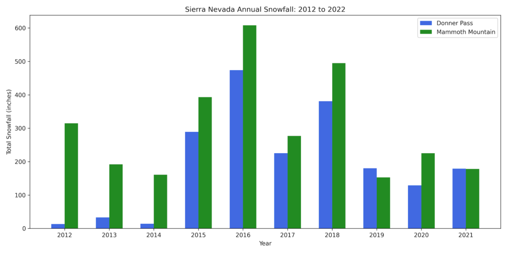
Snowfalls are Way Down in Recent Years Throughout the West
From the bar chart, it’s pretty clear that snow levels in the Sierra Nevada are way down every year since 2018. This pattern is echoed across mountain ranges throughout the west, from Washington to New Mexico. As a result, water levels have plummeted across the entire region due to the lack of snow melt. The southwestern states, plus California have born the brunt of the recent drought.

To further compound the matter, smaller snowpacks mean that the snow melts faster. In 2021, snowpack across the entire state of California had completely melted by May, about two to three months earlier than average. The faster rate of snow melt results in most of the water running off instead of being absorbed into soils that so desperately need it.
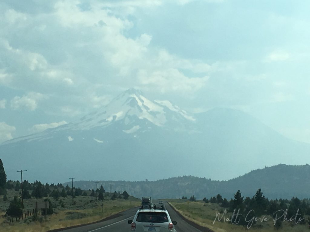
As you can probably deduce, dry soils lock a layer of extremely dry air at the surface throughout the summer months. Unfortunately, that only makes it harder for much needed rain to reach the ground. Much of California is caught in this vicious positive feedback loop that only makes the drought worse.
An Anthony Bourdain Quote and a Trip Up Interstate 5 Makes the Severity of the California Drought Really Hit Home
In January 2022, I took a road trip from Las Vegas to Salem, Oregon. Coupled with a stop to visit one of my best friends in San Francisco, the trip took me across nearly the entire state of California. It marked my first visit to California since February, 2020.
During that time, both the drought and wildfires have gotten exponentially worse, thanks to a lack of snowpack in the mountains. And seeing areas that were so lush and vibrant in 2017 now completely ravaged by drought and wildfire really left a big mark on me. In ways that really didn’t expect.
“Travel changes you. As you move through this life and this world you change things slightly, you leave marks behind, however small. And in return, life – and travel – leaves marks on you.”
Anthony Bourdain
A Stunning Drive Through California’s Central Valley
If you’ve never driven through California’s Central Valley, it’s one of the more uniquely spectacular drives in the United States. Responsible for 8% of the United States’ agricultural output, the Central Valley features lush and fertile fields surrounded by majestic mountains. It’s hard to not feel a special connection to nature. And if you drive through at the right time of year, the smell of fresh fruits and vegetables is heavenly.
Furthermore, when I drove through in mid-January, farmers were in the process of prepping and seeding their fields for the spring and summer growing seasons. Passing through the Central Valley was like a cleansing and rebirth for you mind and soul. At times, you felt like you were in a fairy tale, having been teleported to some faraway land. The pandemic and all the other problems in the world felt so far away.

A Stunning Snow-Capped Mt. Shasta Completes the Fairy Tale
Towering 14,179 feet above sea level and over 10,000 feet above the surrounding terrain, Mt. Shasta dominates the northern California landscape. It’s the second tallest mountain in the Cascades, behind only Mt. Rainier. And Rainier is only 250 feet taller. On a clear day, you can see Mt. Shasta from as far as Central Oregon, over 140 miles away. You can actually find some of the best views of Mt. Shasta right from both US-97 and Interstate 5.


Surrounding Mt. Shasta, you’ll find simply breathtaking scenery. Golden meadows, stunning rolling hills, and refreshing pine forests transport you even further into that fairy tale. All those worries you had to start the day seem even further away than they did down in the Central Valley.
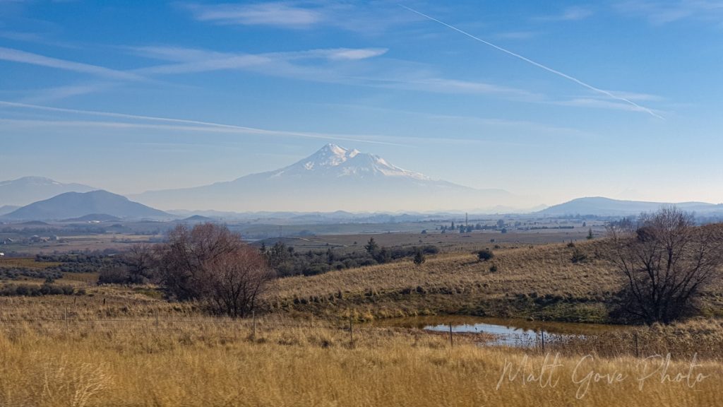
As a photographer, I try to keep an eye out for good photo ops on road trips. However, a truly spectacular composition catches your eye right away. Shortly after beginning the climb out of the Central Valley up into the Cascades, I came around a corner on Interstate 5 and into a clearing. And what lay before me was one of the most perfectly composed landscapes I had ever seen.
Off in the distance sat Mt. Shasta, perfectly framed between two smaller mountains. It provided a beautiful backdrop for seemingly endless meadows and rolling hills that disappeared into a light haze that shrouded the base of the mountain. Small ponds dotted the foreground on the side of the freeway, adding even more diversity to the shot. It was a combination of beautiful, mysterious, and exotic, balanced to perfection. The perfect composition to capture the fairy tale I had drifted off into.
You Can’t Stop on the Freeway to Take Pictures
Unfortunately, I also had a few things working against me. Most critically, I was cruising at 70 miles per hour up Interstate 5. There were no exits or pullouts nearby, and I wasn’t about to stop in the middle of a busy freeway just to take a picture. Furthermore, there was no safe way for me to take a picture with my DSLR camera while I was driving. But I wasn’t going to let this perfect photo op go to waste.
While using my big camera was out of the question, I still had one more tool available to me. And at this point, it was really my only option. I grabbed my phone, rolled down the passenger side window, leaned over far enough to get the window frame out of the picture, and blindly started snapping as I kept looking forward to keep my eyes on the road.
I expected to get a decent shot. What I didn’t expect was to get one of the best photos I’ve ever taken, and one that will be put up for sale in our store very soon.
Then reality hit, hard. Like being hit by a Mack truck hard.
A California Landscape Ravaged by Wildfire and Drought
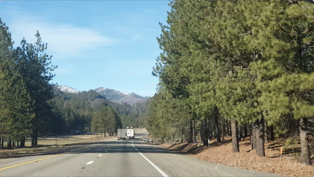
Over the past five years, parts of the Shasta-Trinity National Forest have been devastated by several major wildfires. The extreme drought that has suffocated California for much of that time has only made these fires larger and more intense. Most notable, the Carr Fire torched nearly 230,000 acres in the summer of 2018, forcing 38,000 people to evacuate their homes. It killed 11 people and caused $1.7 billion in damage.
Fast-forward three years. In late June, 2021, another fire broke out along Interstate 5 just north of Lake Shasta. That blaze, dubbed the Salt Fire, torched 13,000 acres on both sides of the freeway. While few people live in the area, the intensity of the fire devastated the landscape, changing it into a barren wasteland for years to come. The drought is one of the prime culprits behind the increase in both intensity and magnitude of these fires in California. But it’s not the only culprit. And there were far more blazes than just the two we’ve discussed here.
From Lush Forest to Charred Hellscape
Like many natural disasters, you simply cannot grasp the scale of these California wildfires from newscasts on television. The only way to properly do so is by traveling to the burn area and seeing the devastation firsthand. And when you’re driving through lush green forests, it hits e0ven harder when it catches you by surprise. Which is exactly what the burn scar from the Salt Fire did. You come around a corner, and bam, the landscape instantly changes.
The Salt Fire completely incinerated everything in its path. It wiped entire parts of the National Forest completely off the map. It was just blackened hills and a few remaining trunks of the trees that had burned. Everything else was gone. As far as the eye could see. Even six months after the fire, the smoky smell of burnt wood still faintly hung in the air.
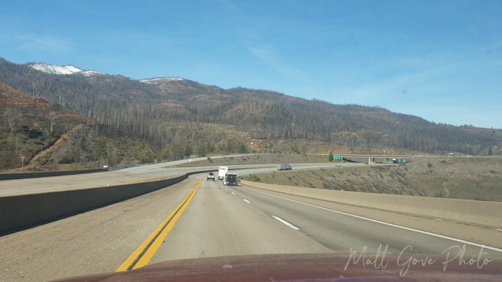
Combined with the Wildfire Devastation, the California Drought at Lake Shasta Really Left Its Mark on Me. It Should Leave its Mark on You, Too.
The second I drove into that burn scar north of Redding, it instantly ended that fairy tale from the Central Valley. But interestingly, it didn’t leave as big a mark as you would have thought. For that, it took driving across the bridge at Lake Shasta to see the true effect the drought and the fires have had on California. It hits hard and it hits heavy, but it’s a series of pictures everyone should see.
View of Lake Shasta from Interstate 5 in August, 2017 (left) vs January, 2022 (right). Click on the image to enlarge.
And while the water level in the lake should be what instantly catches your eye, did you notice the mountains behind the lake in the 2022 picture? They were all burned in the recent fires. It’s hard to see in the 2017 photo because the lake was shrouded in smoke, but the forest was lush green back then.
Conclusion
As Anthony Bourdain so famously said, travel changes you and leaves its mark on you. But at the same time, it gives us the opportunity to leave our mark on it. We can use these experiences and lessons to influence our own decisions. The vast majority of wildfires in the United States are the result of human error. We can make better decisions to help prevent states like California from burning, as well as reduce the effect of severe drought. What steps will you take?
To wrap this all up, let’s go full circle and end with another Anthony Bourdain quote: “Travel isn’t always pretty. It isn’t always comfortable. Sometimes it hurts, it even breaks your heart. But that’s okay. The journey changes you; it should change you. It leaves marks on your memory, on your consciousness, on your heart, and on your body. You take something with you. Hopefully, you leave something good behind.” What good will you leave behind? Let us know in the comments.
If you want to stay up-to-date with our latest adventures or want more travel guides, please consider signing up for our email newsletter. We’ll send these travel guides, plus exclusive deals, tutorials, and much more, straight to your inbox, twice per month, all for free.
Top Photo: Low Water Levels Due to Severe Drought
Lake Shasta, California – January, 2022
The post A Powerful, Heartbreaking Exhibit of the Severe Drought in California appeared first on Matthew Gove Blog.
]]>The post 5 Reasons You Need to Travel Your Home Country Before Setting Off Abroad appeared first on Matthew Gove Blog.
]]>Travel in Your Home Country will Establish a Baseline for Comparison Once You Get Abroad
In the scientific method, establishing a baseline using a control group is a critical step in conducting a successful experiment. If you’re unfamiliar with a control group, it’s the group in your experiment where you don’t introduce the independent variable you’re testing. The most well-known recent example of a control group was in the clinical trials of the COVID-19 vaccines. In those trials, participants were either given the vaccine or a placebo. The group that received the placebo was the control group.
Traveling in your home country before setting off abroad establishes the same type of baseline. Without that baseline, you’ll have nothing to compare your adventures abroad to. Your experiences won’t be as authentic or as deep as they would be had you fully experienced your home country first before going abroad.
My adventures throughout the United States have taken me to some pretty amazing places over the years.
Traveling in Your Home Country will Open and Re-Open Your Mind
We’re all creatures of habit. There’s simply no denying that. We all have our routines that we like to follow every day, no matter how monotonous they may seem. Unfortunately it’s easy to become close-minded when all you do is follow the same routine every day. Furthermore, it’s so easy to fall into the trap of only exposing yourself to content and ideas you agree with. It can be difficult for a lot of people, but it’s really beneficial to at least hear what the other side has to say.
Getting out to travel and explore your home country will break that routine, regardless of whether or not you intend to go abroad. I strongly recommend that you travel beyond your home state or region. That will almost force you to open up to other regional cultures throughout your home country. See new sights. Try new foods. Listen to different types of music. The list goes on and on. Some you may agree with, and some you may not.
Opening your mind through travel in your home country is even more important in large diverse countries, such as the United States and Canada. For example, in the United States, which is my home country, you’ll have vastly different experiences in New England vs. the Deep South, the coast vs. the heartland, Alaska vs. Hawaii, and beyond. Is that still not enough to convince you? Getting out of your rut has been proven to boost your mental health, productivity, and efficiency. And domestic travel is one of the best ways to get out of your rut! What are you waiting for?
To fully open my own mind, it has been a long-time goal of mine to visit all 50 U.S. States and all 13 Canadian Provinces and territories. Furthermore, I intend to visit as many Mexican states as I can. Not only will this help me better understand my fellow Americans, it will also open my mind to our neighbors to both the north and south.
You’ll Expand Your Horizons Domestically and Gain a Better Perspective of Your Home Country
Travel allows you to better understand the issues facing fellow citizens in your home country. Even better, you’ll learn about issues that are affecting people across the aisle from you, whether that aisle is political, age, gender, race, or anything else. Because when we can better understand each other, we can better heal the rifts that divide us, as well as strengthen the bonds that unite us. This is especially true for large and diverse countries such as the United States and Canada.
Two Cross-Country Road Trips Across the United States During the COVID-19 Pandemic are Eye-Opening
When the COVID-19 pandemic broke out in early 2020, it cut me off from the rest of my family on the other side of the country. The pandemic, plus the complete shitshow that Arizona turned into following the 2020 election pushed me over the edge, as I was receiving threats related to either the pandemic or the election pretty much any time I went out in public. As a result, I drove across the United States at the height of the winter COVID-19 wave in February, 2021 to re-unite with my family on the east coast.
Just a few of the hazards to deal with on my February, 2021 cross-country road trip
Without access to vaccines or much other protection from the pandemic, traveling in the bubble while trying to avoid all contact with the outside world was not particularly comfortable or pleasant. But I made it across without getting sick, and I’m really damn proud of that. Most importantly, that trip was absolutely eye-opening for how different parts of the country viewed the pandemic. The lessons I learned from that trip were heartbreaking. However, they ultimately gave me a much better appreciation for the issues that have bitterly divided the country, and I am eternally grateful for that.
What a Difference a Year Makes
Now fast-forward a year. Vaccines are widely available. But less than a week before I was set to leave to drive back across the country to sell my house, South Africa announced they discovered the omicron variant. On the second day of my road trip, the U.S. confirmed its first case of omicron in California. I vividly remember listening to Dr. Fauci’s press conference that afternoon as I drove across Iowa.
As omicron spiked to nearly four times the peak of the 2020 winter wave, I can only describe the feeling in the western US as eerily normal. I still don’t know whether that was a good thing or a bad thing. But the big thing I noticed was that each side’s animosity towards the other side over COVID-19 restrictions was far less compared to just nine or ten months earlier. The bitter divisions were still clear as I made my way around the United States, but there was a sense of optimism everywhere that didn’t exist earlier in the pandemic. Even better, I was able to enjoy the first “fun” trip since my 2019 road across Mexico, the United States, and Canada. What a difference a year makes!
Scenes from my Winter 2021-2022 Cross Country Road Trip
Get a Fuller and Deeper Perspective of Your Home Country Once You Travel Abroad
As a result, once you go abroad, you’ll have a much deeper understanding and perspective of your home country. Between 2017 and the onset of the pandemic, I routinely traveled to Puerto Peñasco and Los Algodones, Mexico because I wanted to see how “the other side” viewed the border issues that became a central talking point of the Trump presidency.
Interestingly, what hit the hardest was not what the Mexicans thought about the border issues. Instead, it was how much visiting Mexico changed my perspective of the United States. Specifically, it opened my eyes to just how bitter and divided the U.S. had become. More importantly, I realized that I had become rather narrow-minded and needed to be more open and accepting of other views.
You don’t need to go far to realize this deeper perspective. The majority of my trips to Mexico brought me to Los Algodones, where I could make these comparisons less than a block and a half from the border.
You’ll Have a Deeper Connection to Culture and Customs Abroad
You can’t be a global citizen without understanding you own country. A global citizen is someone who is aware of the world and has a sense of their role in it. They are involved as members of the international community and are committed to building on this community in a meaningful and positive way. Becoming a global citizen will broaden your global perspective and allow you to bring fresh, new views back to your own community. As a global citizen, you’ll gain a deeper connection to culture and customs both at home and abroad.
When you travel in your home country, you’ll expose yourself to new culture and history. On my recent trip through the western United States, I not only traveled, but also experienced the entire length of the Oregon Trail. Being able to see the wagon ruts and walk in the exact same spot as so many westbound emigrants nearly 180 years ago transports you back in time. You realize the immense scale of the challenges and hardships these settlers had to endure on what was often a nine or ten month journey west, in a way that history textbooks simply cannot teach. These direct experiences in culture and history in your home country ultimately lead to a much richer experience abroad.
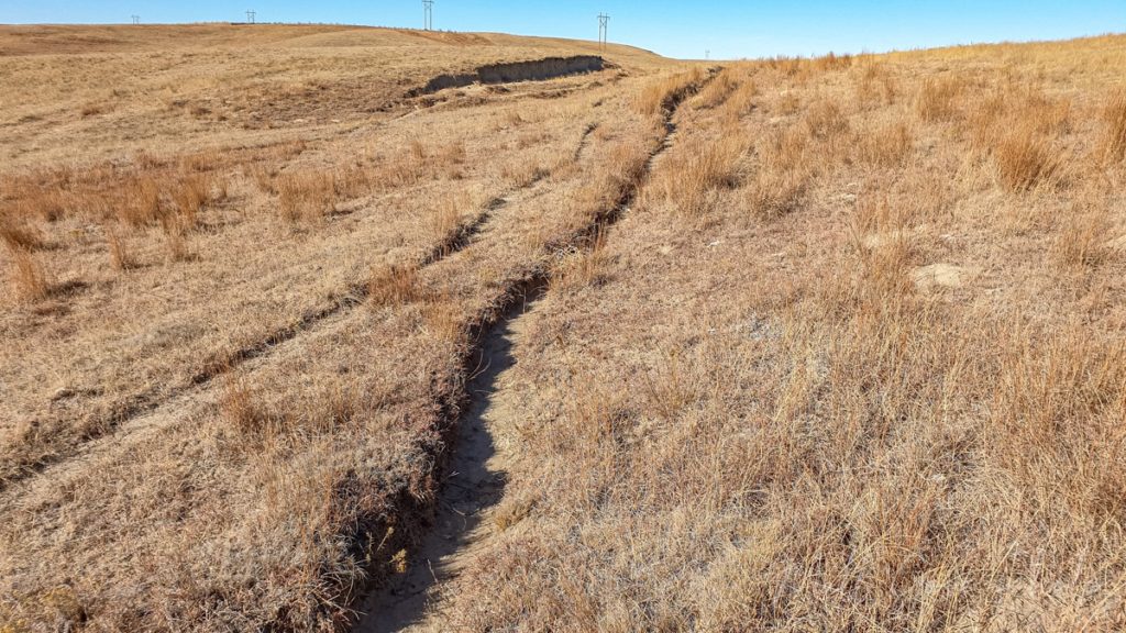
You’ll Learn New Things About Yourself
There’s no better way to learn new things about yourself than to step out of your comfort zone. Get out there and try new things. It will open your mind and you’ll be amazed at how many new things you’ll learn about yourself. Then, once you head abroad, you’ll be able to expand on those lessons and learn even more about yourself.

You’ll Support Local Economies
Here in the United States, greed is pretty much built into the corporate culture. Instead, I prefer to shop local when I travel. You’ll be supporting small businesses and mom and pop shops that can use the revenue a lot more than some mega corporation. Furthermore, your money will stay local and support the local economy instead of lining the pockets of some rich CEO in a big city that’s a long way from where you happen to be. As a small business owner, I encourage you to shop small and shop local. Your local economy will thank you.
Conclusion
Traveling abroad is one of life’s richest experiences. You’ll immerse yourself in new cultures and customs, push yourself beyond your comfort zone, as well as learn an incredible amount about yourself, your home country, as well as the destinations to which you’re traveling.
However, in order to get the fullest experience abroad, you must travel and experience your home country first. Without experiencing your own country first, you won’t have that baseline to compare your adventures abroad. And as a result, you’d miss out on one of the primary reasons we travel in the first place.
Top Photo: Rafting the Colorado River
Grand Canyon National Park, Arizona – June, 2015
The post 5 Reasons You Need to Travel Your Home Country Before Setting Off Abroad appeared first on Matthew Gove Blog.
]]>The post How to Experience History on the Oregon Trail in Nebraska appeared first on Matthew Gove Blog.
]]>While Interstate 80 follows the Oregon Trail’s approximate route across the majority of Nebraska, you’ll need to get off the Interstate to fully immerse yourself in an incredible piece of American history. You’ll literally be walking over the exact same spots the wagon trains followed over 180 years ago. And if that’s not enough, you can still see and wagon ruts at many landmarks across Nebraska, Wyoming, and Idaho. And on this trip, you’ll actually be able to walk right along side them.
Overview
You’ll want to start your day either in Lincoln or Omaha and head west along Interstate 80. Along the way, you’ll stop at forts, hills, springs, and rivers. Your journey will cover nearly 500 miles (800 km) of the Oregon Trail from one end of Nebraska to the other.
As you set off for your journey west, take that first hour once you get west of Lincoln to truly appreciate just how endless, open, and expansive the Nebraska prairie is. Put yourself in the shoes of the settlers and emigrants traveling the Oregon Trail. Imagine what they were thinking seeing that prairie for the first time. What did you think when you saw the endless prairie for the first time?
A Word About Nebraska’s Weather
When you plan your Oregon Trail trip across Nebraska, be aware that Nebraska’s weather can be extreme and volatile at times. Summer temperatures routinely exceed 90 to 95°F (32 to 35°C). In the winter, sub-zero temperatures are common. Average low temperatures across the state drop to 10 to 15°F (-12 to -9°C) at their coldest point. Furthermore, snow and wind can cause blizzards that can paralyze the state.
Finally, don’t forget about the state’s location in Tornado Alley. Tornado season in Nebraska peaks in the late spring, from May to early June. When you come to Nebraska, make sure you plan and dress accordingly for the weather conditions you’ll likely experience.
Buy a Nebraska State Parks Entry Permit
Several of your stops on this Oregon Trail road trip are at Nebraska State Parks. To enter the state parks, you’ll need to buy an entry permit from the state, either online or at the park. You can buy daily or annual passes. Passes will get you into all of the Nebraska State Parks for either the day or the year, so you don’t need to buy a pass at every park you visit. In addition, as of the time this article was published, all National Park facilities along your route route do not charge entry fees.
Prepare for Your Journey at Fort Kearny
Fort Kearny was the first fort settlers on both the Oregon and California Trails reached on their journey west. The U.S. Army established the fort in 1848 to protect emigrants from the threat of Native American attacks. Today, Fort Kearny is one of Nebraska’s State and Historical Parks. You will need to buy an entry permit either online or at the park before going off to explore the fort.
Fort Kearny itself is located just across the river from the town of Kearney on State Route 50A. It’s easily accessible from Exits 279 or 272 on I-80. At the fort, you can partake in several outdoor activities.
- Watch an interpretive video about the history of the fort and its relationship with nature
- Tour reconstructed buildings and see live re-enactments of what life was like at the fort during the heyday of the Oregon Trail
- Hike or bike the nature trail. Fort Kearny is along a major sandhill crane migration route and is a haven for birdwatchers during the migration.
- Visit the nearby Fort Kearny Recreation Area for even more outdoor activities.
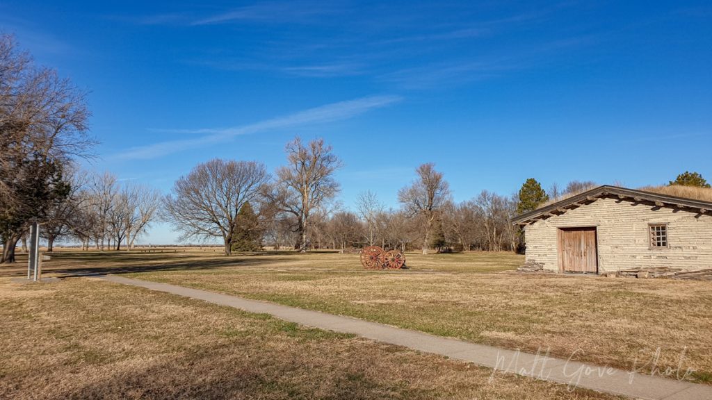
For the most immersive experience, you’ll want to visit during the warmer months when everything is open. On the other hand, if you visit in the winter, having the entire park to yourself can be magical.
Hike California Hill, the First Major Ascent on the Oregon Trail
Ascending 240 feet in about a mile and a half, California Hill presented the first topographical challenge for westbound wagon trains. Near the town of North Platte, Nebraska, the Platte river forks into the North Platte and South Platte rivers. After the fork, the Oregon Trail follows the North Platte River across western Nebraska and into Wyoming.
Because the Oregon Trail started in Missouri, wagon trains went along the south shores of the Platte River east of the fork. But here’s the dilemma. The easiest crossing of the South Platte River meant that you had to go over California Hill. The alternate route passed over relatively flat terrain, but the river crossing was far more perilous. As a result, many wagon trains opted for California Hill as the safer option.
How to Access the Trailhead at the Base of California Hill
Today, California Hill has some of the best-preserved wagon ruts on the entire Oregon Trail. Unfortunately, online directions to the hill itself are inaccurate at best and misleading at worst. From the town of Brule, Nebraska, head west on US-30. About 4.5 miles (7.2 km) west of town, you’ll see a pull off on the side of the road with the historical marker for California Hill. However, if you want to hike up California Hill or simply get the best view of it, you’re still in the wrong place.
At the historical marker, you’ll see a dirt road that heads north from US-30. Follow that dirt road north for about a quarter mile or so, and park in the small cutout on the left side of the road. There are no signs or anything for parking, but it’s the only cutout along the whole stretch of road. There are small placards for both the Oregon and California Trails nailed to the fence. It’s not well noted, but the National Park Service owns the land here, which is open to the public.
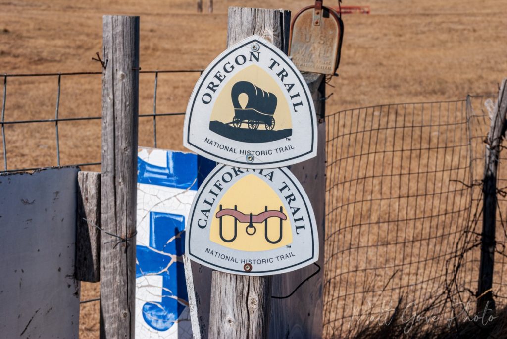
Experience Some of the Most Well-Preserved Wagon Ruts on the Entire Oregon Trail
Walk through the cut in the fence and follow the tire tracks up the hill. The initial tire tracks you see are modern, but you’ll quickly pass by some old cow troughs and under some power lines. As soon as you’re under the power lines, everything you see from that point onward are the wagon ruts from the Oregon Trail. Most of these ruts are between 150 and 180 years old. While you’re welcome to walk to the top of California hill, the best wagon ruts are only about 1,000 feet (300 m) from the parking area.
See More Wagon Ruts Where Emigrants Locked Their Wheels to Descend Windlass Hill
Just 20 miles from California Hill is the first major descent on the Oregon Trail, and the steepest descent in Nebraska. Windlass Hill marked the transition from the high table lands of western Nebraska down into the North Platte River Valley.
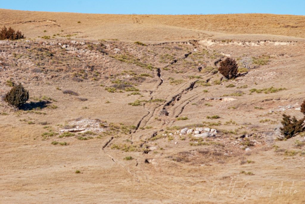
Despite Nebraska’s reputation as being largely flat, Windlass Hill is mind-numbingly steep – about 50% steeper than the steepest hills in San Francisco. Wagons had to descend a 25° angle, or 47% grade, for about 300 feet (100 m). For comparison, the steepest grades on major U.S. highways are usually between 6 and 8%. Because Windlass Hill is so steep, most wagon trains simply locked their wheels and dragged the wagons down the hill.
While it was an effective method to control the wagons on the descent, locking the wheels left deep scars in the landscape, which are still clearly visible today. And unlike California Hill, the wagon ruts on Windlass Hill are clearly visible from the parking lot.
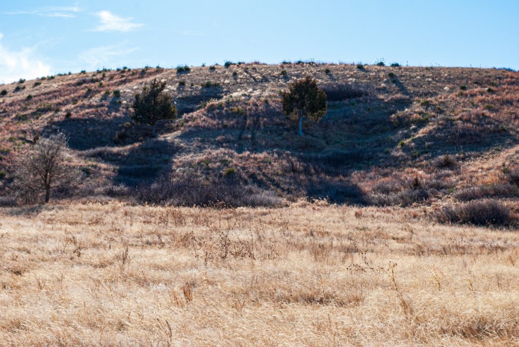
However, to completely immerse yourself in the history, hike the 0.6 mile (1 km) round trip paved trail to the top of the hill. You’ll quickly discover that the wagon ruts on the top of Windlass Hill are not the deepest scar in the landscape. Not even close. It’s the deep gorge at the bottom of the hill as you transition into the valley. You’ll cross a bridge over the gorge about 150 feet or so after you leave the parking lot.
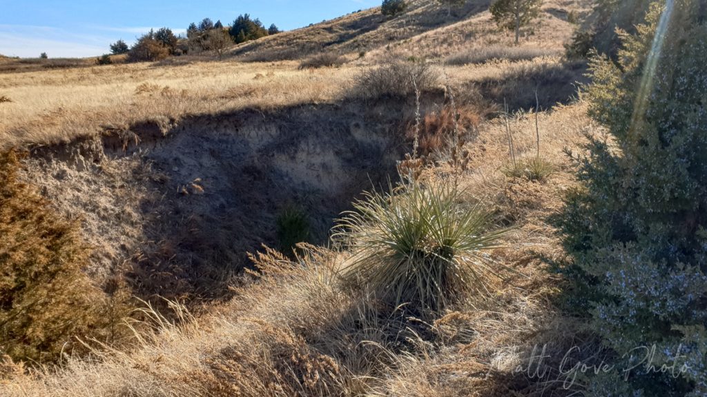
Interestingly, at first glance, the gorge looks like a natural feature, but the exact opposite is true. The gorge is 100% man-made and would not exist had the Oregon Trail not run through there. It is the result of wagon trains with locked wheels passing over the same area for 50 years.
When you return to the parking lot after the hike, have a look across the valley. You’ll see several sets of wagon ruts going up and over the next hill and down into Ash Hollow.
Ash Hollow Spring: An Oasis on a Arid Prairie
Water was a precious resource along the Oregon Trail. While the Platte River is a logical source of water for the Oregon Trail route across Nebraska, heavy traffic often contaminated the water in the river. That’s why Ash Hollow Spring was such an oasis for westbound wagon trains. In fact, Ash Hollow was so precious that Native Americans fought bitterly over the spring for centuries before the white man first arrived in the early 1800’s.
Ash Hollow gave emigrants a source of pure, clean spring water. As a result, Ash Hollow was a popular “rest area” on the Oregon Trail. Settlers often camped at the spring for a few days to rest up and recharge before continuing on their journey west.
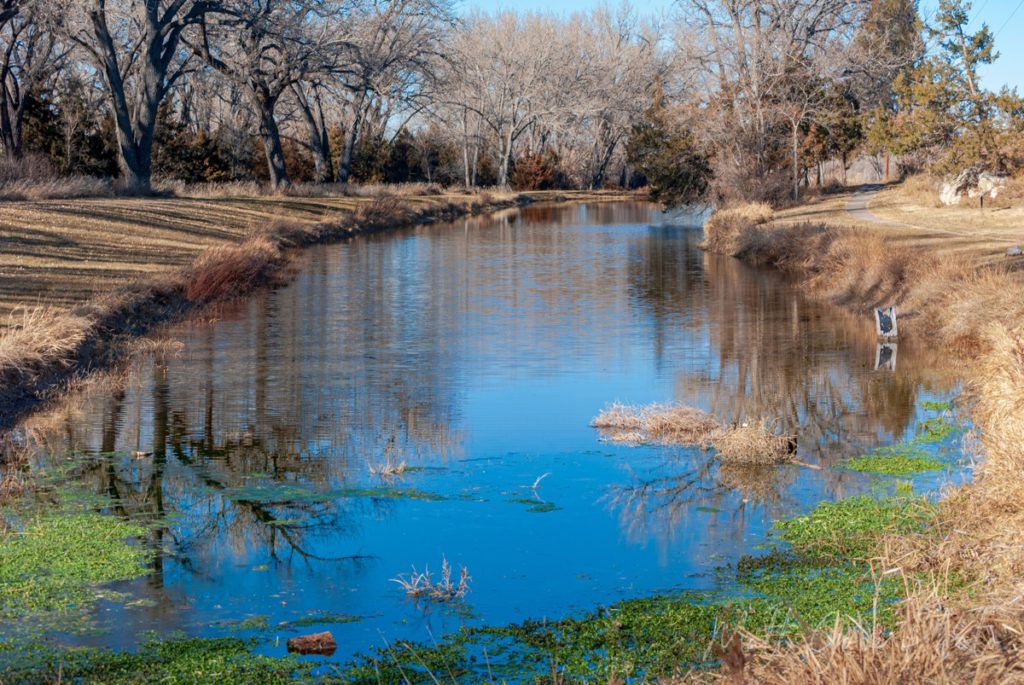
Ash Hollow is located right off of US-26, about 2.5 miles (4 km) northwest of Windlass Hill. Once you’re in the park, take the first left onto an unmarked dirt road. That dirt road will end after short distance at a picnic area. Park at the end of the road and walk across the picnic area to Ash Hollow Spring. Sit on one of the benches and enjoy the peaceful tranquility, or walk along the edge of the spring. And keep your eyes peeled. There’s plenty of wildlife to see in the area.
Finally, don’t forget to enjoy the rest of Ash Hollow State Historical Park. At the very least, drive up to the top of the bluff and take in the breathtaking view of the surrounding prairies and hills. There is a visitor’s center and museum up there, too. However, they were both closed when I was there due to the COVID-19 pandemic.
Take in the Breathtaking Vistas from Courthouse and Jail Rocks
Originally called McFarlane’s Castle, Courthouse and Jail Rocks were the first major rock landmarks for westbound settlers. Marking the point where the major trunks of the Oregon and California Trails merged, the massive presence of Courthouse Rock caused many people who passed it to liken it to a castle or court. Records of using Courthouse and Jail Rocks as a landmark date back as early as the fur traders that charted the original Oregon Trail around 1810.
From a geologic standpoint, Courthouse and Jail Rocks give you a glimpse into the ancient plateau that once towered over what is now western Nebraska. Over thousands of years, wind and water have slowly eroded the plateau. It left behind several stunning monoliths across western Nebraska that became famous landmarks along the Oregon Trail. Can you think of any others? Chimney Rock is one that immediately comes to mind.
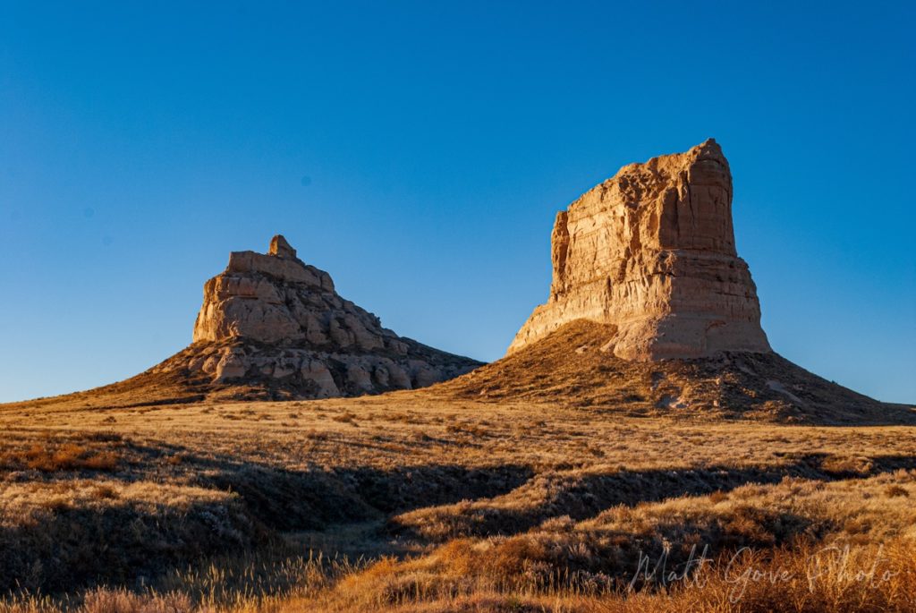
Courthouse and Jail Rocks are located along State Route 88 about 4 miles (7 km) south of Bridgeport, Nebraska. The rocks tower over the surrounding landscape, so they are quite hard to miss. When you get close to the rocks, turn right onto a dirt road called Road 81. It’s not terribly well marked other than a small Oregon Trail placard at the entrance to the road. In good weather, the road is easily passable in a standard passenger car. Park at the end of the road, hike the short loop around Courthouse and Jail Rock, and take in the breathtaking vistas of the surrounding prairies.
Chimney Rock: The Most Famous Oregon Trail Landmark
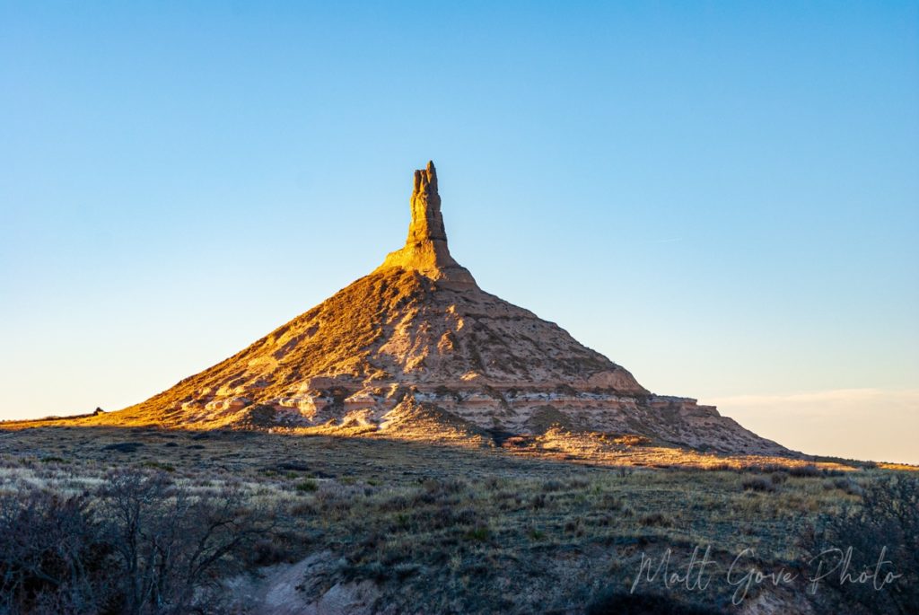
I don’t know about you, but the one landmark I really remember from playing the Oregon Trail game as a kid is Chimney Rock. Like Courthouse and Jail Rocks, Chimney Rock is one of the most famous rock landmarks on the entire Oregon Trail. And it didn’t just provide a very recognizable landmark for the Oregon Trail. Westbound settlers on the California Trail and the Mormon Trail also used Chimney Rock as a critical landmark.
Shortly after leaving Bridgeport on US-26 going west, Chimney Rock should come into view way off in the distance. From this vantage point, you can see why it was such a world famous landmark. Even in a car at 65 mph, you can see it for at least 15 minutes before you get to the turnoff. On a wagon train, it would be visible for at least a day or two. You have to try really hard to miss it.
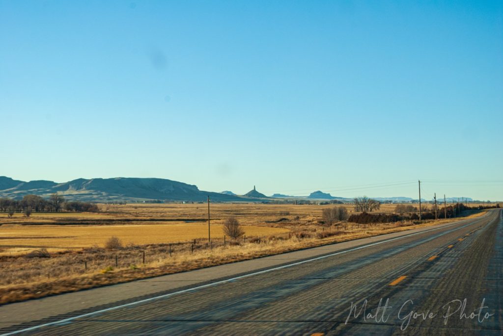
Thankfully, access is both easy and well-signed. Chimney Rock is located just south of the junction of US-26 and SR-92 near Bayard, Nebraska. Regardless of where you’re coming from, just follow the signs for Chimney Rock. It’s really that easy. In addition to the beautiful landscapes, there is a Visitor’s Center, museum, cemetery, and hiking trails at Chimney Rock.
There are a few things to keep in mind for your Chimney Rock photography and videos. The only roads and viewpoints to it look west, so mornings offer the best light for photographing Chimney Rock. The viewpoint at the end of the road and the hiking trails offer the best photo opps.
However, if you’re there in mid-December like I was, you can also take advantage of the low sun angles in the afternoon. From the lookout area, once the sun disappears behind the nearby bluff, it still bathes Chimney Rock in a beautiful low, warm light. You actually get a bit of an extended Golden Hour before sunset that is simply divine.
End Your Oregon Trail Journey Across Nebraska Taking in Sunset at Scottsbluff National Monument
Towering 800 feet over the North Platte River, Scott’s Bluff is a fitting place to end your Oregon Trail road trip across Nebraska. The bluff was another key landmark for settlers along the Oregon, California, and Mormon Trails, as well as the Native Americans. The wagon ruts have unfortunately eroded over time, but you can still walk about half a mile of the actual Oregon Trail within the National Monument.
If you want to drive up the bluff, make sure to arrive at least 30 to 45 minutes prior to sunset, as the road closes shortly before sunset. However, I find that your best photo and video opportunities actually come from down near the Visitor’s Center. Take advantage of the Golden Hour as the setting sun lights up the bluff in brilliant shades of yellows, oranges, and reds.
From Scottsbluff National Monument, it’s a quick drive back into town for accommodations for the night. In Scottsbluff, you’re only about 20 miles (30 km) from the Wyoming border. As a result, you’ll be in perfect position to continue your Oregon Trail journey west into Wyoming the next day.
Conclusion
Taking a road trip along the Oregon Trail route across Nebraska is one of the most interactive ways to immerse yourself in American history. You’ll literally be passing over the same terrain and seeing the same sights that the westbound settlers experienced nearly 200 years ago. While modern amenities have made the journey today far safer and more comfortable, I hope you’ll get an appreciation for the sacrifices and hardships so many emigrants encountered as they chased a better life in the west. Have you driven any of the Oregon Trail across Nebraska? Please feel free to share your experiences in the comments below.
If you want more of these travel guides, please consider signing up for our email newsletter. We’ll send these travel guides, plus exclusive deals, tutorials, and much more, straight to your inbox, twice per month, all for free.
Top Photo: Wagon Ruts are Carved into the Side of California Hill
Brule, Nebraska – December, 2021
The post How to Experience History on the Oregon Trail in Nebraska appeared first on Matthew Gove Blog.
]]>The post Indiana Dunes: One of America’s Most Underrated National Parks appeared first on Matthew Gove Blog.
]]>Update: Beginning 31 March, 2022, Indiana Dunes National Park will charge $25 per vehicle to enter the park.
A Brief History of the Indiana Dunes
In 1899, Henry Chandler Cowles, a botanist at the University of Chicago, began the first movement to preserve what’s now the Indiana Dunes. Cowles’ movement cited the unique flora at the dunes as the reason to preserve the area. The movement rapidly gained momentum. By 1916, the National Parks Service held hearings in Chicago about preserving the area as Sand Dunes National Park.
Unfortunately, local manufacturing plants had discovered that the sand at the Indiana Dunes was ideal for making glass. As a result, the 1916 hearing went nowhere. Glass manufacturing had completely consumed one of the most famous dunes by 1920. Facing backlash from the local residents, the State of Indiana stepped in and designated the area as Indiana Dunes State Park in 1926. You can still see evidence today of the manufacturing that went on at the Indiana Dunes in the early 20th century.
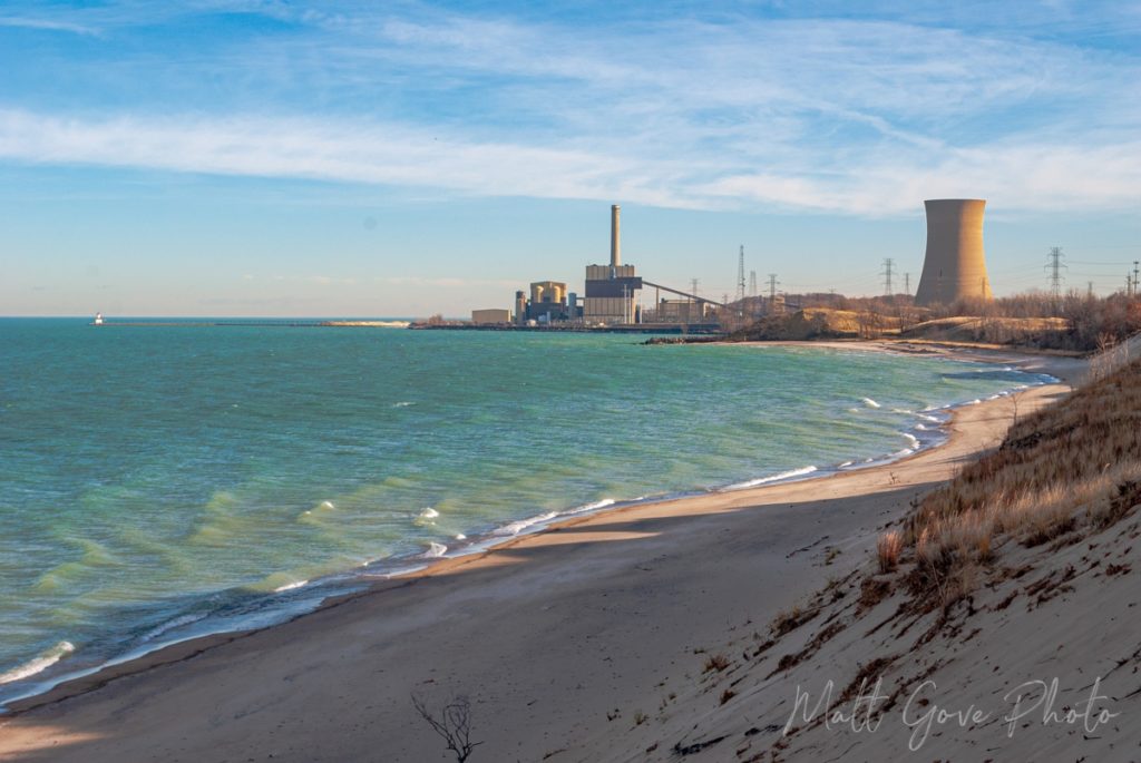
The federal government didn’t show any interest in the Indiana Dunes until the 1950’s. Preservation efforts ramped up again when a Port of Indiana was proposed to maximize economic development in the area. Activists began a nationwide campaign to buy the land and preserve the dunes. Their efforts were successful. In 1966, the U.S. Congress passed a bill to preserve the area as the Indiana Dunes National Lakeshore. Between 1976 and 1992, Congress expanded the national lakeshore four times, bringing it to the size it is today.
In 2017, both senators and representatives from Indiana sponsored a bill to turn the Indiana Dunes National Lakeshore into a National Park. While it took a couple years to finally get a vote on the bill, it passed Congress and became law on 15 Feburary, 2019. Indiana had its first National Park.
Where is Indiana Dunes National Park?
Indiana Dunes National Park covers 15 miles (24 km) of shoreline on Lake Michigan between Gary and Michigan City, Indiana. It’s just a 45 minute drive from both downtown Chicago and South Bend. If you’re coming from further away, the dunes are an easy day’s drive from Detroit, Indianapolis, much of Ohio, and even St. Louis.
The Indiana Dunes Can Migrate Up to 18 Feet Per Year…and Swallow Everything in Their Path
Indiana Dunes National Park has some of the most fascinating geology east of the Mississippi. At times, the dunes can behave like a living, breathing creature. In fact, the U.S. Geological Survey makes quite a statement about them on their website.
Dunes in the park are still actively migrating downwind. They move as layer after layer of sand is blown from the front of the dune over to the slipface. The most active dune, Mount Baldy, can move up to 18 feet in a year, swallowing up entire trees as it advances.
U.S. Geological Survey
When I first read that, I thought, “Come on. I get that dunes are always moving, but entire trees? Really?” When I got to Indiana Dunes National Park, Mt. Baldy happened to be my very first stop. When I pulled into the parking lot, this is what I saw. Insert foot into mouth.
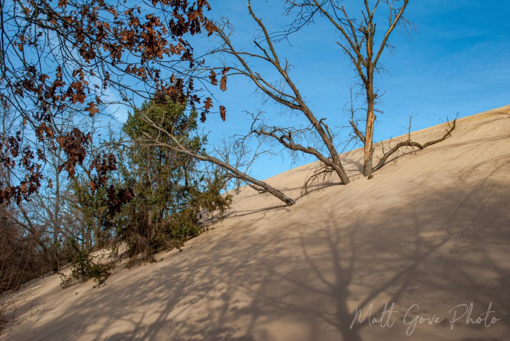
Interestingly, I continued to notice the dunes just swallowing everything as I made my way through the park. Trees, signs, benches, parking lots. You name it, the dunes were swallowing it. The Indiana Dunes actually remind me a lot of White Sands National Park in New Mexico. Both parks have a lot of fine, sugary sand. Dunes are constantly in motion, advancing and retreating as the wind shifts throughout the year. However, unlike White Sands, the sand at Indiana Dunes National Park does not dissolve in water.


Indiana Dunes National Park Offers Outdoor Activities Year Round
While Indiana Dunes is best known for its summer recreation and relaxation, the park offers an abundance of outdoor activities year round. Don’t discount the shoulder or offseason. There is plenty to do, and the lack of crowds in any National Park makes for a completely immersive and memorable experience.
- Hiking
- Biking
- Swimming and Sunbathing
- Boating
- Cross Country Skiing, Snowshoeing, and Sledding
- View the spectacular shelf ice on Lake Michigan in the winter
- See beautiful colors in the fall
- Scenic Drives
- Birdwatching and Animal Watching
- Horseback Riding
- Camping and Picnicking
- Learn About the History of the Area
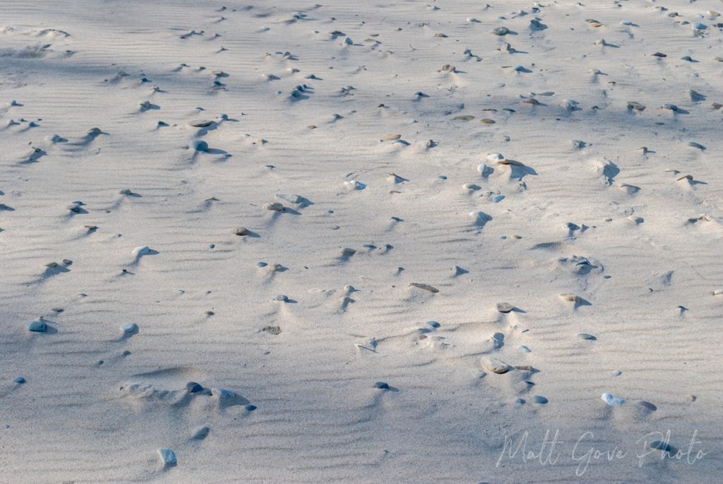
Take in Breathtaking Views of Lake Michigan
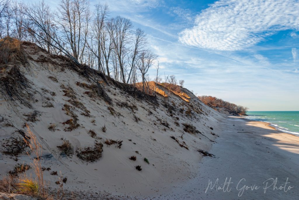
For being in a state that has a reputation of being very flat, the Indiana Dunes offer an incredibly diverse choice of absolutely stunning viewpoints and lookouts over the turquoise waters of Lake Michigan. Hike up to the top of the tallest dunes and paths for stunning panoramic vistas nearly 200 feet above the lake. Alternatively, soak in the sun and scenery from lake level as you walk along the beach or wade in the water. I could go on and on here, but I’ll let the photos speak for themselves.


See Indiana’s Rarest Flora and Fauna
Indiana Dunes is one of the most diverse regions in the United States. The park is home to some of Indiana’s rarest flora, as well as many species of fauna. If you’re looking for a specific species, make sure you know the best season for viewing them before you plan your trip. If you don’t have a specific species in mind, the Indiana Dunes boasts both spectacular fall colors and an incredible variety of wildflowers in the spring. Even when I visited in early December, it’s easy to get caught up and absorbed in nature. There was no shortage of plants and animals to look at in the winter.
Indiana Dunes Photography and Videography Tips
To get the most from your photo or video shoot, you’ll want to spend at least one full day at the park. Take advantage of the Golden Hour at both ends of the day to get some spectacular sunrise and sunset pictures. Let the low light bathe the dunes in vibrant warm colors. During the day, shift your focus to the water. Let the powerful midday sun bring out the best teals, blues, and greens in Lake Michigan. Additionally, go for a hike or a scenic drive to photograph some of the lesser seen parts of the park in the woods, marshes, grasslands, and other surrounding areas.


Furthermore, Indiana Dunes National Park offers so many different stories you can tell through your photos and videos. Whether you’re into nature, history, recreation, or anything else, there’s a story for you to tell. I encourage you to partake in any of the activities we discussed earlier to help you tell your story.
Best Locations to Shoot Photos and Videos
You can take great pictures and videos pretty much anywhere inside Indiana Dunes National Park. But here are my favorite places for a shoot.
- Mt. Baldy
- Central Avenue Beach
- Dunbar Beach
- Porter Beach
- Forest scenery along US-12
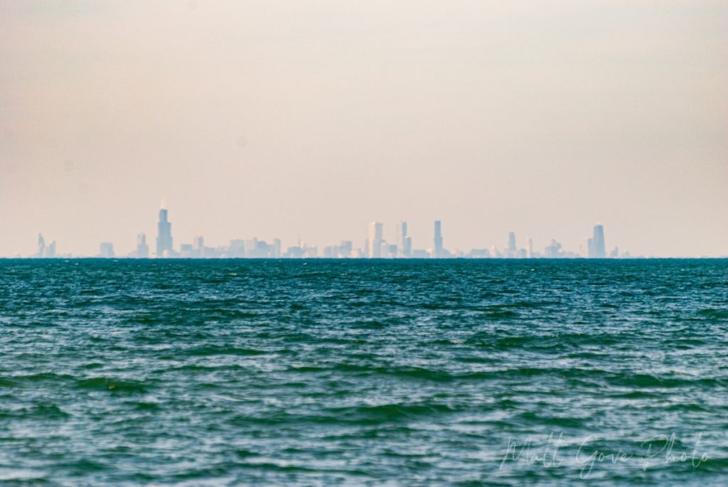
Advantages of Visiting in the Winter Offseason
There is one major reason to visit Indiana Dunes National Park during the winter offseason: the lack of crowds. When I visited in early December, there were certainly a few other people out and about, but I largely had the place to myself. You don’t have to worry about traffic or parking, even in places where parking is typically very limited. And being able to shoot photos and videos on a nearly empty beach is simply magical.
Furthermore, the low sun angle in the wintertime makes for some really beautiful light on the dunes for landscape photography. The sun remains high enough in the winter that you can still get shots of the brilliant turquoise, blue, and green waters in the middle of the day. And with sunset being so early, you’ll be done with your sunset shoot long before dinner.
Conclusion
Indiana Dunes is one of America’s newest, most diverse, and most underrated National Parks. Regardless of your interests, hobbies, and passions, the park offers outdoor activities, places to explore, and stories to tell for everyone year round. Have you been or are you planning to go? What was your favorite part? What are you most looking forward to? Let us know in the comments below.
Top Photo: The turquoise waters of Lake Michigan shimmer under the brilliant sunlight
Indiana Dunes National Park, Indiana – December, 2021
The post Indiana Dunes: One of America’s Most Underrated National Parks appeared first on Matthew Gove Blog.
]]>The post Why You Shouldn’t Panic Over the Omicron Variant of COVID-19 appeared first on Matthew Gove Blog.
]]>- A country announces they have discovered a new variant
- Experts speculate that this is the variant that will evade vaccines
- Everyone freaks out and panics for a few weeks
- Data proves that vaccines still provide adequate protection against the variant
- You see a wave of the variant sweep through many countries
- Life goes on
With the omicron variant of COVID, most countries are currently in the early stages of step 5. However, there are still two big unknowns: how big will the wave be, and how quickly will it surge?
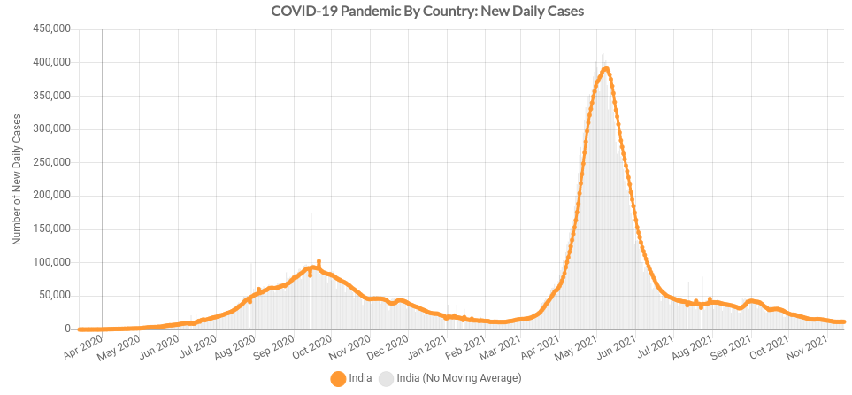
The Omicron Surge Will Resemble the COVID Spike in India From the Delta Variant
Remember how highly contagious the Delta Variant is? As you can probably guess, the Omicron Variant must be significantly more contagious in order to out-compete Delta. And initial data shows that it is. As a result, Omicron will spread much faster, making the spike taller. But there’s a silver lining: it will come and go quickly. Think of it coming through like a tornado instead of a hurricane. Recall the COVID spike in India from the Delta Variant.
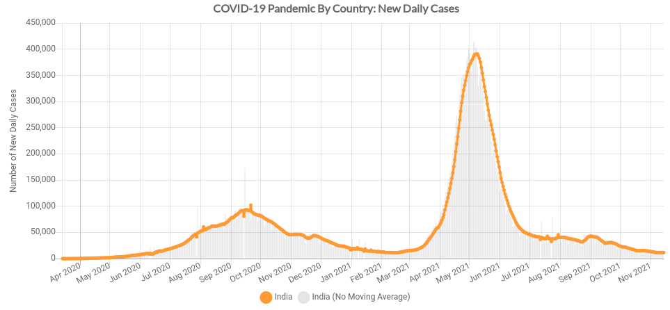
Because Omicron is more contagious than Delta, that spike will be taller, but last shorter. And don’t forget to account for population. With nearly 1.4 billion people, India is the second most populous country in the world. Smaller populations in just about every other country will result in both a shorter and less severe spike. In an Omicron wave, the United States is the only country that has the potential to come anywhere remotely close to the 400,000 daily cases that India saw in their Delta spike. And I think even that is highly unlikely.
COVID Cases from the Omicron Variant Have Already Peaked in Some Countries
Yes, you read that right. The Omicron wave has already peaked in some countries. After South Africa first identified Omicron in late November, health officials quickly contact traced cases back to both Germany and the Netherlands. And guess what? New Omicron cases are now falling in all three countries.
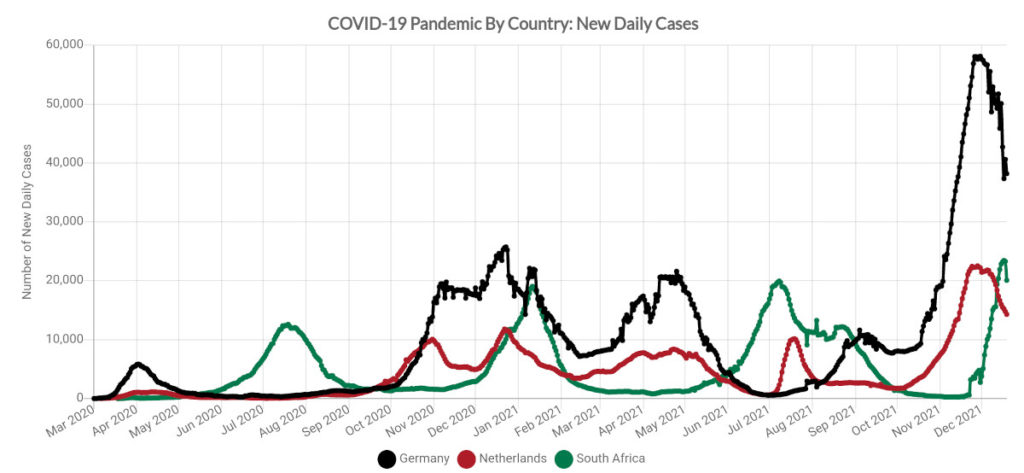
Omicron has obviously spread far beyond those three countries. However, I expect any Omicron surges in other countries will resemble the time series above.
A Word of Caution About South Africa’s Demographics
South Africa has one of the most advanced and sophisticated health science programs in the world. There is nothing wrong with data coming out of South Africa. In fact, I trust their data 100%. The issue lies primarily in South Africa’s age demographics, which heavily skew towards younger people. Just 5.5% of South Africans are over 65. That’s a stark contrast to 17% in the United States, 16% in Canada, and 21% in the European Union. That’s why health officials originally cautioned about reports of omicron in South Africa being primarily mild. Thankfully, data from the European Union seems to confirm that omicron is less severe than Delta.
Additionally, don’t forget that South Africa’s location in the Southern Hemisphere means that they are heading into summer right now. Omicron is so contagious that summer vs winter may not make any significant difference anymore. However, data since the start of the pandemic has repeatedly shown that surges are worse in the winter season, regardless of which hemisphere you live in.
I Believe the Omicron Variant Originated in Europe, Not Africa
Just because South Africa discovered the Omicron variant doesn’t necessarily mean that it originated there. And after looking at the data, I believe that Omicron actually originated in Europe and was then brought to South Africa, not the other way around.
First, let’s recall the new daily COVID cases from Germany, the Netherlands, and South Africa we just looked at in the previous section.

What jumps out at me right away? The slope of the upward side of the omicron spike in late 2021 is identical in all three countries. While it’s not definitive proof, it’s likely that the same variant caused all three surges. And we know for certain that Omicron caused the surge in South Africa. In addition, Notice how the spike starts earlier in both Germany (black) and the Netherlands (red) earlier than it does in South Africa (green). We’ll circle back to this in a sec.
Second, look at how Omicron spread in South Africa. The first clusters emerged in Gauteng Province, which is mostly comprised of the City of Johannesburg. And do you know what’s in Johannesburg? South Africa’s largest international airport. Nearly all international flights in and out of the country go through Johannesburg. As Omicron spread throughout the country, the worst of the outbreak remained in Gauteng. Interestingly, Gauteng was also the first province in South Africa to reach the peak of the Omicron outbreak.
Botswana Contact Traces Omicron Back to Europe…Before Any Evidence of it Appeared in Africa
After popping up in South Africa, Omicron quickly jumped the border into neighboring Botswana. With the help of the South African Health Ministry, the Federal Government of Botswana contact traced omicron cases back to the Netherlands as early as 8 November. And it may have been in Germany earlier than that.

Furthermore, after extensive contact tracing, neither Botswana nor South Africa could find any evidence of the omicron variant in Africa prior to 15 November. If it was in Europe as early as 8 November, but didn’t appear in Africa until the 15th, how could it have originated in Africa? For reference, South Africa announced the discovery of Omicron on 26 November.
Timing of the Omicron Wave Lines Up Perfectly with it Originating in Europe
To prevent confusion, let’s have a look at new daily Covid cases in just Germany. The start of Germany’s Omicron spike lines up perfectly with Botswana’s contact tracing of Omicron back to the Netherlands on 8 November. Germany’s uneven uptick in cases in late October is likely from the Delta Variant.

Repeat the process for the Netherlands and you get the same perfectly-aligned timing.

Interestingly, the data out of both South Africa and Botswana seem to confirm the contact tracing that Omicron was not present in Africa prior to 15 November. Unlike Germany and the Netherlands, South Africa’s Omicron spike did not start until after they announced they had discovered Omicron on 26 November.
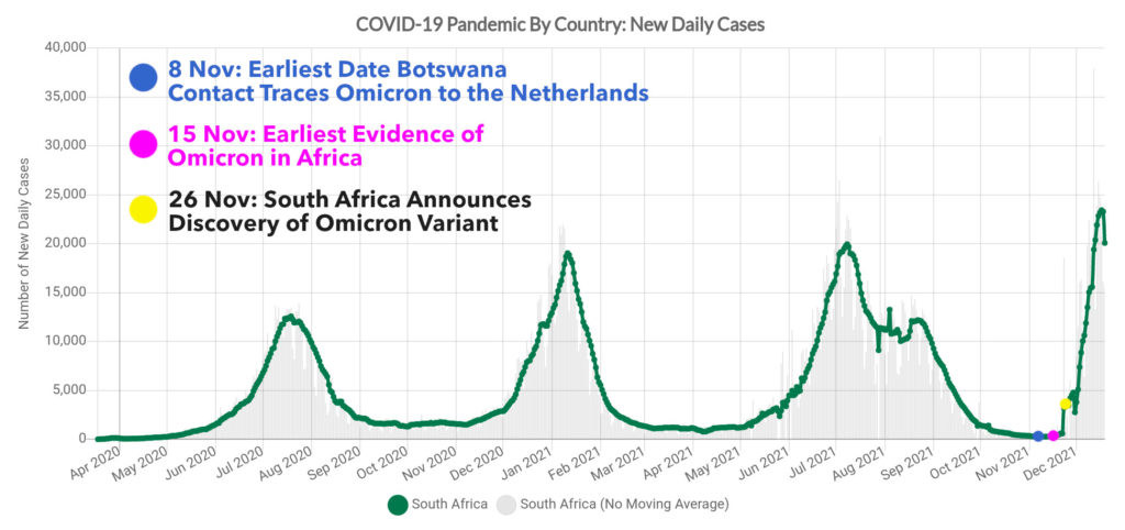
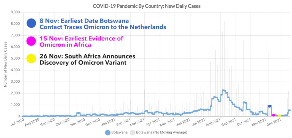
So is this definitive proof that Omicron originated in Europe? Most certainly not. However, it does illustrate how ineffective travel bans are in stopping COVID-19. If my theory is true, banning travel from southern Africa would have done absolutely nothing to stop the Omicron variant if it originated and had already taken hold in Europe.
What Will the Omicron Spike Look Like in the United States, Canada, and Great Britain?
All three countries will see something similar to what India saw with Delta, or what Germany, the Netherlands, and South Africa saw with Omicron. The million dollar question is how big will the spike get, and how long will it last?
To answer those questions, let’s look where each country stands right now. All three countries have started spiking from Omicron. The United States currently has the highest new daily case loads, and as a result, will likely get hit the hardest. The UK is experiencing the biggest spike, while Canada is in the best shape of the three.
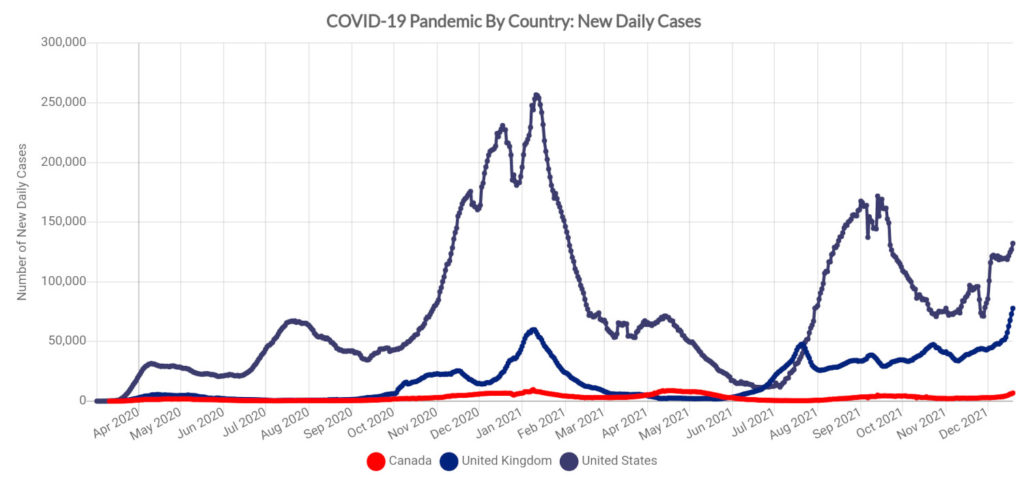
For what to expect, let’s turn to the University of Washington’s Institute of Health Metrics and and Evaluation (IHME) model.
| Parameter | United States | Canada | United Kingdom |
|---|---|---|---|
| Actual New Cases – 20 Dec, 2021 | 132,003 | 6,822 | 77,781 |
| Universal Masks – Max Daily Cases | 196,695 | 10,216 | 63,415 |
| Universal Masks – Peak Date | 16 November, 2021 | 14 Feburary, 2022 | 16 November, 2021 |
| Most Likely – Max Daily Cases | 210,350 | 30,562 | 119,405 |
| Most Likely – Peak Date | 11 January, 2022 | 14 February, 2022 | 6 January, 2022 |
| Worst Case – Max Daily Cases | 771,187 | 195,123 | 280,920 |
| Worst Case – Peak Date | 7 January, 2022 | 6 January, 2022 | 5 January, 2022 |
As expected, I tend to agree with the IHME’s most likely projections. I think both the Universal Masks case as well as the worst-case scenario are both highly unlikely. Holiday gatherings may slightly increase the peak daily cases as well as push the peak date shortly into the future.
We Are Much Better Prepared for Omicron than Any Previous Variant of COVID
Despite all of the doom and gloom predictions, the world is much better prepared for Omicron than any previous variant. First, and foremost, we still have highly effective vaccines. Yes, their effectiveness took a hit, but go back to the Fall of 2020. As companies raced to develop vaccines, most infectious disease experts said that vaccine effectiveness of 50-60% would be a major victory. After a booster shot, both Pfizer and Moderna are reporting 70-75% effectiveness against Omicron.
Furthermore, many more people have immunity after the Delta wave. Through both vaccinations and natural immunity, the pool of susceptible people is much smaller than previous variants had, and that pool keeps shrinking every day. Combined with the highly infectious nature of Omicron, the wave will be over before you know it.
In addition, antiviral treatments are becoming more effective and more widely available. In fact, some of the antivirals are not expected to lose any effectiveness because they don’t target the virus’ spike protein, which is where all of Omicron’s mutations are. And it seems like more treatments are being approved just about every day.
Finally, don’t forget about what I said about Delta. The more infectious it becomes, the harder it will be for other variants to compete with it. As a result, that may end up being a blessing in disguise and help us end the pandemic sooner. The same logic applies to Omicron.
Other Areas of Interest to Watch
Besides all of the countries and regions we have covered so far, there are a few additional areas to watch over the next few months as Omicron spreads around the world.
| Country/Region | Reason |
|---|---|
| Australia | Summer vs Winter Comparison. It’s currently summer in Australia |
| New Zealand | How does Omicron spread through countries that previously used a zero-COVID strategy? |
| Southeast Asia | Highest vaccination rates in the world. If they see a major spike, that’s a major red flag for vaccine efficacy. Watch Malaysia and Singapore, which both boast vaccination rates greater than 95%, in particular. |
| India | Can Delta immunity stop or slow down Omicron? |
| EU Schengen Countries | Does the pattern observed in Germany and the Netherlands repeat in other parts of the European Union? Watch both Spain and Portugal, which have very high vaccination rates. |
| Southern Africa | Omicron behavior and spread in areas with limited access to vaccines |
Conclusion
The Omicron Variant is a harsh reminder that the COVID-19 pandemic is still far from over. However, the panic and hysteria surrounding Omicron is largely unwarranted. Yes, some restrictions will likely be re-introduced, but we will not be going back to the dark lockdown days of March and April, 2020. Back then, there were no vaccines and no treatments.
Today, we have a much bigger toolbox. Go get your booster, and be smart about your holiday gatherings. The Omicron wave will be in and out quickly, regardless of what country you’re in. Then, we can get back to living our lives, and be one step closer to putting this awful pandemic behind us once and for all. Happy New Year, everyone!
Top Image: Matt’s COVID-19 Risk Index for the United States as of 23 December, 2021
The post Why You Shouldn’t Panic Over the Omicron Variant of COVID-19 appeared first on Matthew Gove Blog.
]]>The post The HRRR Weather Model: How To Add Dramatic Skies To Your Landscape Photography appeared first on Matthew Gove Blog.
]]>So what’s my secret? I apply my education and experience in meteorology and storm chasing to make weather a focal point of my landscape photography and travel videos. Being proactive instead of reactive allows me to stay in front of changing weather. As a result, I am already in position ready to shoot whenever my target weather arrives. It doesn’t matter if I’m waiting for a sunset, a blizzard, or a thunderstorm. The strategy is the same. And today, I want to teach you that strategy so you can use weather to improve your landscape photography and travel videos.
A Word About Safety While Filming Weather
Whenever you go out in the field when hazardous weather is expected, safety should always be your number one concern. You can easily get yourself hurt or killed if you bite off more than you can chew. For example, don’t try to shoot lightning in the middle of an open field. If you don’t feel comfortable doing something, then don’t do it. It’s not worth hurting or killing yourself just to get “the shot”.
The High-Resolution Rapid Refresh (HRRR) Model
The U.S. Federal Government’s National Oceanic and Atmospheric Administration (NOAA) developed the HRRR model (pronounced “her”). As a result, its spatial domain is limited to the United States. Because of its extremely fine resolution, it is highly accurate, having never let me down once during my tenure chasing storms. My own intuition ignored the model a few times, and let’s just say those always ended in busts.
The HRRR has several key features.
- Initialized from the Rapid Refresh (RAP) model, which gets its data from the global GFS (American) model.
- 3 km resolution is fine enough to resolve most individual thunderstorms, making it an invaluable tool for storm chasing
- Runs once per hour, on the top of the hour
- Forecasts 48 hours into the future, a significant increase over its 12-hour forecasts when I started storm chasing
While you can easily get HRRR predictions from most modeling sites, I prefer to get it straight from NOAA. When you load the NOAA site, you’ll see an interface that looks like this. To zoom in on a particular geographic area, select a region from the “Domain” dropdown. The timestamps contain the day of the week and the hour of the day, in UTC. Each row is a different model parameter. Click on a cell for the parameter and forecast hour you want to see, or click on the check in the “Loop” column to see a loop of all times.
Basic HRRR Parameters
Before I begin a model analysis, I like to look at the basic weather parameters, both on a national and regional scale. Here are the HRRR parameters that correspond to the basic weather data. We’ll define them shortly once we dive into some examples.
| Weather Feature | HRRR Parameter |
|---|---|
| Temperature | 2m temp |
| Wind Speed and Direction | 10m wind |
| Wind Gust | 10m wind gust potential |
| Dew Point | 2m dew point |
| Relative Humidity | 2m RH |
| Barometric Pressure | surface pressure |
| Total Rainfall | total acc precip |
| Radar Reflectivity | 1 km agl reflectivity |
| Visibility | visibility |
We’ll dive into additional parameters that are specific to certain types of weather phenomena, photography, and videography later in this tutorial, but these are more than enough to get you going.
HRRR Time Zones
All HRRR parameters and runs are initialized and output using Universal Coordinated Time (UTC), or Greenwich Mean Time. UTC always uses the 24-hour clock, so you don’t need to worry about AM or PM. The model often uses Zulu notation to indicate times. For example, if the model date says “14 Dec 2021 – 17Z”, that means that the model was run on 14 December, 2021 at 17:00 UTC. In the model output, “Wed 08” indicates the model’s prediction for Wednesday at 08:00 UTC.
| Time Zone | Standard UTC Offset (Hours) | DST UTC Offset (Hours) |
|---|---|---|
| Eastern | UTC-5 | UTC-4 |
| Central | UTC-6 | UTC-5 |
| Mountain | UTC-7 | UTC-6 |
| Pacific | UTC-8 | UTC-7 |
| Alaska | UTC-9 | UTC-8 |
| Hawaii | UTC-10 | UTC-10 |
| Arizona | UTC-7 | UTC-7 |
Basic Storm Chasing Strategy for Weather Photography
You can ask three different storm chasers for their strategy, and you’ll probably get three very different answers. However, I prefer to keep my strategy as simple as possible. Not only because I’m a big believer in the moniker “Keep It Simple, Stupid”, but also because it makes it much easier to share my knowledge with you. Even though I designed this strategy for storm chasing, you can apply it to every type of landscape photography or travel video.
Step 1: 1 to 2 Days Before the Chase
Look at the Storm Prediction Center‘s (SPC) Day 2 and 3 Severe Weather Outlooks. Next, read the forecasts and discussions from your local National Weather Service Office. Finally, have a look at the weather models, looking for where the parameters best come together. At the very least, look at the GFS (American) and ECMWF (European) models. You may not quite be into the HRRR’s time range yet. However, if you are, please use the HRRR, too.
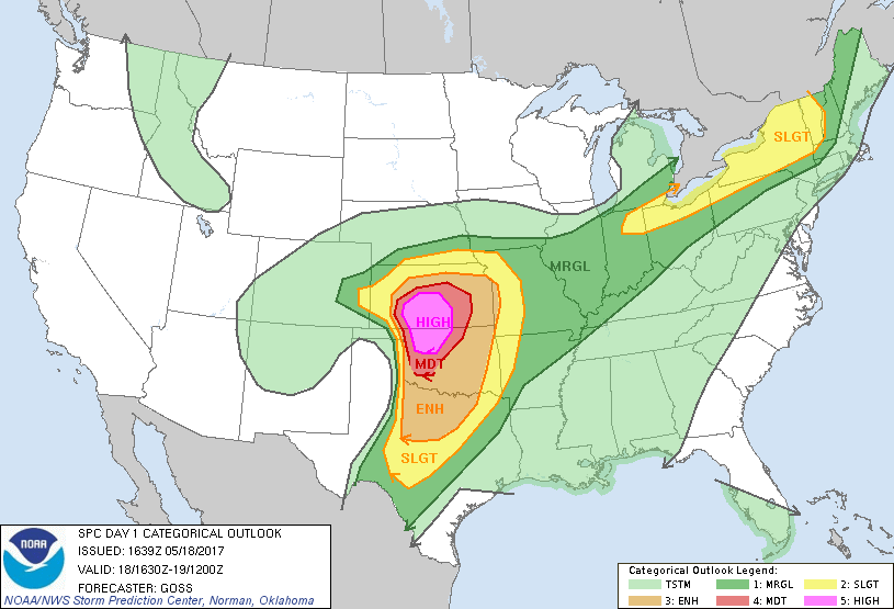
Your goal is to identify broad potential target areas. For example, you could identify Western Oklahoma, Central Kansas, and the Texas Panhandle as potential targets. While the outlook above doesn’t give the whole picture, targeting Northwestern Oklahoma and South-Central Kansas seems like a pretty safe bet. Don’t worry about specific locations within that target area yet. You’ll figure that out once the event gets a little closer and the models get a better idea of what’s going to happen.
Step 2: The Evening Before the Chase
Using the same resources you used in Step 1 to choose your preferred target area. If you can identify a backup target area in case your primary target doesn’t work out, great, but it’s certainly not necessary. At this point, you can start looking at specific areas inside your broader target area. You just want to identify them, since you won’t choose one until tomorrow.
Step 3: The Morning of the Chase
Have a final look at the models, SPC Outlooks, and local forecasts before you hit the road. Confirm or adjust your chosen target area as needed. After that, choose a specific area to start within that broader target area.
Additionally, you should identify a jumping off point before departing for the chase. The jumping off point should be close enough to where storms are expected to fire, but far enough in front of them so you’re not trying to outrun them just to get ahead. I often used small towns, truck stops, and scenic lookouts as jumping off points. Look for places where two major roads intersect. You want to quickly and easily be able to go north, south, east, or west once storms fire.
Step 4: Drive to Your Target Area
Once you’re on the road, you should be checking the HRRR every hour or two. That way, as you drive to your jumping off point, you can easily adjust it as necessary. Try to arrive at least 30 minutes before storms are expected to initiate so you can get your gear set up. If you pick your jumping off point correctly, you’ll be in perfect position when storms do fire.
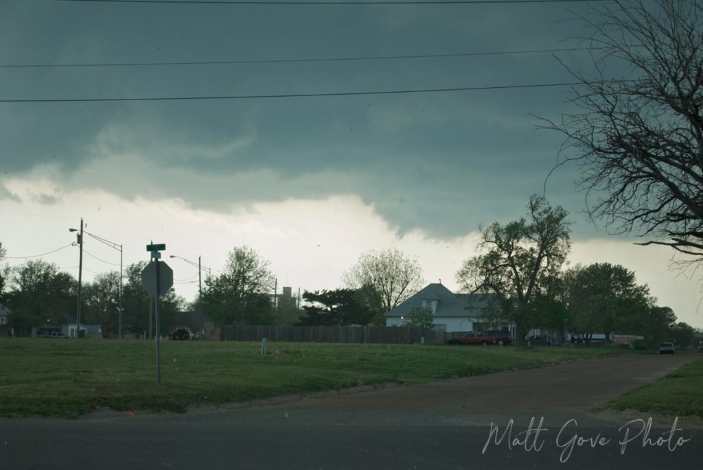
Step 5: Wait for Storms to Fire
Once storms initiate, use doppler radar to identify the specific storm you want to chase. Your target storm should align with your goals for the chase. For example, you could pick very different storms depending on whether you were doing weather or landscape photography versus trying to deploy sensors into the storm. Then, the chase is on.
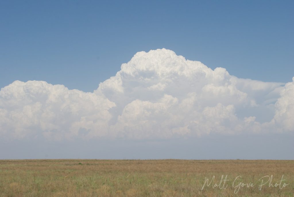
My Greatest Storm Chasing Success: The 19 May, 2012 Harper, Kansas Tornadoes
My greatest storm chasing success came when a hunch, model intuition, and a little luck all came together just perfectly. I could write an entire post telling this story, so I’ll give you the abridged version here.
For several days leading up to 19 May, 2012, it became clear that there was a very good chance for tornadoes near a triple point that was setting up in south-central Nebraska. If you’re unfamiliar with the concept of a triple point, it’s the point where a warm front, cold front, and dryline meet. Model runs the morning of the chase confirmed that Nebraska was the most likely spot for tornadoes.
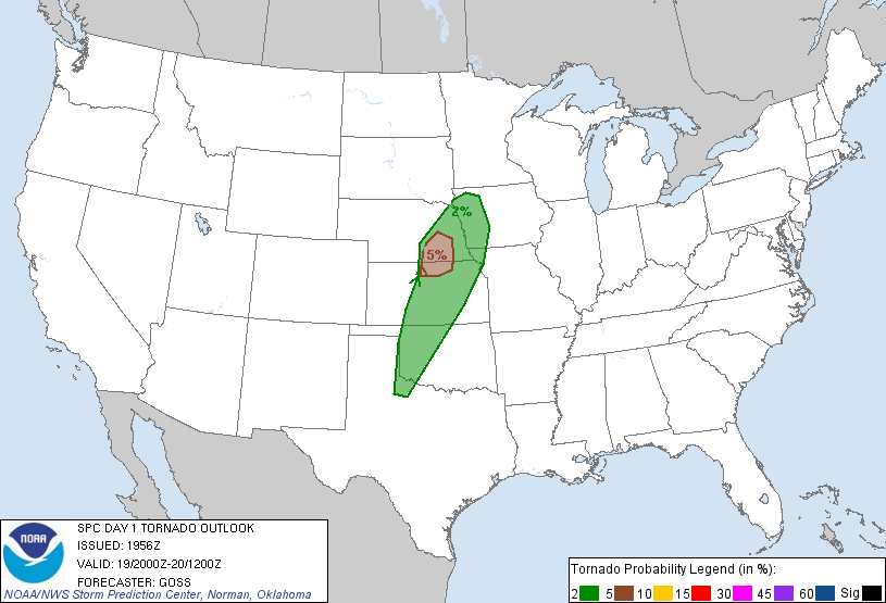
I wasn’t all that keen on driving from Oklahoma all the way to Nebraska, so I instead decided to look for something closer to home. That’s when I turned to the HRRR. It showed a window of very favorable conditions for tornadoes opening along the Kansas-Oklahoma border just before sunset. It was a very brief window – only about 20 minutes or so – but it looked even better than Nebraska. Timing would be critical.
Not wanting to rely on just a single model, I looked at several other models. They all showed the same window for tornadoes opening up along the Kansas-Oklahoma border. I had to give it a shot. Before I knew it, I was on the road, heading north up Interstate 35.
Everything Comes Together Perfectly for Awe-Inspiring Weather and Landscape Photography
I got up to the Kansas-Oklahoma border about 2 hours before sunset. My first stop was right off I-35 in Blackwell, Oklahoma to set up my jumping off point. A quick look at the HRRR showed everything was still in place for tornadoes at sunset just north of the state line. I decided to head west and make Medford, Oklahoma my jumping off point, which gave me easy access to a northbound road (US-81) into Kansas.
Before long, clouds started to bubble up on the dryline out to the west. Satellite and radar confirmed the HRRR’s predictions that the storms were going to be north of the state line, so I decided to move my jumping off point up to Caldwell, Kansas. By the time I got to Caldwell, the storms had fired and were heading towards the town of Harper, Kansas. I continued north and the chase was on. By the time I got to US-160, the weather radio was already blaring with Tornado Warnings. All I had to do was head west.
Just east of Harper, I pulled off onto a side street and had the whole show to myself. There was not another vehicle around, let alone any chaser traffic. That cluster of supercells produced over a dozen tornadoes in about 20 minutes, capped off by a breathtaking EF-3 tornado packing winds over 160 mph. The setting sun behind it was just icing on the cake.
Then, just like that, our very brief window for tornadoes slammed shut. The tornado became rain-wrapped before lifting as the sun set and darkness set in.
The Sweetest Victory Lies in the Photography
As I made my way back to I-35 to head home, lots of storm chasers started passing me going the other direction. After being so void of vehicles the entire chase, I couldn’t believe how many storm chasers were now heading towards Harper. But I knew they were too late. The tornadoes were done. The window was closed.
Interestingly, I didn’t realize the sweetest part of my victory until the next morning when I turned on the local news. Remember that triple point up in Nebraska? It had completely busted. Have a look at the storm reports. The red dots are confirmed tornadoes.
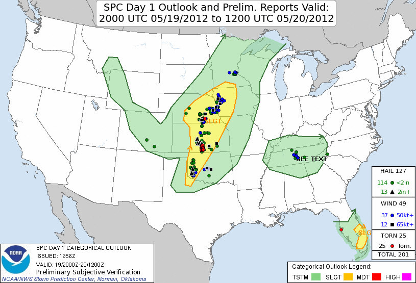
As a result, all of the chaser traffic I encountered on my way home were everyone who had been up in Nebraska racing down trying (unsuccessfully) to catch the storms in Kansas. I was one of only a small handful of people who had gotten footage of tornadoes that day.
Severe Weather in Landscape Photography and Travel Videos
As you can probably guess, the most practical application of our storm chasing strategy is for severe weather photography. Here are some severe weather parameters you should consider for your photo or video shoot. I’ve defined them in layman’s terms to help you understand them. You need to look where all of these come together with the target values. Just one parameter being off can completely shut off all storm activity.
| HRRR Parameter | Definition | Target Value |
|---|---|---|
| Surface CAPE | How much fuel is available for the storm | > 1,500 J/kg |
| Surface CIN | Strength of the Capping Inversion that Prevents Storms from Forming | 0 J/kg |
| 0-6 km Shear | Amount of Rotation in the Low Levels of the Atmosphere | > 30 kt |
| 2m Dew Point | Amount of Moisture in the Atmosphere | > 65°F |
| LI | Amount of Lift in the Atmosphere | Less Than 0 |
Sunrises and Sunsets in Landscape Photography and Travel Videos
The Golden Hour is one of the most sought after period for landscape photographers and travel videographers. The low, warm light seems to make the landscape glow and the shadows dance. It’s a truly magical time of day. In fact, weather is what transforms you sunset landscape photography from okay to jaw dropping. Fortunately, the HRRR makes it pretty easy to identify the best location to film a sunrise or sunset.
Before we dive into the HRRR parameters, let’s recall what makes a good sunset. Brilliant sunset colors come from light refraction through clouds, dust, and other particles, so we need to examine cloud cover and thickness closely. Too many or too few clouds will result in a lousy sunset.
Unfortunately, the HRRR does not output cloud thickness as a parameter. However, it does output all of the parameters we need to calculate it. To get cloud thickness, simply use one of the following equations. The terms of each equation are defined below.
cloud thickness = cloud top height - ceiling
cloud thickness = cloud top height - LCL
Do note that if you’re using the second equation, cloud top heights are output in feet, while the LCL is output in meters! For best sunset colors, you want 25 to 45% coverage of thin, mid-to-high-level cirrus or cumulus clouds.
A Word About the Cloud Ceiling
The cloud ceiling is primarily used in aviation to indicate the height of the bottom of obstructing clouds. That means that if there is a cloud ceiling present, clouds will likely be thick enough to obscure the sunset, regardless of whether you find them in the low, mid, or high levels.
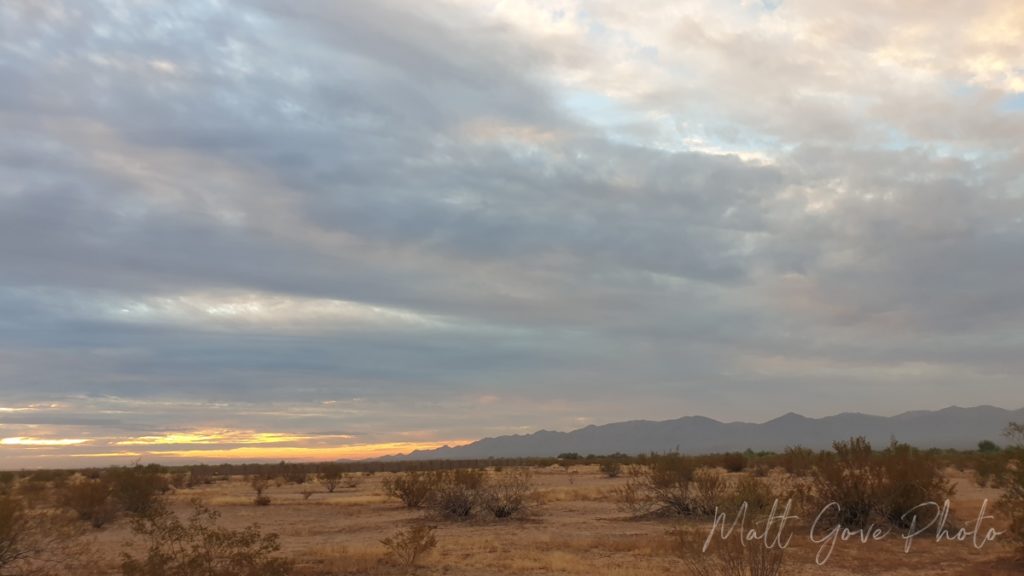
Additionally, don’t forget that rain showers can also make for spectacular sunsets. However, you should only try to integrate rain showers into your landscape photography in the summer. Small, pop-up summer showers can refract the light in spectacular ways. Winter showers are most often too thick and widespread to refract any light, which will ruin your sunset. Use the 1 km agl reflectivity parameter to evaluate rain shower potential.
| HRRR Parameter | Definition | Target Value |
|---|---|---|
| Total Cloud Cover | Percentage of Sky Covered in Clouds | 25 to 45% |
| Low-Level Cloud Cover | Percentage of Sky Covered in Low-Level Clouds | 0% |
| Mid-Level Cloud Cover | Percentage of Sky Covered in Mid-Level Clouds | 0 to 30% |
| High-Level Cloud Cover | Percentage of Sky Covered in High-Level Clouds | 25 to 50% |
| Cloud Top Height | Height of Top of Clouds Above Ground | Same as Ceiling or LCL |
| Ceiling | Height of Bottom of Obstructing Clouds Above Ground | 0% or N/A |
| LCL | Lowest Height Above Ground Water will Condense into Clouds | Min 2,000 to 3,000 m |
| 700 mb vvel | Vertical Velocity at ~10,000 feet altitude Upward (positive) velocity means increasing clouds, and downward (negative) velocity means decreasing clouds | At or near zero |
Finally, know what compass bearing the sun sets or rises at. That bearing varies by both location and by time of year.
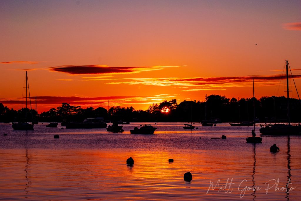
Winter Weather in Landscape Photography and Travel Videos
I break winter weather photography into two categories: inside the storm and post-storm. Both have their pros and cons. On one hand, you can capture the drama and intensity of blowing snow and bitter cold temperatures from inside the storm. On the other hand, a post-winter storm period can often be a spectacular 24-hour long Golden Hour to add breathtaking weather scenes to your landscape photography or travel videos. A fresh blanket of snow on a dramatic landscape makes for absolutely stunning photos and videos. For a textbook example, just have a look the Grand Canyon under a fresh blanket of snow.
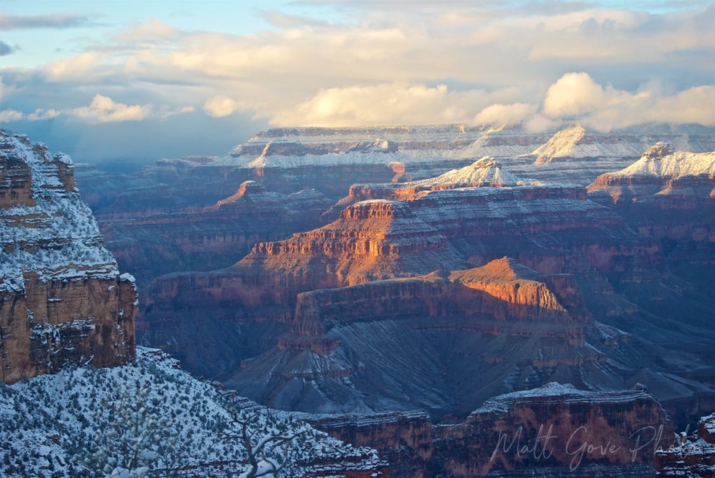
Thankfully, both types of winter weather photography use the exact same strategy and parameters with the HRRR. The only difference is the timing.
| HRRR Parameter | Definition | Target Value |
|---|---|---|
| 2m, 925mb, 850mb, 700mb, 500mb temp | Temperature at various heights in the atmosphere up to ~17,000 feet / 5 km | All below 32°F or 0°C |
| precip type | Type of precipitation expected | Snow |
| total acc snowfall (10-1) | Total accumulated snowfall for the storm (use for post-storm photography) | > 2 inches |
| 1h snowfall (10-1) | Amount of snow expected to fall in the hour prior to the forecast interval (use for in-storm photography) | > 0 inches |
For in-storm filming, you may want to also consider both wind speed and visibility. Alternatively, if you’re heading out after the storm, you’ll generally want at least 5 miles (8 km) of visibility, with at least a little sunlight poking through the clouds.
Finally, a word of caution. Be very careful around winter weather. Roads can close and travel can become impossible with little to no warning. If you don’t feel comfortable doing something, don’t do it. Trust me, you do not want to be stranded in your car in the middle of a major winter storm. If you have four wheel drive and/or tire chains, use them.
Lightning in Landscape Photography and Travel Videos
Lightning photography is one of the most challenging types of weather photography, but also one of the most rewarding. If just 5% of your lightning photos come out, you’re doing extraordinarily well. Thankfully, lightning happens everywhere, so you shouldn’t have to travel great distances to film it. In fact, you don’t need severe weather to get good lightning.
Before setting off to photography lightning, you must ensure your own safety. Lightning is one of the top weather killers not just in the United States, but around the world. Always shoot lightning from inside a building or car, or at the vary least, a grounded overhang. Do not under any circumstance stand under trees to try to film lightning. Trees often explode when struck by lightning, which will shower you in splinters, jagged wood, and molten sap.
Lightning Strategy
The strategy for lightning photography is staggeringly simple: set up in a dark spot at night, open the shutter, and let the picture take itself. If you’re shooting video, you can film lightning in the daytime, but even then, I still find your best shots come at night. Set up a ways from the storm to shoot lightning. That way, you’ll stay out of the rain. You’ll need a bit of luck, but when you do succeed, the results are, quite literally, electric.
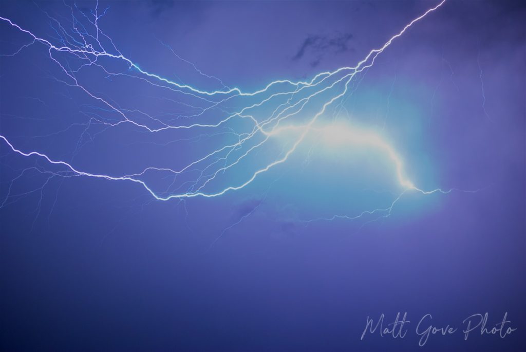
While it’s impossible to predict exactly when and where lightning will strike, the HRRR will give you enough information to have a really good shot at it. Try to set up in a location where you don’t put yourself directly in the storm’s path.
| HRRR Parameter | Definition | Target Value |
|---|---|---|
| 10m wind | Wind speed 10 meters above the ground | < 10 knots |
| 10m wind gust potential | Potential wind gusts 10 meters above the ground | As close to the 10m wind speed as possible |
| lightning threat 3 | Expected number of lightning strikes per square kilometer per 5-minute time frame | At least 5 |
| surface CIN | Strength of inhibition that prevents thunderstorms from forming | 0 J/kg |
| surface CAPE | Amount of fuel or energy available for the storms to tap into | At least 500 J/kg |
| 1 km agl reflectivity | Expected radar image | No rain between you and your target storm |
Rainbows in Landscape Photography and Travel Videos
Most rainbow photos occur when you happen to look up and see a rainbow. But believe it or not, rainbow chasing is actually a thing. And unlike tornadoes, lightning, and blizzards, rainbows are one phenomenon you don’t have to worry about killing you while you’re out doing weather or landscape photography.
In order to see a rainbow, you need to put yourself between the sun and the rain, with the sun behind you and the rain in front of you. In order to see a rainbow in the afternoon or evening, you want to be looking east at the rain. On the other hand, you want to look west to see rainbows in the morning.
Additionally, sun angles play a critical role in finding rainbows. Unless you’re standing on top of a mountain or skyscraper, it’s much easier to put yourself between the sun and the rain when sun angles are low. As a result, you are much more likely to encounter rainbows during the Golden Hour period near sunrise and sunset than you are at high noon.
You can easily track cloud cover and precipitation with the HRRR. However, keep in mind that rainbows are far from guaranteed under any circumstance. No model is accurate enough to predict exactly where a rainbow will occur.
| HRRR Parameter | Definition | Target Value |
|---|---|---|
| total cloud cover | Percentage of the sky covered by clouds | Less than 50% |
| low-level cloud cover | Percentage of the sky covered by low-level clouds | Less than 20% |
| 1h precip | Rainfall expected in the 1-hour period of the HRRR forecast | Greater than 0 |
| 1 km agl reflectivity | Expected radar image. Use it to identify locations where you can position yourself between the rain and the sun. | N/A |
Weather in Seascape Photography
Seascapes are a stunningly effective way to integrate weather into your landscape photography and travel videos. Similar to winter weather photography, you have two options when it comes to the seascape side of landscape photography. With a few very unique exceptions, they require being in vastly different locations. If you’re looking to double-dip and get both types in one shoot, you’re likely going to be disappointed.
Cold Weather Seascape Photography
Largely grey and void of color, when taken correctly, viewers can almost feel the cold from a maritime layer that’s often thick and penetrating when they look at the photo or video. Locations such as downeast Maine, northern Europe, the Pacific Northwest, and the Canadian Maritimes come to mind when you think of cold weather seascapes. You’ll need to look at a few HRRR parameters
| HRRR Parameter | Definition | Target Value |
|---|---|---|
| total cloud cover | Percentage of the sky covered by clouds | 90 to 100% |
| low-level cloud cover | Percentage of the sky covered by low-level clouds | 90 to 100% |
| 10m wind | Wind speed 10 meters above the ground | Less than 10 kt |
| total acc precip | Total precipitation that has fallen | 0 inches |
Tropical Seascape Photography
White sand. Warm breezes. Salty air. Lit up with brilliant and vibrant greens, blues, and turquoises, tropical seascapes will whisk you off to paradise. They’re warm, inviting, and relaxing, putting you in that vacation mode whenever you look at them, seemingly an escape from your reality. That’s probably why you have them as your computer desktop and have them hanging throughout your office. You can almost taste the fruity cocktails before you snap back into reality.
Interestingly, tropical seascapes are one of the only types of outdoor photography or videography that are more striking in the middle of the day than during the Golden Hour. Applying color theory explains a lot. Warm low light doesn’t draw out greens and blues. In fact, it does the opposite.
Finally, don’t forget about the optics and the physics of your tropical seascape. Those brilliant colors come from the sunlight refracting in the water. In order to maximize the brilliance of those colors, the sun must be as high in the sky as possible. Thick cloud cover blocks much of the sunlight, significantly limiting the amount of light that can refract in the water. As a result, colors will appear dull, dim, and muted.
| HRRR Parameter | Definition | Target Value |
|---|---|---|
| total cloud cover | Percentage of the sky covered by clouds | Less than 20% |
| low-level cloud cover | Percentage of the sky covered by low-level clouds | 0% |
| LCL | Lowest Height Above Ground Water will Condense into Clouds | Greater than 2,000 m |
| ceiling | Height of Bottom of Obstructing Clouds Above Ground | N/A or Non-Existent |
| 700mb vvel | Vertical Velocity at ~10,000 feet altitude Upward (positive) velocity means increasing clouds, and downward (negative) velocity means decreasing clouds | At or near 0 |
| 10m wind | Wind speed 10 meters above the ground | Less than 10 kt |
Temperatures for Seascape Photography
You may have noticed that temperature is missing from the HRRR parameters for seascape photography and videos. Why is that? It’s because you don’t actually need cold temperatures for grey seascapes or warm temperatures for tropical beach photos. Don’t believe me? Have a look at these pictures I took at Lake Tahoe during the month of February. Temperatures that day topped out at 41°F (5°C), with plenty of fresh snow in the mountains.
Mist or Fog in Forest Landscape Photography and Travel Videos
I love forests shrouded in mist. They instill a sense of mystery and adventure, often whisking you away to another world. There’s a reason they are the setting of so many adventure movies. And I just love the striking contrast of the sun shining through the mist like a spotlight.
Best of all, you can find misty forests year round. One of my favorite locations to capture misty scenes is at Great Smoky Mountains National Park, which sits on the border between North Carolina and Tennessee. The sequoia and redwood forests in California are another top destination for misty forest photography and videography. Make sure you pick a destination that still has plenty of green in the forest. Early mornings in the spring and fall work best for mist, but you can get some stunning winter pictures in a forest of evergreens.
Before we dive into HRRR parameters, let’s have a look at what conditions make for the best mist photography. First and foremost, you need to have 100% relative humidity. Mist will not condense out of the air if the humidity is below 100%. Second, there should not be any wind. Wind causes mist and fog to mix out and burn off.
Go Up in Elevation to Lengthen Your Window for Mist
Once you start photographing fog and mist, you’ll be amazed at how quickly it comes and goes. This is especially true early in the day, as heat from the morning sun drops the relative humidity, rapidly burning off any mist or fog. However, there is one more secret weapon in our back pocket to maximize the length of your window for shooting mist: the much overlooked z-axis, or, to put in layman’s terms, controlling your elevation.
As you go up in elevation, the temperature cools. Because cooler air can’t hold as much moisture as warmer air, more moisture will condense out at higher elevations. As a result, fog and mist will hang around longer because it requires more energy to burn them off. But, like everything, it comes with a catch. If too much water condenses out, the mist and fog will be too thick to let the sunlight shine through. Those photos and videos can still be stunning, but you won’t get those really striking pictures of the sun shining through the mist. If you ever find yourself in this situation, go back down to lower elevations to thin out the fog and mist.
| HRRR Parameter | Definition | Target Value |
|---|---|---|
| 2m temp | Temperature 2 meters above the ground | Can be anything, but works best below 50°F/10°C |
| 10m wind | Wind speed 10 meters above the ground | 0 kt |
| 80m wind | Wind speed 80 meters above the ground | Less than 5 kt |
| 2m dew point | Dew point 2 meters above the ground | Equal to 2m temp |
| 2m RH | Relative humidity 2 meters above the ground | 100% |
| total cloud cover | Percentage of sky covered by clouds | Less than 50% |
| low-level cloud cover | Percentage of sky covered by low-level clouds | 0% |
Live in the Desert? You’re Not Completely Out of Luck
And if you live in an arid climate, don’t worry, you can still get in on the action. Sunlight filtering through dust, pollution, or wildfire smoke can give you the same effect. Even in a desert climate like Arizona, you can still get spectacular mist scenery in the winter, when cooler temperatures are much more conducive to condensing out what little water there is in the atmosphere. Dawn after an overnight rain will present you with your best photo and video opportunities for mist and fog.
Get Started Boosting Your Efficiency Adding Weather to Your Landscape Photography and Travel Videos
NOAA’s High Resolution Rapid Refresh model is an incredibly powerful tool whose applications stretch far beyond storm chasing. When used with storm chasing strategy, you can take the guess work out of adding weather to your landscape photography and travel videos. Give yourself more control over your photo and video shoots and work much more efficiently. And at the end of the day, you’ll ultimately be able to boost your revenues. What are you waiting for?
Want more photography and video tips and tutorials? Sign up for our email list today and you’ll also get exclusive personalized deals to our store, early access to all of our travel guides and tutorials, and much more. We’ll deliver them directly to your inbox, twice a month, all for free.
Top Photo: A large dust storm swallows up a mountain range as it crosses from Mexico into the United States
Why, Arizona – July, 2018
The post The HRRR Weather Model: How To Add Dramatic Skies To Your Landscape Photography appeared first on Matthew Gove Blog.
]]>The post Is the United States Nearing the End of the COVID-19 Pandemic? Model Predictions May Surprise You. appeared first on Matthew Gove Blog.
]]>I also believe that the Delta Variant is so dominant that it will ultimately help us end the COVID-19 pandemic sooner. How is that, you ask? It’s actually quite simple
- It blocks other potentially vaccine-resistant variants from taking hold. The Mu Variant that everyone thought was vaccine-resistant has been eradicated. No other variants have been able to establish themselves since Delta became dominant.
- It spreads so fast that most places will reach herd immunity faster.
- Treatments continue to improve, which will help drive down the death rate
Furthermore, the models have spoken loud and clear about the outlook for this winter and the end game for the COVID-19 pandemic. And they’re largely in agreement, too. Barring some freak mutant variant emerging, the COVID-19 pandemic will finally start winding down in 2022.
End Game in the United States: COVID-19 Has Started Shifting from Pandemic to Endemic
As soon as COVID-19 began to spread around the world, it became clear the the only end game is for the virus to become endemic. In its final endemic phase, the virus continues to circulate through the population, but at a much slower rate than during the pandemic phase. As treatments become more effective and widely available, the virus becomes much less dangerous. Many infectious disease experts predict that once COVID-19 reaches its final endemic stage, it will be a similar threat to the flu or the common cold.
Current Status of the COVID-19 Pandemic in the United States
First, let’s look back at what the COVID-19 map looked like back in the summer. Highly vaccinated areas had largely suppressed COVID-19 spread. On the other hand, the Delta variant had set the southeast on fire, where you could find the lowest vaccination rates in the country.
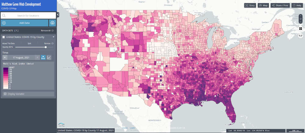
By September, the epicenter had spread north and west, hitting the Inner Mountain West and the Ohio Valley particularly hard. Both areas still have large pockets of unvaccinated residents.
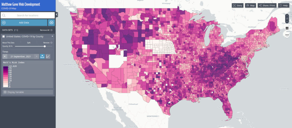
Today, the summer wave has largely subsided. The last dregs of it are rolling through the upper midwest and the northeast, as well as parts of the southwest. All in all, the country is in much better shape than it was back in September. Additionally, notice how the current map looks almost like the inverse of the August map. If reinfections are not occurring in the hard-hit southeast, that’s a major step forward to reaching herd immunity.
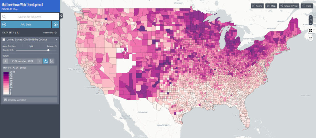
Despite the threat of another wave, I do not see any scenario where the United States implements more COVID-19 restrictions. Pandemic fatigue is real, and it’s unlikely further restrictions will be effective. So what exactly lies ahead? Let’s dive into the models.
University of Washington IHME Model
The University of Washington’s Institute for Health Metrics and Evaluation Model remains the gold standard go-to model in the United States. Everyone from the White House to the media to everyday citizens like you and me use it to plan their lives amidst the COVID-19 pandemic.
Before we dive into the cases and deaths, let’s first look at mobility and vaccination projections. Both parameters will help us understand the big picture. Lots of people will be traveling for the holidays this year, even though large pockets of the population remain unvaccinated. First, let’s look at the vaccination projections.

One thing really jumps out at me here. The model projects that vaccine coverage will basically plateau starting in January 22, with 63% of the population fully vaccinated. With a population of 330 million, that means that 125 million people in the United States will remain unvaccinated. Thankfully, that should be high enough to keep hospitals from being completely overwhelmed.
As for mobility, the IHME agrees with my prediction that the United States will not implement any further restrictions. Mobility should approach its pre-pandemic levels in early 2022.
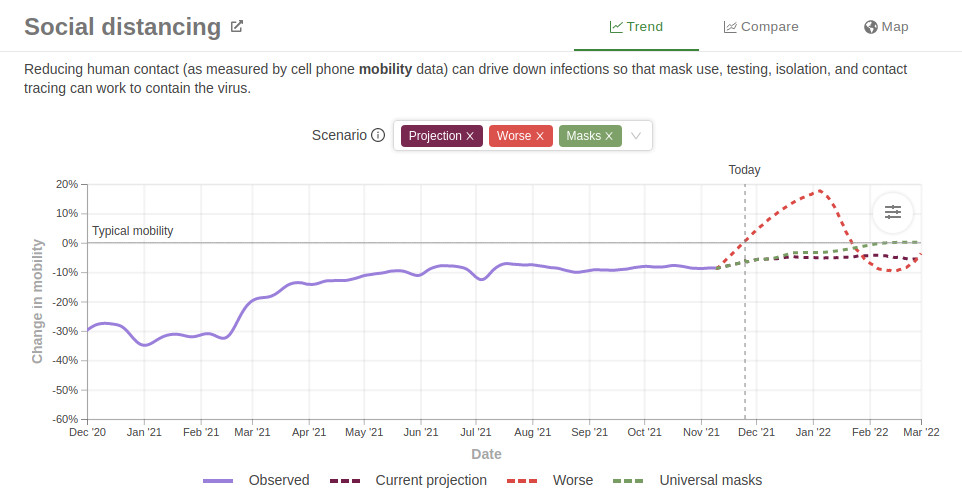
Do Case Loads Lead to the End of the COVID-19 Pandemic?
Before we look towards the end of the COVID-19 pandemic in the United States, there is still one final hurdle to clear: the holidays. Remember that in 2020, holiday travel and gatherings sent COVID-19 cases spiking to nearly 300,000 per day in the U.S. Things are much different this year, but the threat of another wave is still very real.
A fifth wave in the United States would take on one of two forms. You could have a tsunami of cases like we did last winter or when the Delta Variant hit this summer. However, this scenario is quite unlikely due to the vaccines and the high number of infections in the United States. Instead, my gut feeling is that you’ll see much more of a minor uptick, similar to Scenario 2 in the plot below.
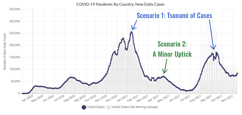
The IHME model agrees. Its official projection calls for a minor uptick of COVID-19 cases over the holidays. Only in the worst case scenario do you see anything like what the U.S. experienced this summer.

COVID-19 Simulator Model
The COVID-19 Simulator is run by Massachusetts General Hospital, Harvard Medical School, Georgia Tech, and the Boston Medical Center. We’ve used it in many of our past analyses and forecasts. It has been reliable and accurate throughout the duration of the COVID-19 pandemic.
Because I’m not expecting that the United States will make very many changes to the current COVID-19 protocols, let’s initialize the model to run on the current interventions for the full 16 week projection. To account for waning immunity, let’s also bump the vaccine efficacy down to 75% from its default 90%.
The COVID-19 Simulator falls largely in agreement with the IHME. In a worst-case scenario, new daily case loads would remain below the September, 2021 surge, peaking around 148,000 new cases daily. However, the far more likely scenario is that you’ll see a slight bump in cases as people gather for the holidays. Hopefully, once that’s done, we can have a much clearer view of the COVID-19 pandemic’s end game.

Massachusetts Institute of Technology Model
The MIT Model is based off of the SEIR (Susceptible, Exposed, Infected, Removed) Model. Like our model, it accounts for features specific to the COVID-19 pandemic, such as government intervention, vaccinations, and human behavior. And it’s probably the most optimistic of the three models. It doesn’t expect much, if any, surge due to the holidays. In fact, it predicts that the United States will only gain about 1 million more cases in the eight-week period between now and late January, 2022.

^ Cumulative case projections from the MIT Model ( https://www.covidanalytics.io/projections)
Places Delta Has Hit Hard Appear to Be Reaching Herd Immunity
One very encouraging pattern that has emerged is that places that the Delta Variant has hit very hard to not appear to be getting much by way of reinfections. Indeed, cases loads and risk levels across the southeastern United States are at the lowest levels they’ve been since the beginning of the pandemic.

This pattern is becoming prevalent around the world. India and Indonesia both experienced major spikes of the Delta Variant between April and July. Both countries have brought new case loads to near record lows and have kept them there. You can say the same thing for Japan. Following the Olympics in July, Japan experienced a major Delta Variant Spike. It’s now reporting less than 200 new cases per day. Even Brazil, which has had a moderate burn throughout the pandemic instead of a big spike, has gotten new case loads down to their lowest levels since May, 2020.
While these are only a few examples, this scenario is playing out in countries on all 7 continents.
Watch the Southern Hemisphere for a Preview of the COVID-19 End Game
Throughout the pandemic, Southern Hemisphere winters (June to September) have offered a glimpse into what the Northern Hemisphere should expect for its winters. While they haven’t been a perfect crystal ball, they have at least gotten us in the ball park for what to expect. And even though not all Southern Hemisphere countries have experienced a spike of the Delta Variant, the ones that did have all gotten case loads down to near record lows and kept them there.
Southern Hemisphere countries on the African continent have had particular success at keeping case loads down following a Delta Variant spike. And keep in mind, vaccines are still few and far between in many of those countries. In fact, the Southern Hemisphere as a whole seems to confirm the models’ predictions that the end game for the COVID-19 pandemic will come in 2022. However, for the best previews of what the United States has in store, I would watch Australia and South Africa.
How Close is the United States to Herd Immunity?
It’s hard to say for sure how close the United States is to herd immunity, but we can run some back-of-the-envelope calculations to get a ballpark number. First and foremost, there are likely far more actual infections than the data show. And that’s true in every single country across the board. The data only contains diagnosed cases from tests. With so many cases either asymptomatic or mild, many people did not get tested even though they contracted COVID-19.
Even though the U.S. has about 48 million positive tests, experts believe that the actual number of cases could be as high as 200 million. However, I think that it’s unlikely that high. Instead, let’s use the COVID-19 Simulator’s best estimate of total U.S. cases: 157 million.
US Population = 330 million
Estimated Cases = 157 million
157 million / 330 million = 47% of population has contracted COVID-19
Now, we’ll add in the vaccinations. About 59% of the U.S. population is fully vaccinated. However, we must keep in mind that a portion of the vaccinated population has also contracted COVID-19, either before vaccines were available, or as a breakthrough case. For purposes of this argument, let’s assume that half of the vaccinated population has also contracted COVID-19. When calculating the total population that has immunity, we’ll need to subtract those from the vaccinated pool so they’re not counted twice.
330 million * 0.59 = 195 million fully vaccinated
195 / 2 = 98 million vaccinated, but have not contracted COVID-19

157 million infections + 98 million vaccinated = 255 million immunized
255 million immunized / 330 million population = 77% of population immunized
It’s believed that 90 to 95 percent of the population must be immunized to reach full herd immunity against the Delta Variant. The United States isn’t quite there yet, but it’s getting close. These calculations also point to the COVID-19 end game coming in 2022.
A Tale of Caution: Zero-COVID Strategy Does Not Work Against the Delta Variant
Unfortunately, not every country is succeeding in the war against COVID-19. Europe has once again become the epicenter of the pandemic. Cases are surging in New Zealand. Much of Southeast Asia and Oceania are coming down off of record Delta spikes. What do these countries have in common? They all adapted a zero-COVID strategy at the onset of the pandemic, and the Delta Variant is forcing them to abandon that strategy because of its extraordinarily high transmissibility.
Can Zero-COVID Countries End the Pandemic with Vaccines?
It’s unlikely vaccines alone will end the pandemic. The Delta Variant is so contagious and transmissible that you’d need to vaccinate more than 95% of the population to reach herd immunity through vaccination alone. However, that doesn’t mean vaccines can’t suppress clusters, waves, and hotspots. Just have a look at Europe.
| Country | Percent Fully Vaccinated |
|---|---|
| Portugal | 86.69 |
| Spain | 79.55 |
| Germany | 67.53 |
| Czechia | 57.96 |
This graph tells the whole story.
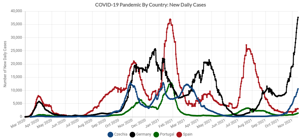
So what does this all mean for Europe? Europe is likely going through the same Delta spike that the United States and so many other countries saw back in July and August. Did you notice on the figure above that neither Germany (black line) nor Czechia (blue line) had a major COVID-19 surge over the summer of 2021, while Spain did?
Rapid Vaccine Rollout Kills One-and-Done Delta Spikes in Southeast Asia
Southeast Asia had done a stunningly good job controlling COVID-19 until the Delta Variant arrived in May, 2021. After abandoning their zero-COVID strategy, many countries saw horrific Delta spikes as the variant ripped through the population. But the pattern has mirrored what the rest of the world has seen. You get one major spike in cases, and once it peaks, you can quickly suppress it through both vaccines and natural immunity.
Three countries in Southeast Asia really stand out for having some of the highest vaccination rates in the world. They are Cambodia, Malaysia, and Singapore. All three countries saw a major Delta spike earlier this year, and rapidly rolled out vaccines to kill the outbreak in its tracks. Even neighboring Thailand is seeing remarkable success despite having a much lower vaccination rate. Unlike the United States, all four countries continue to rapidly vaccinate their populations.
| Country | Percent Fully Vaccinated |
|---|---|
| Singapore | 82.47 |
| Cambodia | 80.06 |
| Malaysia | 77.56 |
| Thailand | 51.32 |
The lesson for the United States here is that it, too, can keep the Delta Variant at bay. Even if it can’t ramp up its vaccination rate, highly-effective new treatments coming on the market should help blunt the death rate, even in the unvaccinated. Herd immunity is in sight, but you can’t rule out another surge this winter. We just need do everything we can to get there as quickly and safely as possible.
Conclusion
It’s been a long two years, but the end game for the COVID-19 pandemic seems to be finally starting to come into focus. As weird as it sounds, the Delta Variant is actually helping us end the pandemic. It has kept other variants at bay, while establishing a clear pattern around the world. You’ll need to endure one major spike from the Delta variant. And once that’s finished, when coupled with a high vaccination rate, herd immunity should be in sight.
The United States has already endured the worst of the Delta spike. Whatever surge we get this winter should be minor in comparison. The combination of highly effective vaccines and treatments is the silver bullet we’ve been waiting 2 years for. Let’s finally put an end to all of this once and for all.
The post Is the United States Nearing the End of the COVID-19 Pandemic? Model Predictions May Surprise You. appeared first on Matthew Gove Blog.
]]>The post Travel Journal: Post-COVID Adventures Kick Off in New York City appeared first on Matthew Gove Blog.
]]>Which is exactly why New York City was the perfect and unusually satisfying destination to kick off our post-COVID travel. Seemingly the antithesis of my standard adventures deep in the remote back country, New York became the piece that fit perfectly into this often warped and twisted post-COVID puzzle. Having grown up in Massachusetts as a die-hard Red Sox fan, going to New York always felt like walking into enemy territory. Only this time it didn’t. People seemed very welcoming, much like what I experienced when I would travel to Mexico prior to the COVID-19 pandemic. Twisted and warped, indeed. At least we still got the quintessential New York experience of sitting in traffic and paying the ridiculous tolls to cross the George Washington Bridge.

Our destination in New York was the Cosmic Nature: Infinity exhibit at the New York Botanical Garden in The Bronx. After nearly two years of living through the pandemic, Infinity turned out to be an impeccable theme for our first post-COVID travel adventure.
Travel in a Post-COVID World
I’ll be honest with you. I had no idea what to expect in my first “real” post-COVID adventure. It’s been no secret how unpleasant so many of my previous encounters with the public throughout the pandemic. From the death threats I got in Arizona to derogatory slurs being hurled at me in Texas to the intimidating stares in just about every other state, I was pretty skeptical heading into New York City. The pandemic had seemed to bring out the absolute worst in everybody.
Despite their reputation, New Yorkers could not have been more friendly, welcoming, and respectful. Lines were orderly. Nobody was making a fuss over COVID-19 restrictions. What an incredible contrast from what I had to deal with in Arizona throughout the pandemic! Did it make any sense to me? No. Was I happy and relieved to see it? Without a doubt.
How has the COVID-19 Pandemic Changed Travel?
It has and it hasn’t. While many people expect a 9/11-style division between pre-COVID and post-COVID travel, I didn’t see it as quite that harsh. At least not right now. Flying out of Logan Airport in Boston less than 6 months after the 9/11 attacks was nothing like pre-9/11 travel. The endless lines, the extremely tight security, and the bomb-sniffing dogs didn’t feel real. Don’t forget that two out of the four hijacked planes in the 9/11 attacks originated in Boston, so we were grateful for the extra security at the time. But over time, we learned to accept that there was no going back to a pre-9/11 world.
While there will definitely be a pre and post-COVID distinction, I found a lot of normalcy visiting the Botanical Gardens in New York. Walking around looking at the exhibit felt eerily like pre-COVID times. You still have to wear a mask going into buildings, and there are signs everywhere to remind you that the pandemic is not yet over. But all the social distancing placards and blocked off areas were all gone. Those are so 2020, I guess.
New York City’s COVID-19 Vaccine Mandate
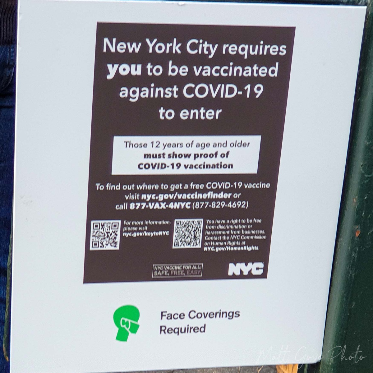 Nearly all of the post-COVID changes to your travel will be entering facilities. New York City requires you to show proof of COVID-19 vaccination to enter just about every public facility. If you’re not vaccinated, you will be denied entry, as negative tests are not accepted. Acceptable proof of vaccination includes:
- The original physical copy of your vaccination card
- An electronic copy or photograph of your vaccination card
- A photocopy of your vaccination record
Because they featured both indoor and outdoor exhibits, the Botanical Gardens were the perfect place to get a glimpse into what post-COVID travel may look like. Staff members verified our vaccine cards at the main entrance, and once we were inside, we did not need to show them again. My aunt and I both got our shots in the US, while my uncle was vaccinated in Canada. We had no issues getting in.
Both staff and security at the entrance to each building reminded us to wear masks inside and closely monitored foot traffic to ensure that the building did not exceed capacity. Other than that, though, it felt oddly normal.
Infinity: The Crossroads of Art and Physics
The Cosmic Nature: Infinity exhibit at the Botanical Garden was easily one of the most fascinating art exhibits I’ve ever seen. Artist Yayoi Kusama presented a captivating crossroads between land and water, art and physics, and indoors and out to showcase her lifelong fascination with the natural world. Unfortunately, we were there on one of the last weekends the exhibit was open. If you ever get a chance to see Kusama’s work elsewhere, I highly recommend it. It’s well worth the journey.
The grounds of the New York Botanical Gardens are beautiful to begin with. However, it doesn’t take long before you see Kusama’s touch. What originally feels like walking onto the grounds of The Masters quickly transports you Japan. The combination of all the flowers in bloom and the near-peak fall colors made it truly magical.
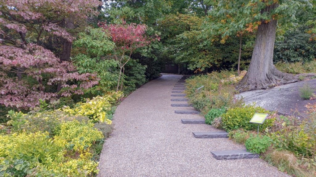
Our first stop was at a large tent where the public could make their own infinity art. Each person was given a flower and had to place it somewhere in the tent that was not on the fan, not on the fire extinguisher, and not in your pocket. When you walk into the tent, it is simply sensory overload for your eyes.

The First Taste of Infinity in Our Post-COVID Travel
Next up was our first taste of infinity at the Infinite Pumpkins room. It takes a second going from the bright, sunny outdoors to a pitch dark room, but I think that was done intentionally. Once your eyes adjust, you find yourself in a small room with a cube that’s roughly 4 feet in all dimensions.
A light underneath the cube slowly turns on, illuminating paper lantern pumpkins covering the bottom of the cube. As the light reaches full brightness, you look into the cube, and like magic, the rows of pumpkins look like they go on forever, into infinity. You start walking around the cube, and find that every side you look into, you’re staring into infinity. Look down, and you’re staring into a bottomless pit full of pumpkins. Since I have a degree in physics, my interest was particularly piqued.
So how does she do it? If you’re familiar with Kusama’s work, you know that reflection is a common theme in her art. The sides of the Infinity Pumpkins cube were all two-way mirrors, which gives you a truly unique sense of infinity regardless of the angle you’re viewing it. Photography was banned in the room, so I unfortunately can’t show you any pictures. However, you can find pictures of similar exhibits with a quick Google search.
Your Narcissism For Sale at the Narcissus Garden
In Greek Mythology, Narcissus is the god who was well-known for his beauty. He rejected all romantic advances, and ultimately fell in love with his own reflection in a pool of water. He became so consumed by his obsession with himself he stared at his reflection for the rest of his life, drawing the ire and vengeance of the other gods. If you’ve ever wondered where the term “narcissism” comes from, that’s where.
As part of a protest against elitism in the 1960’s, Kusama stood among 1,500 mirrored orbs with a sign that read “Your Narcissism For Sale”. She sold the orbs for $2 each. Later in her career, she built the Narcissus Garden, letting the orbs float around a large pond surrounded by plants and nature. In addition to seeing your own reflection, the orbs reflect the trees, sky, and water, allowing you to be one with the landscape.

Discovering Teleportation Inside the Conservatory
The Enid Haupt Conservatory is one of the most striking buildings at the New York Botanical Gardens. Housing exotic plants from around the world, the majestic Palm Dome ties the building together. And if there’s one thing walking amongst so many exotic tropical plants gives you, it’s some serious wanderlust.
Due to COVID-19 restrictions, the loop through the conservatory was only one-way. You start in the tropical rainforest, where you’re instantly transported to the lush jungles of South America, Africa, Asia, and the Caribbean. You’ll see everything from common houseplants to the most exotic and rare flora. And if you listen closely, you can almost hear the exotic birds, monkeys, and jaguars that call the rainforest home.

Towards the end of the rainforest exhibit, the path starts to descend, like you’re sinking into the ground. The exhibit surrounds you with swampy aquatic plants. Then, all of a sudden you reach a flight of stairs. Go down the stairs into an underground metal tunnel that feels like it’s right out of Star Trek. Walk for a couple of minutes. You’ll go up a short flight of stairs and be dropped right into the middle of the desert. I turned to my aunt and said, “if we ever figure out teleportation, I’m pretty sure that’s what it’s gonna feel like.”

The desert exhibit is just as exotic. While it features many staples of the American Southwest, it will also transport you to more deserts such as the Kalahari, the Australian Outback, and Arabia. Seeing the native plants from the Kalahari mixed in with American staples such as the Saguaro and the Prickly Pear did catch me off guard a little. But it was really cool to see them together. You can’t do that in Arizona.

Chance Encounters are One Reason Why I Love to Travel
When the COVID-19 pandemic shut down travel in 2020, there was one thing I really missed from my adventures. Prior to the pandemic, I really enjoyed the short, chance encounters with interesting people when I would go down to Mexico. You can learn a lot about yourself and other cultures if you stop, listen to what they have to say, and learn from it. As I traveled more and more, I found myself having more of these interactions in unexpected places.
Not surprisingly, I had a really cool chance encounter in New York while waiting in line to see the Dancing Pumpkin exhibit. It’s hard to describe the Dancing Pumpkin other than it looks like a dancing polka-dotted octopus, so here’s a picture of it. You can get your picture taken in front of it and walk around underneath it.

A Blast From the Film-Era Past
As we got towards the front of the line, there was a group of three young women in front of us. I had my DSLR camera around my neck, so one of them turned to me and asked if I could take their picture for them. They told me the secrets to using their camera, and then went to pose for their picture in front of the Dancing Pumpkin.
As they walked over, I couldn’t help but notice their camera didn’t have a screen on the back of it. A closer glance at the back and I saw a label that said “Insert Film Here”. I hadn’t used a film camera in at least 20 years, so I thought this was pretty cool. But it gets better. After they got into position, I gave them the countdown. 3-2-1, and then pushed the button. You could hear the gears of the camera pulling the film through as it captured the image. Then I felt pressure pushing up on the underside of the brim of my hat.
I pulled the camera away from my face and looked down to see the picture coming out of the top. It was a Polaroid camera. I have a very high level of respect for people that still use film cameras, so I made sure to tell them. We had a good laugh over it as I gave the camera back to them. This may be the COVID isolation talking, but that brief interaction really made my day.
The Grand Finale at the Infinity Room
The Infinity Room is what people come to the Kusama exhibits for. Using nothing more than light and mirrors, the Infinity Room immerses you in an environment that fosters an out of body experience while at the same time heightening and arousing your senses. Remember the Infinite Pumpkins exhibit we visited earlier? The Infinity Room is the same thing, except instead of putting paper pumpkins inside the cube, you put yourself. And the other big difference? You can take pictures inside the Infinity Room. You only get 45 seconds inside, so be ready with your camera to make the most of it.
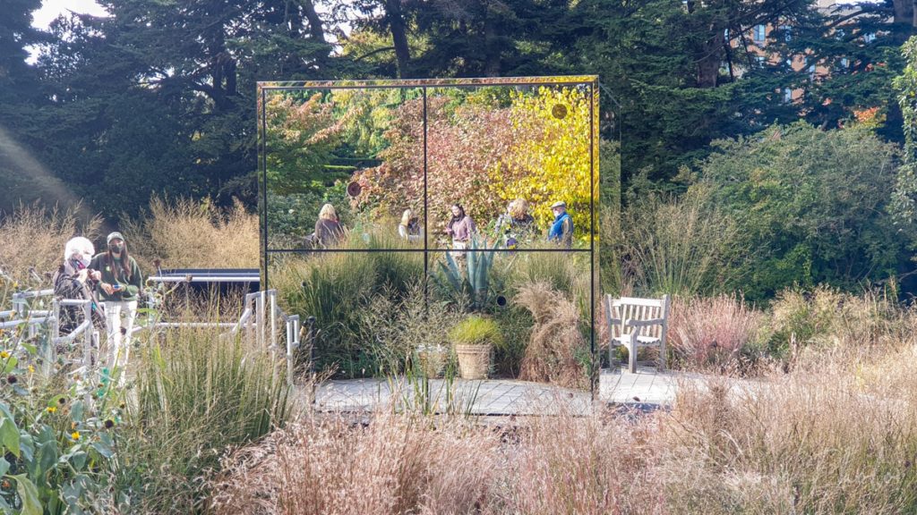
If you’re wondering where the worlds of art and physics collide, it’s inside the Infinity Room. When you step in, you’re instantly hit with visual overload. Prisms all over the wall and ceiling light up the mirrored walls with what feels like infinite colors. A slight echo subconsciously enhances your hearing, too. Make sure to observe the room from different angles. The optics will give you a sense for the many, or dare I say infinite, different aspects of infinity. Then just like that, the door opens and your time is up.

Final Thoughts on Post-COVID Travel
It felt so good to finally be able to get out and go adventuring. I really believe that post-COVID travel will feel much more “normal” than many people think. I got a bit of that feeling on a day trip to Boston a couple months ago, and this trip to New York certainly reinforced it.
However, just like after 9/11, we must remember that new practices, policies, and protocols are in place to keep you safe. Those 5-hour waits to get through security at Logan Airport in early 2002 quietly faded away as we embraced the new post-9/11 normal. And the COVID-19 restriction will do the same. Since the onset of the pandemic, I felt safer in New York City than I did in Phoenix, Boston, and everywhere else I’ve been in between. This is just the beginning of our next chapter, and as the world fully reopens, I couldn’t be more excited for what future adventures hold in 2022 and beyond.
Stay Up-to-Date with Our Adventures
To follow along and stay up-to-date with our post-COVID travel adventures, please sign up for the Matt Gove Photo newsletter. In addition, you’ll also get exclusive deals to our store that we don’t offer anywhere else, as well as free travel guides and visual storytelling (photography/video) tutorials. It’s free, and always will be. Where will your first post-COVID adventure take you?
Want to See More Photos of Cosmic Nature: Infinity?
Can’t get enough of infinity here? Head over to the Matt Gove Photo website. You’ll find the complete photo album from the Cosmic Nature: Infinity exhibit there.
Top Photo: Kusama’s Tulip Sculptures Take Over a Pond at the Cosmic Nature: Infinity Exhibit
New York, New York – October, 2021
The post Travel Journal: Post-COVID Adventures Kick Off in New York City appeared first on Matthew Gove Blog.
]]>The post The Complete Travelers’ Guide to Rue Canusa appeared first on Matthew Gove Blog.
]]>Where is Rue Canusa?
Rue Canusa sits in a beautiful, rolling, and rural part of the Green Mountains separating Stanstead, Québec from Beebe Plain, Vermont. As the crow flies, it’s equidistant from both Montréal and Burlington; however, the nearest city is Sherbrooke, Québec, about 45 km (28 mi) to the northeast.
Why You Should Drive Rue Canusa
Despite Rue Canusa’s short length – about half a kilometer – it’s loaded with history. Despite increasingly tightened security on both sides of the border over the past 30 years, it will give you glimpse into the past when life along the border was much simpler and much more unified.
In addition, Rue Canusa is one of the only places in the world where you can drive down the street, turn around, and come back down the same street in the opposite direction and be in a different country. In fact, it may be the only place in the world you can do that, but I haven’t been able to verify that for certain.
Prior to the September 11th terror attacks, communities along this part of the US-Canada border largely functioned as a single community. Crossing the border was simple and painless, more often resembling the process of crossing state or provincial boundaries than the international border crossings you know today.
Modern Times Means Tighter Border Security
Both the United States and Canada really began cracking down on border security in the immediate aftermath of the September 11th attacks. All of these small bi-national communities on the border were split in half overnight. People stopped crossing the border for simple errands, and many facilities that were built on the border to cater to patrons from both countries closed. The only venue that remains open today is the Haskell Free Library and Opera House, though it, too, has been closed during the COVID-19 pandemic.

Today, all that remains of those simpler times are gates and barriers across streets that once united the communities on each side of the border. All cross-border traffic is redirected to official ports of entry. While you hate to lose the unification of border communities, the benefits of tighter border security far outweigh the convenience of being able to walk into another country completely unaware that you’re crossing the border.
An Interesting Historical Legend
One of the more fascinating aspects of the history of Rue Canusa is its historical legend. The legend claims that when Stanstead and Beebe Plain were being settled back in the 1700s, a group of surveyors had too much to drink when they were working to determine where the international border was. Some people claim that these drunk surveyors were behind Rue Canusa. Others say it was just a mistake. Either way, both Stanstead and Beebe Plain continue to try and function as a single community despite the ever-evolving international border.
How Do You Get to Rue Canusa?
You can easily access Rue Canusa from either the United States or Canada. However, it is much easier from a logistical standpoint if you access it from Canada because you do not need to check in with customs prior to entering Rue Canusa. We’ll circle back to this very shortly.
Rue Canusa itself is very short, only about half a kilometer (1/3 mile). However, both countries have ports of entry at the west end of Rue Canusa. About 2 km to the east, you’ll find a much larger port of entry at the northern terminus of Interstate 91 and the southern terminus of Autoroute 55.
Access From Canada
From Canada, head south from Magog, Québec on either Autoroute 55 or Highway 247. If you have time, I recommend using Highway 247, a scenic, laid back drive that runs through rolling hills, forests, and quaint farmland along the shores of Lake Mamphrémagog. On the other hand, Autoroute 55 is a major freeway. Even better, Highway 247 becomes Rue Canusa when you reach the border.
On Highway 247, you’ll know you’re close when you start seeing signs for “Douanes”, which means “customs” in French. When you reach the border, follow the large orange barricade as the road bends 90 degrees to the left. Pass between the American and Canadian customs halls and onto Rue Canusa.
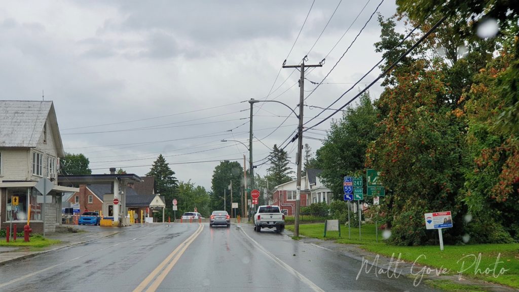
Access From the United States
From the United States, follow Interstate 91 North to its northern terminus at the border. Take the first left after clearing Canadian customs onto Québec 247. Follow Highway 247 for about 2 kilometers, which will bring you to the eastern end of Rue Canusa. After completing your journey down Rue Canusa, turn left to return to the United States, or turn right to continue north into Canada.

How Customs Works
It’s no surprise that Rue Canusa’s unique design causes confusion among visitors and non-residents. Thankfully, it’s not as complicated as it may seem. Both countries have special rules for residents of Rue Canusa to deal with the border issue, but they do not apply to visitors.
When visiting Rue Canusa, always remember my golden rule: if in doubt, stop at the customs hall and check in. If they don’t need anything from you, they’ll send you on your way. On the other hand, failure to check in at customs will result in thousands of dollars in fines and can even result in jail time. A quick stop at customs can save yourself a ton of headaches.
Because Rue Canusa is a Québec Provincial Highway, the rule is shockingly simple. If you’re coming from Canada and staying in Canada, you do not need to pass through customs. If you’re doing anything else, you will need to clear customs on either or both of your outbound and return trips. The map below should make it clear why.
| Origin | Destination | Canadian Customs | U.S. Customs |
|---|---|---|---|
| United States | Canada | Yes, at Entry | No |
| United States | United States | Yes, at Entry | Yes, at Exit |
| Canada | United States | No | Yes, at Exit |
| Canada | Canada | No | No |
What to Expect Driving or Walking Rue Canusa
If I dropped you onto Rue Canusa without any context, it would feel just like any other quiet, quaint residential street in the US or Canada. Well-kept homes line both sides of the street. There are even a few businesses on the Québec side of the street near the east end of Rue Canusa.
Furthermore, you would have no idea an international border ran right down the middle of the street. Okay, maybe Canadian flags flying on one side of the street and American flags flying on the other might clue you in. But there are no fences, markers, or other indicators of the border aside from the customs buildings at one end of Rue Canusa and a survey marker at the other.
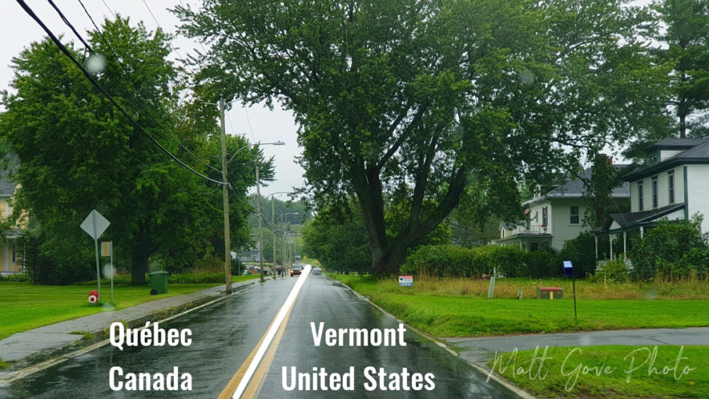
What Language Do You Speak on Rue Canusa?
If you speak English or French, you’re all set. All federal operations (read: customs) on both sides of the border are fully bilingual. In town, you will find both languages used in many places. However, people will favor English on the Vermont side of the border and French on the Québec side.
What Else is There to do near Rue Canusa?
There are so many other things to do and places to explore on both sides of the border year round. From skiing and snow sports in the winter to swimming and boating in the summer to leaf peeping and maple syrup in the fall, there are activities for everyone.
Activities in Canada
The closest and most popular attraction to Rue Canusa on the Canadian side of the border are Québec’s National Parks. About 25 kilometers to the north, you’ll find Parc National du Mont Orford, which is famous for its breathtaking mountain landscapes and outdoor recreation. And if that’s not enough, there are 4 additional National Parks within a two to three hour drive of Rue Canusa, as well as numerous nature preserves, provincial parks, and lakes.
But what if you’re not the outdoorsy type? Montréal, Sherbrooke, and Québec City are all less than a three-hour drive from Rue Canusa. All three cities are rich in culture, history, and activities both indoors and out. And if you’re willing to travel a little further, Toronto, Ottawa, and the Canadian Maritimes are all easily within reach.
Activities in the United States
While the northeastern United States does not have the National Parks that Québec boasts, all of the northeast states have amazing state parks, forests, and outdoor recreation. You can easily reach both Boston and New York City in a day’s drive. And if you’re craving some of the best seafood in the world, the same goes for downeast Maine. And while you’re there, don’t forget to visit Acadia National Park, either.
Haskell Free Library and Opera House
About a kilometer east of Rue Canusa, you’ll find the Haskell Free Library and Opera House. Intentionally built straddling the international border, the fully bilingual library has served both nations since it opened in 1904. Furthermore, it’s the only performance space in the world where the stage and the audience are in two different countries. There’s actually a running joke that it’s the only library in the United States without books and the only opera house in the United States without a stage. The bookshelves and the opera stage are both on the Canadian side of the building.
You can enter the library from either the US or Canada and move around freely while inside, but once you’re done, the rule is simple: you must return to the country from which you came.


Conclusion
Rue Canusa is one of the most unique streets in the world. Whether you’re driving, walking, biking, or something else, you’ll be able to say you’ve done something very few other people in the world have. But don’t get caught up in the moment. While the US and Canada are very friendly, they both take border security very seriously. Respect the laws, soak in the uniqueness of the moment, and you’re bound to have a safe, fun, and memorable time.
Resources
- Canada Border Services Agency
- U.S. Customs and Border Protection
- Rue Canusa Photos (August, 2019)
- Haskell Free Library Photos (August, 2019)
- Driving Rue Canusa (August, 2019)
- Visiting to the Haskell Free Library (August, 2019)
- Haskell Free Library Website
Top Photo: Driving Rue Canusa
Stanstead, Québec, Canada – August, 2019
The post The Complete Travelers’ Guide to Rue Canusa appeared first on Matthew Gove Blog.
]]>


